Teichalm (Teichalmsee) - Hochlantsch (via Zachenkreuz)
Starting point: Teichalm (Teichalmsee) (1172 m)
| Latitude/Longitude: | 47,35034°N 15,46031°E |
| |
Route name: via Zachenkreuz
Walking time: 1 h 55 min
Difficulty: easy unmarked way
Elevation gain: 550 m
Elevation difference along the route: 565 m
Map:
Recommended equipment (summer):
Recommended equipment (winter): ice axe, crampons
Views: 131
 | 1 person like this post |
Access to starting point:
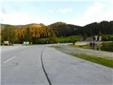
From the border crossing Šentilj we continue driving on the motorway towards Graz and further towards Linz and Salzburg. We soon leave the motorway A9 and continue driving slightly to the right in the direction towards Vienna / Wien and continue driving on the expressway S35. We leave the mentioned expressway at the exit for Mixnitz, and then from the roundabout we take the exit in the direction of Teichalm. We also continue to follow the signs for Teichalm. At the end of the settlement St. Erhard we once again turn right towards Teichalm, and then we start to ascend steeply. When we reach the alpine pasture Breitalm we gradually start to descend, but we follow the road to the parking lot at the lake Teichalmsee.
Route description:
From the parking lot, we walk to the inn Almgasthof Zum Teichwirt, where we notice the first yellow hiking signposts. We head on the path in the direction of the summit Hochlantsch, and behind the buildings the path splits.
We choose the slightly right path in the direction of the summit Hochlantsch (slightly left Rote Wand, Schüsserlbrunn, Guter Hirte...), where in a gentle ascent to the edge of the forest we continue on a grassy cart track. At the edge of the forest, signs point us to the left on a footpath which ascends first at the edge of the forest and then through the forest. Higher, we cross a few cart tracks and forest roads, and the path occasionally leads also through some panoramic parts, of which there are more and more higher up. A little further, we reach a larger grassy slope, from which a nice view opens up mainly towards the south.
When higher up the marked path flattens and starts turning to the left, we leave it and by a cairn continue right on an unmarked footpath, along which we continue the ascent on and beside the ridge. Higher up, the path enters the forest and brings us to Zachenkreuz, where a wooden cross is located.
From the top we continue towards the west, where the still unmarked path leads along and on the ridge, which is precipitous on the right side in several places, but the path runs slightly to the left all the time so there is no major danger of slipping. The path, which continues with a few shorter easy ascents and descents, then brings us back to the marked path, along which we continue.
When we reach the marked path, we start ascending again, initially still through the forest, and later on an increasingly panoramic path. We follow such a path all the way to the summit with the larger metal cross.
To the highest point of the summit, where the cross is located, the path is more rocky and somewhat more difficult, but it is possible to find a fairly easy passage to the top.
Starting point - Zachenkreuz 1:20, Zachenkreuz - Hochlantsch 0:35.
The description refers to the condition in June 2025, and the pictures are from various periods.

Photos:
 1
1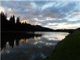 2
2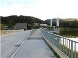 3
3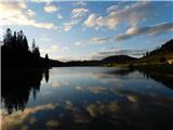 4
4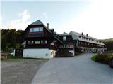 5
5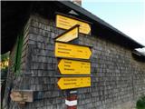 6
6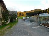 7
7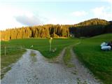 8
8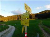 9
9 10
10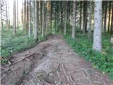 11
11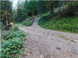 12
12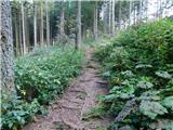 13
13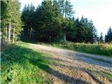 14
14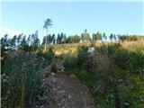 15
15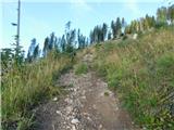 16
16 17
17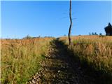 18
18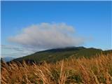 19
19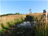 20
20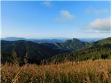 21
21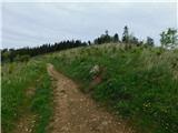 22
22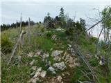 23
23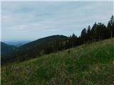 24
24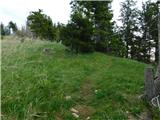 25
25 26
26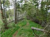 27
27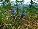 28
28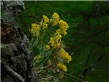 29
29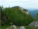 30
30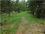 31
31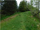 32
32 33
33 34
34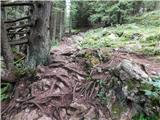 35
35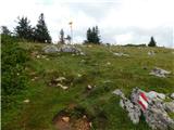 36
36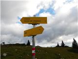 37
37 38
38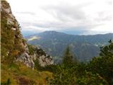 39
39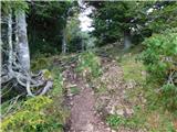 40
40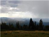 41
41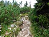 42
42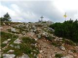 43
43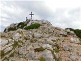 44
44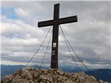 45
45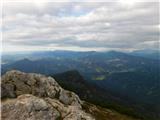 46
46
Discussion about the trip Teichalm (Teichalmsee) - Hochlantsch (via Zachenkreuz)
To post a comment you must log in:
If you do not yet have a username, you must first
register.