Teichalm (Teichalmsee) - Tonneggerkogel
Starting point: Teichalm (Teichalmsee) (1172 m)
| Latitude/Longitude: | 47,35034°N 15,46031°E |
| |
Walking time: 35 min
Difficulty: easy unmarked way
Elevation gain: 171 m
Elevation difference along the route: 171 m
Map:
Recommended equipment (summer):
Recommended equipment (winter): ice axe, crampons
Views: 147
 | 1 person like this post |
Access to starting point:
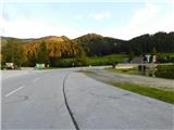
From the border crossing Šentilj we continue driving on the highway towards Gradec / Graz and further towards Linz and Salzburg. We soon leave highway A9 and continue driving slightly right in the direction towards Dunaj / Wien and continue driving on the fast road S35. We leave the mentioned fast road at the exit for Mixnitz, and then at the roundabout we go to the exit in the direction of Teichalm. Further on, we continue to follow the signs for Teichalm. At the end of the settlement St. Erhard we once again turn right towards Teichalm, and then we start ascending steeply. When we reach the mountain pasture Breitalm we gradually start descending, but we follow the road to the parking lot at the lake Teichalmsee.
Route description:
From the parking lot, we walk to the inn Almgasthof Zum Teichwirt, where we notice the first yellow hiking signposts. We go on the path in the direction of the summit Hochlantsch, and behind the buildings the path splits.
We choose the slightly right path in the direction of the summit Hochlantsch (slightly left - Rote Wand, Schüsserlbrunn, Guter Hirte...), where in a gentle ascent to the edge of the forest we continue on a grassy cart track. At the edge of the forest, signs point us to the left on a footpath which ascends first along the edge of the forest and then through the forest. Higher, we first cross a cart track, and when we reach the road, we leave the marked path and continue the ascent to the right on the macadam road.
On the road, we ascend diagonally to the right for some time, and when the road turns sharply to the left, we leave it and continue to the right on a slightly overgrown but well-trodden footpath that quickly leads us to a grazing fence. On the other side of the fence, we continue across the pasture, and as we approach the indistinct southern ridge, we veer left from the footpath and quickly ascend to the nearby peak with a cross.
The description refers to the condition in June 2025, while the pictures are from September 2022 and June 2025.

Photos:
 1
1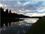 2
2 3
3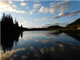 4
4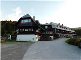 5
5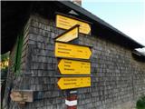 6
6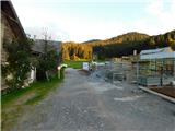 7
7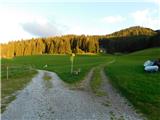 8
8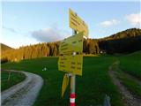 9
9 10
10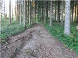 11
11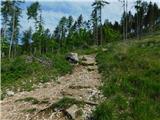 12
12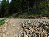 13
13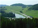 14
14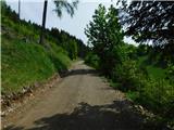 15
15 16
16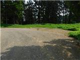 17
17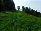 18
18 19
19 20
20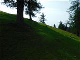 21
21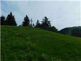 22
22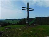 23
23
Discussion about the trip Teichalm (Teichalmsee) - Tonneggerkogel
To post a comment you must log in:
If you do not yet have a username, you must first
register.