Temnica - Sveti Ambrož (Tabor) (northern path)
Starting point: Temnica (402 m)
| Latitude/Longitude: | 45,84520°N 13,67640°E |
| |
Route name: northern path
Walking time: 50 min
Difficulty: easy unmarked way
Elevation gain: 129 m
Elevation difference along the route: 160 m
Map: Goriška - izletniška karta 1:50.000
Recommended equipment (summer):
Recommended equipment (winter):
Views: 448
 | 1 person like this post |
Access to starting point:
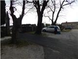
A) We drive to Dornberk (to here from the Vipava expressway exit Selo, or from Šempeter pri Gorici), then we continue driving towards Branik. Still in Dornberk we leave the road towards Branik and we go right in the direction of the settlements Potok and Trstelj. Further on, we begin to ascend steeply; after Železna vrata the road flattens, and we follow the signs for the settlement Lipa and then Kostanjevica na Krasu. Soon after the settlement Lipa ends, we go left into the village Temnica, where we drive to the church and cemetery, where we park.
B) We drive to Sežana, then we continue driving towards Komen and then Kostanjevica na Krasu. Soon after the settlement Vojščica we turn right in the direction of the settlement Temnica; when we arrive in the mentioned village, we park on the parking lot by the cemetery.
Route description:
From the parking lot by the cemetery, we head onto the road that leads towards the northeast, along which we quickly arrive at the NOB monument. From the crossroad by the monument we go left, then we slowly begin descending and soon also leave the village Temnica. Lower down, we cross the main road and continue on the side road towards Trstelj. There follow a few minutes of easy walking, where we pass another NOB monument; after the monument we gradually begin ascending.
From the next crossroad, by which there is a memorial in memory of the independence war of 1991, we continue right, then we ascend transversely. Somewhat after we cross the route of the high-voltage power line, a cart track branches off to the right, which leads towards the top of Sv. Ambrož or Tabor peak (western path); we, however, continue along the road, which we follow to the saddle north of Tabor peak, or Sv. Ambrož.
Here on the right we notice a footpath that begins to ascend through a belt of bushes and low forest. We follow this path for approximately 10 minutes, then we already arrive at the summit, where we notice the ruins of the church of St. Ambrož.

Photos:
 1
1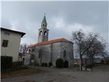 2
2 3
3 4
4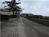 5
5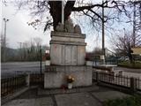 6
6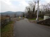 7
7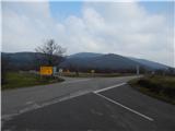 8
8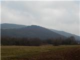 9
9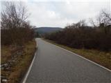 10
10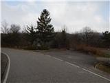 11
11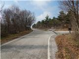 12
12 13
13 14
14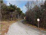 15
15 16
16 17
17 18
18 19
19 20
20 21
21 22
22 23
23
Discussion about the trip Temnica - Sveti Ambrož (Tabor) (northern path)
|
| *Sanda*11. 10. 2024 22:41:35 |
Today (October 2024) partially on this path (from the pass) to the summit. The path is unmarked but visible. On the path I notice branches scattered on the path (harder access), but I reach the church ruins. There, past the ruins, I start descending and notice a fence below to the right. While looking where the path is, a person starts approaching me from below and I quickly realize he's crazy and try to distance myself, but he follows me. Not even the barking of one of my dogs scares him, and I had three with me. A bit under adrenaline I finally find the path and quickly head to the starting point. In short, a very unpleasant experience. If I had read the path description before leaving, maybe this summit wouldn't have seen me.
|
|
|
To post a comment you must log in:
If you do not yet have a username, you must first
register.