Dolina Kot - Visoka Vrbanova špica (via Staničev dom)
Starting point: Dolina Kot (950 m)
| Latitude/Longitude: | 46,41570°N 13,89770°E |
| |
Route name: via Staničev dom
Walking time: 4 h 30 min
Difficulty: difficult marked way
Elevation gain: 1458 m
Elevation difference along the route: 1465 m
Map: Triglav 1:25.000
Recommended equipment (summer): helmet
Recommended equipment (winter): helmet, ice axe, crampons
Views: 33.689
 | 4 people like this post |
Access to starting point:
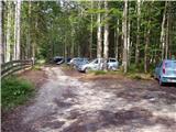
Leave the Gorenjska motorway at the Hrušica exit and continue following the road towards Kranjska Gora. Just a little before the village of Dovje, a road branches off to the left from the main road leading to Mojstrana (Vrata, Kot and Krma). Continue following the road towards the village of Radovna and the Krma and Kot valleys. The relatively steep road then takes us past the TNP sign, after which the road soon flattens and brings us to a junction where a gravel road branches off to the right into the Kot Valley (straight ahead Radovna and Krma). We then follow this occasionally somewhat rougher road to the parking lot, where we also notice the mountain signposts.
Route description:
From the end of the road, we continue on the wider marked path in the direction of Staničev dom and Kredarica, which gently ascends through the forest. After a few minutes, we reach the Kotarice scree, which we cross transversely to the other side, where the path reappears.
This is followed by some easy walking through the forest, but after about half an hour of walking, the path quickly becomes quite steep and, due to the often very slippery ground, also dangerous for slipping, especially on the descent, so extra caution is needed on this section. On this part, a few pegs assist us at the more difficult spots. Higher up, the steepness eases and the path takes us to the spring Pri studenčku, which dries up in dry periods.
Here, an unmarked path branches off to the left towards Macesnovec, but we continue straight across the torrent bed, and after the torrent bed, we cross a short secured but not particularly demanding section. This is followed by an ascent through a belt of dwarf pines, and higher up we reach an increasingly rocky terrain, where we can already clearly see a large boulder ahead. Here, our path is crossed quite unobtrusively by the PP trail (Planica - Pokljuka trail), and we ascend with ever better views to the aforementioned boulder called Debeli kamen.
At Debeli kamen, the dwarf pines occasionally end definitively, and we continue through increasingly high-alpine terrain, mostly ascending on scree. On this section, looking back, we get a nice view of Ladja (Ladja is a distinct sheer, dwarf pine-covered promontory or peak rising above the Kot Valley), and then we ascend to a marked junction where a climbing path to the Vrbanove špice, or Lojze Rekar's path, branches off to the right.
We continue on the left path in the direction of Triglav, Rjavina and Dom Valentina Staniča pod Triglavom, where the steepness eases, and the path leads us along the left side of the Pekel cirque.
Here, first to the left, a marked very demanding secured path to Rjavina branches off, but we ascend transversely above the cirque along the northwestern slopes of Rjavina. As we approach Dovška vrata a bit further on, a passage opens to the left onto the Rjavina ridge, or the passage takes us right to the mentioned gates, from where a marked ridge path leads towards Rjavina, but we continue straight in the direction of the marked path to Dom Valentina Staniča.
In the continuation, we mostly ascend moderately through high-alpine terrain, following such a path all the way to Dom Valentina Staniča pod Triglavom, from where we get a nice view of Triglav and the surrounding peaks.
From the hut, we continue right in the direction of Begunjski vrh, Visoka Vrbanova špica and Cmir (sharply left Krma valley and Rjavina, slightly left Triglavski dom na Kredarici and Triglav, slightly right Vrata valley). The fairly easy path brings us already after a few minutes of further walking to Begunjski preval, where the path to Vrbanove špice branches off to the right.
We continue in the direction of Vrbanove špice and begin ascending an increasingly scenic and relatively easy path, which then brings us to the summit of Visoka Vrbanova špica in a few minutes of further walking.
Starting point - Pri studencu 1:25, Pri studencu - Debeli kamen 1:20, Debeli kamen - Pekel 0:45, Pekel - Dom Valentina Staniča 0:40, Dom Valentina Staniča - Visoka Vrbanova špica 0:20.

Photos:
 1
1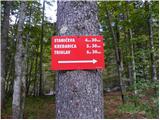 2
2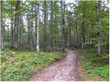 3
3 4
4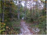 5
5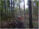 6
6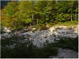 7
7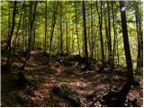 8
8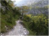 9
9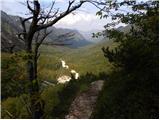 10
10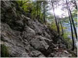 11
11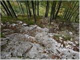 12
12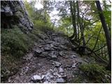 13
13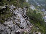 14
14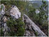 15
15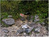 16
16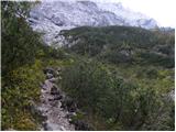 17
17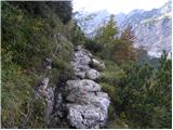 18
18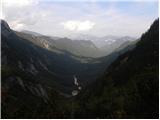 19
19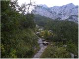 20
20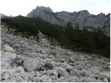 21
21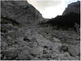 22
22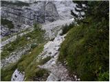 23
23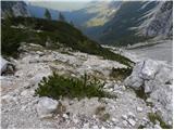 24
24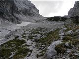 25
25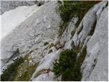 26
26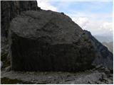 27
27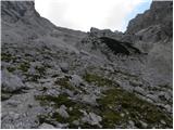 28
28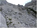 29
29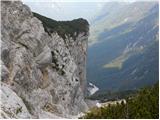 30
30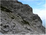 31
31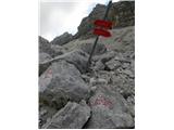 32
32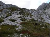 33
33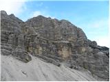 34
34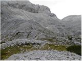 35
35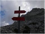 36
36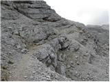 37
37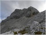 38
38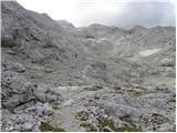 39
39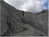 40
40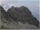 41
41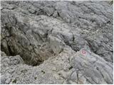 42
42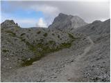 43
43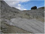 44
44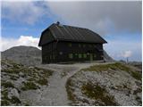 45
45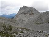 46
46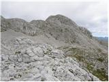 47
47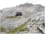 48
48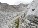 49
49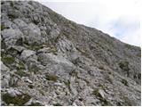 50
50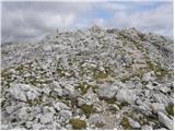 51
51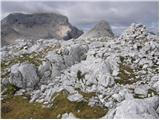 52
52 53
53
Discussion about the trip Dolina Kot - Visoka Vrbanova špica (via Staničev dom)
|
| Bali21. 09. 2007 |
Great, climbed in the opposite direction when returning from Triglav.
Otherwise much less secured, but still sufficient, and some new protections too.
|
|
|
|
| pupek5. 08. 2013 |
Hello!
I'm interested in how long the hike is from the hut to the summit
|
|
|
|
| Hrobson5. 09. 2025 08:21:34 |
Yesterday I walked the described path and I must say it's one of the most beautiful paths I've walked... It should be noted that the path from picture 8 to 20 is very slippery and poses problems on the descent.
|
|
|
To post a comment you must log in:
If you do not yet have a username, you must first
register.