Dolina Krma - Rjavina (via Teme)
Starting point: Dolina Krma (930 m)
| Latitude/Longitude: | 46,38510°N 13,90710°E |
| |
Route name: via Teme
Walking time: 5 h 20 min
Difficulty: difficult pathless terrain
Elevation gain: 1602 m
Elevation difference along the route: 1630 m
Map: TNP 1 : 50.000
Recommended equipment (summer): helmet
Recommended equipment (winter): helmet, ice axe, crampons
Views: 26.938
 | 4 people like this post |
Access to starting point:
We leave the Gorenjska motorway at the Hrušica exit and continue following the road in the direction of Kranjska Gora. Just a little before the village of Dovje, a road branches off to the left from the main road, leading to Mojstrana (Vrata, Kot and Krma). We continue following the road in the direction of the village of Radovna and the Krma and Kot valleys. The relatively steep road then leads us past the TNP sign, after which the road soon levels out and brings us to a junction where a gravel road branches off to the right into the Kot valley. We continue straight on the road that begins to descend. In the middle of the descent, a road branches off to the right into the Krma valley (straight ahead to Radovna). A little further on, we reach the next junction, where we continue right in the direction of Krma. The gravel road then brings us to the Kovinarska koča, and we continue following it. The occasionally somewhat poorer road then brings us to the parking lot before the barrier.
Route description:
From the last parking lot in the Krma valley, named Pri lesi, we continue along the poorer road that continues through the valley and soon brings us to a clearing, where we bypass the nearby building on the left side. We continue along the gravel path that approaches the torrent and crosses it a little further on. On the other side of the torrent, the path enters the forest and ascends initially gently, then for some time quite steeply. Higher up, we come out of the forest into a belt of dwarf pines and shrubs, and beautiful views open up from the path to the nearby cliffs of the peaks, which on the other side slope more gently towards Pokljuka.
Higher up, somewhere at an altitude of a little more than 1400 m, the path temporarily levels out and brings us to the beautiful grassy plain Vrtača.
After the grassy part, the path begins to ascend again along a path that is often quite slippery in this section, which levels out on the Malo polje plain.
Here the path turns right and splits.
To the left, the path branches off towards Bohinjska vratca and Vodnikov dom na Velem polju, while we continue straight and at the foot of Vernar we easily continue to the spring with the trough.
After the trough, the path splits, and we continue straight on the marked path (left unmarked shortcut to the Zgornja Krma pasture). This is followed by some moderate, and higher up also somewhat steeper ascent through sparse, partly larch forest. Higher up the path turns left and levels out, and the aforementioned shortcut joins us from the left.
After the joining of both paths we quickly arrive at the shepherd's hut on the Zgornja Krma pasture, called Prgarca.
From here the path continues in a moderate ascent to the west and brings us to the last spring along the path, and above the spring the path splits again.
To the left continues the path across Kurica, which leads to Konjsko sedlo and further towards Dom Planika pod Triglavom, while we go right on the path that leads further in the direction of Kredarica and Staničev dom.
Just a few steps further, from the usual path towards Kredarica the "old path" towards Kredarica branches off to the left.
Here by the path are the only signs for Kredarica in this direction, while we continue straight on the gentle marked path, along which there are no signs for Kredarica (september 2025), which a few minutes further brings us to the marked junction, where the paths towards Kredarica and Staničev dom separate.
The path ahead leads us through the partly grassy terrain called Murava, later we ascend crosswise through increasingly sparse, mostly larch forest. Higher up the path gradually levels out and brings us to the lower part of Kravja dolina, where first an unmarked path joins us from the right, leading past the hunting lodge Zgornja Krma, and a little higher an also unmarked path branches off to the right, leading towards the central part of Kravja dolina and further towards Veliki Pršivec, the remains of the plane from WWII and to Rjavina via Teme.
We continue right along the unmarked trail (straight ahead Dom Valentina Staniča), which ascends through a smaller inconspicuous valley. The path through the valley leads us through dwarf pines and ascends only slightly, but soon becomes harder to follow and completely disappears towards the end of the valley.
Here we turn left towards Rjavina and after a shorter ascent we come to the grassy slope where we notice the remains of a bomber from the Second World War. We continue to the right along the lower scree to the start of a somewhat more demanding traverse towards Teme. The demanding section is very short, but a lot of caution is required because there is quite a lot of gravel on the path. Then follows another short traverse along a quite steep grassy slope and descent to Teme.
From Teme we then continue cross-country straight upwards towards the summit of Rjavina and ascend towards the north-northwest. If we stay a bit to the right along the ridge, a wonderful view of Luknja peč occasionally opens up. When we reach the main ridge of Rjavina higher up, we have only a few meters of relatively easy ascent left to the summit.
We can descend by the same route or along the marked ridge path.
Krma - Malo Polje 2:05, Malo Polje - Zgornja Krma 0:25, Zgornja Krma - Izvir pod Kurico 0:05, Izvir pod Kurico - razpotje Murava 0:10, razpotje Murava - odcep v Kravjo dolino 0:45, odcep v Kravjo dolino - ostanki letala 0:35, ostanki letala - Teme 0:15, Teme Rjavina 1:00.

Photos:
 1
1 2
2 3
3 4
4 5
5 6
6 7
7 8
8 9
9 10
10 11
11 12
12 13
13 14
14 15
15 16
16 17
17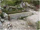 18
18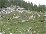 19
19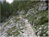 20
20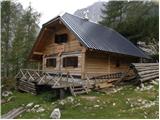 21
21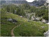 22
22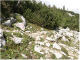 23
23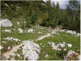 24
24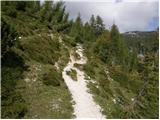 25
25 26
26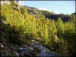 27
27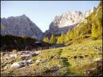 28
28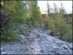 29
29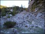 30
30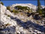 31
31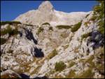 32
32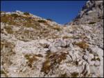 33
33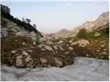 34
34 35
35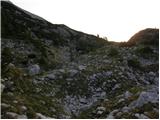 36
36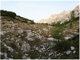 37
37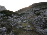 38
38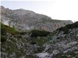 39
39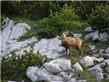 40
40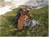 41
41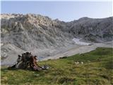 42
42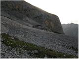 43
43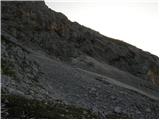 44
44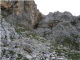 45
45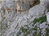 46
46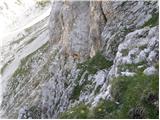 47
47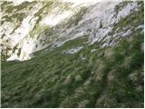 48
48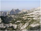 49
49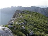 50
50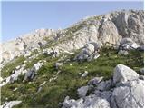 51
51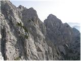 52
52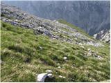 53
53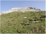 54
54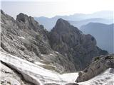 55
55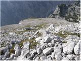 56
56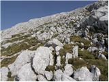 57
57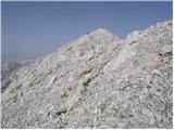 58
58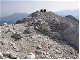 59
59
Discussion about the trip Dolina Krma - Rjavina (via Teme)
|
| lynx11. 08. 2008 |
Interesting tour. I don't recommend it in wet conditions. Above the pass under Teme, a raven nests.
|
|
|
|
| mili24. 07. 2010 |
Yesterday my friend and I were in this area. The crossing from Konjska dolina is marked with a large cairn. At the beginning we missed it because the path ahead is still clearly visible, but the description says to turn left when the path ends. During the crossing to Teme, my friend had a close encounter with an adder - she almost grabbed it, some snakes were also on Temenu. So be careful. The nature here is really wonderful, and yesterday even during the descent to Krma we didn't meet a single person.
|
|
|
|
| PFranci24. 11. 2012 |
Below Zg. Krma I turned onto the hunting path and then a bit higher into the steep gully, where chamois put on a climbing school for me. Higher up I rejoined the hunting path and turned into the valley leading towards Pršivec. Just before the end, follow the cairns and turn left onto the path that leads to the plane wreckage. From there I went straight through the scree to the crossing under the wall and crossed under it to the roof of Rjavina and along it to the summit. Today winter gear was not needed. Back I went the same way, only lower I passed the hunting hut.
|
|
|
|
| metod20. 10. 2014 |
I missed the junction from the marked path, but you can nicely reach the passage at Teme "freely after Prešeren". In such case it's better to stay higher, above the bushes. And not up in the heat. On the roof of Rjavina it burns!
|
|
|
|
| darinka424. 08. 2018 |
We went on 22.8. along this pathless terrain or according to the descriptions. In four. None of us young anymore. We fixed some cairns. In places there is really nothing. Real pathless. We didn't miss it anyway. Definitely a nice tour, although you don't meet anyone there. Physically demanding. There in that rocky part, shorter one, where climbing was needed, there were huge edelweiss. We looked at the remains of the bomber. And descended through Dovška vratca.
|
|
|
|
| mornar2. 09. 2018 |
Darinka please, can you tell how much walking there is from Krma to the summit, I'm a fairly good hiker. How is the route orientationally followable from the plane wreckage onwards towards Teme.
|
|
|
|
| darinka42. 09. 2018 |
We are not fast. It took us about two hours to Prgarca. We started hiking shortly before 7 a.m. And shortly before 1 p.m. we were on Rjavina. We stopped at the bomber wreckage. From Prgarca onwards go right where the turnoff to Staničev dom is. Then at 2000 m elevation pathless terrain begins. Where on the right side you have the slope of Pršivec. Further on it's a bit awkward, if you see a cairn somewhere it's easier, otherwise the path is barely visible in places or not at all. Once you reach the bomber you somehow sketch the route across the scree and then into the wall. When you're on the grassy part, you just go steeply to the summit. Rain caught us there, no problems. The tour can be done in one day. Descent past the window through Dovška vratca involves some climbing. We don't set a very fast pace. Regards
|
|
|
|
| Majdag2. 09. 2018 |
Didn't they remove the plane wreckage during the cleanup action? It looked like that on TV..
|
|
|
|
| darinka42. 09. 2018 |
Here are the remains of an American bomber that crashed into Rjavina in 1945. And exploded in the air. All 8 crew members died, although they initially thought the pilot had ejected. Parts of the bomber are piled up and will probably stay there. Some parts are still found around.
|
|
|
|
| garmont2. 09. 2018 |
The cleanup action where they came across plane wreckage was at Kredarica.
As for the date of the crash under Rjavina and the number of dead, there are different accounts...
|
|
|
|
| Majdag2. 09. 2018 |
It was always written and said only about the plane wreckage on the path over Teme to Rjavina. Thanks Garmont, I didn't know about these wrecks.
|
|
|
|
| mornar12. 07. 2019 |
Since it didn't work last year, I would now go via Teme to Rjavina. I'm interested in how the approach and trail followability is. In which direction from the plane wreckage to reach the passage to Teme. Thanks for the answer and best regards.
|
|
|
|
| garmont12. 07. 2019 |
As written above in the description. Keep to the right through the scree towards the wall you have in front of you. Here, traces of predecessors are noticeable, leading you right, almost horizontally through a demanding rocky passage where you need to do a bit of scrambling, to the Temena grass.
From afar, the passage looks harder than it actually is.
|
|
|
|
| garmont12. 07. 2019 |
...wall in front of you, not barn.
|
|
|
|
| mornar21. 07. 2019 |
Up to where can you drive reasonably normally with a normal car, thanks and best regards.
|
|
|
|
| PFranci21. 07. 2019 |
To the end of the road.
|
|
|
|
| hribba5. 09. 2021 14:42:03 |
On Friday 3.9. I set off on this path. Despite dense fog exactly on the section where it's least needed, I somehow made it to Temena.
Description and all photos can be found here Rjavina via Teme. Maybe it helps someone....
|
|
|
To post a comment you must log in:
If you do not yet have a username, you must first
register.