Tinčkova koča - Selenitza/Palec
Starting point: Tinčkova koča (1070 m)
| Latitude/Longitude: | 46,42280°N 14,19910°E |
| |
Walking time: 3 h
Difficulty: difficult unmarked way
Elevation gain: 956 m
Elevation difference along the route: 1000 m
Map: Karavanke - osrednji del 1:50.000
Recommended equipment (summer): helmet
Recommended equipment (winter): helmet, ice axe, crampons
Views: 10.166
 | 1 person like this post |
Access to starting point:
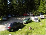
From the highway Ljubljana - Jesenice, we take the exit Lesce and follow the road ahead in the direction of Žirovnica and Jesenice. After a few km of driving, we will come to a crossroads, where the road to Žirovnica and Moste branches off to the right (from the direction of Jesenice, left). Just a few meters ahead, at the next crossroads, we turn left to Moste (right to Žirovnica). Further, we drive past the monument to fallen fighters, where the road starts to ascend the hill under the railway track. At the top of the hill, we turn right (at the sign Vila Karin), and we continue towards Završniško jezero and Valvasorjev dom. The road then flattens and brings us to a crossroads, where the road towards Valvasorjev dom branches off to the left, and we continue straight ahead on the initially still asphalted road. The road soon becomes macadam, and we follow it to the parking lot near Tinčkova koča. The road in the upper part is often in quite poor condition.
Route description:
From the parking lot at Tinčkova koča we continue on a wide rocky cart track in the direction of Koča pri izviru Završnice. Already after a few steps of walking, blazes direct us slightly to the right, onto a somewhat steeper footpath that climbs over a panoramic grassy slope, then returns to the aforementioned cart track, which we follow to the right. The cart track, which ascends relatively steeply through the forest, brings us after a few minutes of further walking to a pasture fence, behind which we arrive at a marked junction.
We continue straight ahead (slightly right to Roblekov dom) on the still rocky cart track, which higher up brings us out of the forest onto the expansive grassy slopes of Smokuška planina. Here the gradient eases and the increasingly scenic path brings us in 15 minutes of further walking to Koča pri izviru Završnice.
From the hut we continue right on the marked footpath in the direction of Zelenica. The path already after a few steps of walking brings us to the spring of Završnica, behind which we step onto a pleasant meadow. Behind the mentioned meadow the path ascends somewhat more steeply and after a few minutes of further walking brings us to the foot of the western part of the Zelenica ski area. Here we leave the marked path that leads to Dom na Zelenici and continue the ascent along the ski lift, walking beside it to a smaller boulder, where we rejoin the marked path. We follow the mentioned path to the left (right to Dom na Zelenici), which gently descends and after a few minutes of further walking brings us to the end of the Suhega ruševja valley, where an unmarked path to Palec branches off to the right uphill.
We continue in the direction of Palec (straight to Stol and Vrtača) on the path that climbs through a belt of forest and higher brings us below the screes of Vrtača and Palec. Here the gradient eases, and the path then leads us along the Suhega ruševja valley. Higher up the path turns slightly right and ascends more steeply again. After a few minutes of further walking we reach the border ridge (Žleb 1916 m) from where a view opens onto the Austrian side.
We continue right on the path, which initially ascends along the ridge, then turns right, crossing several steep gullies (danger of slipping and falling rocks). The path, which runs along a very steep slope, brings us higher back onto the border ridge. Here the path turns sharply left and then continues along and beside the ridge. This is followed by probably the most difficult part of the path, where we must climb a short steep rocky step without protection (1st degree of climbing). The gradient then gradually eases and the increasingly panoramic path quickly brings us to the summit.

Photos:
 1
1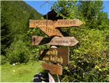 2
2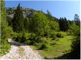 3
3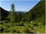 4
4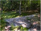 5
5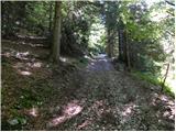 6
6 7
7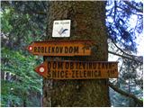 8
8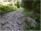 9
9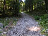 10
10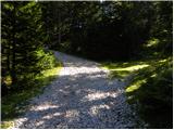 11
11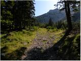 12
12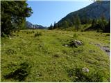 13
13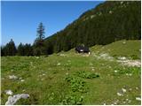 14
14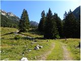 15
15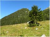 16
16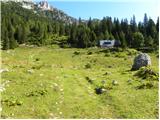 17
17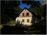 18
18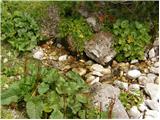 19
19 20
20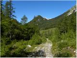 21
21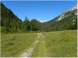 22
22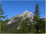 23
23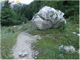 24
24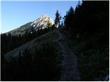 25
25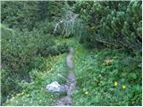 26
26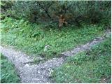 27
27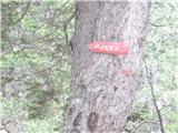 28
28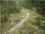 29
29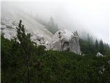 30
30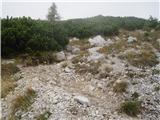 31
31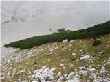 32
32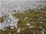 33
33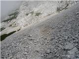 34
34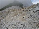 35
35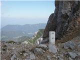 36
36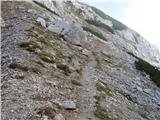 37
37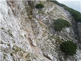 38
38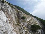 39
39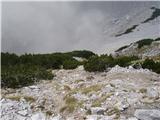 40
40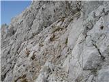 41
41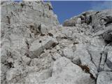 42
42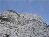 43
43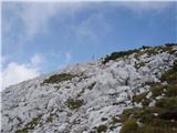 44
44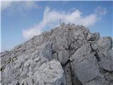 45
45 46
46
Discussion about the trip Tinčkova koča - Selenitza/Palec
To post a comment you must log in:
If you do not yet have a username, you must first
register.