Tinčkova koča - Vertatscha/Vrtača (via Zagon)
Starting point: Tinčkova koča (1070 m)
| Latitude/Longitude: | 46,42280°N 14,19910°E |
| |
Route name: via Zagon
Walking time: 3 h 30 min
Difficulty: easy unmarked way, partly demanding marked way
Elevation gain: 1111 m
Elevation difference along the route: 1111 m
Map: Karavanke - osrednji del 1:50.000
Recommended equipment (summer):
Recommended equipment (winter): ice axe, crampons
Views: 6.420
 | 2 people like this post |
Access to starting point:
From the highway Ljubljana - Jesenice, we take the exit Lesce and follow the road ahead in the direction of Žirovnica and Jesenice. After a few km of driving, we will arrive at a crossroads, where the road to Žirovnica and Moste branches off to the right (from the direction of Jesenice, to the left). Just a few meters ahead, at the next crossroads, we turn left towards Moste (right to Žirovnica). We continue past the monument to the fallen fighters, where the road begins to climb the hill under the railway track. At the top of the hill, we turn right (at the sign Vila Karin), and we continue towards Završniško jezero and Valvasorjev dom. The road then flattens out and brings us to a crossroads, where the road towards Valvasorjev dom branches off to the left, and we continue straight on the initially still asphalted road. The road soon becomes macadam, and we follow it to the parking lot near Tinčkova koča. The road in the upper part is often in quite poor condition.
Route description:
From the starting point, signs for Valvasorjev dom and Stol direct us left onto a wide cart track that enters the forest. Already after some tens of meters, the marked path towards Valvasorjev dom and Stol turns left, and we continue slightly right on the cart track that leads us past a few more cottages. We continue on the unmarked cart track, which first ascends moderately, higher up relatively steeply through the forest. A little further on, the cart track turns into a forest path, which splits into two parts before crossing the torrent. We continue on the lower right path, which crosses the torrent, then for a few minutes only moderately ascends through the forest. The path soon becomes quite steep and on some sections somewhat harder to follow. The path through Zagon valley has a few forks in the upper part, and at all of them we choose the right branches (even if at some we continue straight, higher up we join the path leading from the saddle Šija towards Stol, just reaching it further west).
Higher, at about 1500 meters altitude, the path temporarily takes us right into a small valley, from which it soon withdraws somewhat to the right. On this section, we reach another less noticeable fork, where we go right again, then ascend diagonally with nice views of Stol, Srednja peč, and surrounding mountains. The path, which is followable but overgrown in places, gradually flattens and returns to the torrent valley. For a short time, we ascend along a smaller torrent, then we reach the lower path to Stol.
We follow the mentioned path slightly right to the nearby collapsed concrete hut, from there right in the direction of the saddle Šija and Zelenica. A short ascent follows, then the path turns left and continues diagonally ascending the northwestern slopes of Srednji vrh. After a few minutes, the traverse ends, and the path brings us to the saddle Šija, where there is a marked fork.
We continue left in the direction of Vrtača (right Srednji vrh, straight Dom pri izviru Završnice) on the path that ascends through a belt of dwarf pines and after a few minutes of further walking brings us to the upper path Zelenica - Stol.
Here we continue left in the direction of Stol, but only a few steps, then we will notice a poorly trodden path that continues up the slope almost straight upwards (if we do not find the path branch, we can also continue in the direction of Zelenica and then at the marked fork go left upwards). The path ahead begins to ascend ever steeper and after a few minutes of further walking joins the wide marked path from Zelenica. We continue left and continue the ascent on the path that steeply ascends towards the side ridge of Vrtača. Higher, the path turns slightly left, crosses steep, partly rocky slopes, and after a few minutes of further walking brings us to the aforementioned ridge, where the path turns sharply right (straight down to Stol past Vatelca or Skleda).
The path ahead begins to ascend steeply on quite steep and slippery-dangerous slopes. Higher, the path brings us to the main ridge of the Karawanks, where it flattens. Approximately 20 minutes of walking follow on and along the ridge, which is slightly exposed in places and slippery-dangerous throughout. We then follow this panoramic path all the way to the summit of Vrtača.
Due to the steep grass, there is a high risk of slipping especially when wet.
Starting point - Šija 1:40, Šija - Vrtača 1:50.

Along the route: Šija (1693m)
Photos:
 1
1 2
2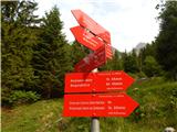 3
3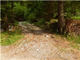 4
4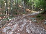 5
5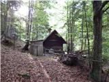 6
6 7
7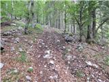 8
8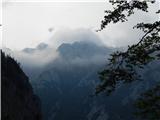 9
9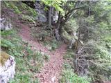 10
10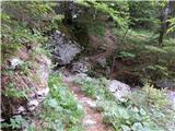 11
11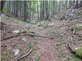 12
12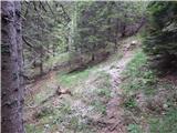 13
13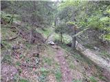 14
14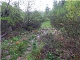 15
15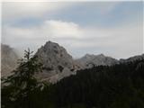 16
16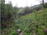 17
17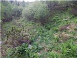 18
18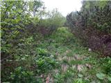 19
19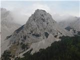 20
20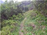 21
21 22
22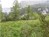 23
23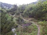 24
24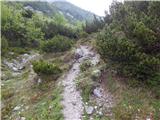 25
25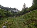 26
26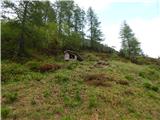 27
27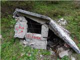 28
28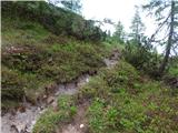 29
29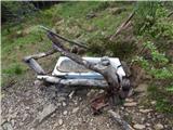 30
30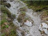 31
31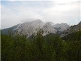 32
32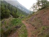 33
33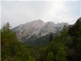 34
34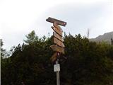 35
35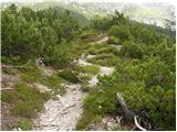 36
36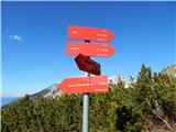 37
37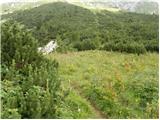 38
38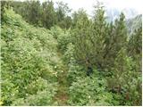 39
39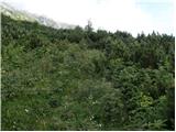 40
40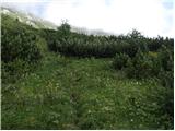 41
41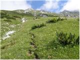 42
42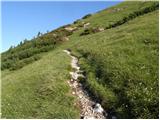 43
43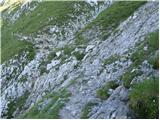 44
44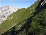 45
45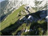 46
46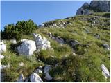 47
47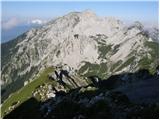 48
48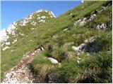 49
49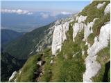 50
50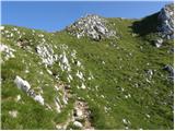 51
51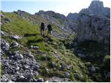 52
52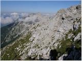 53
53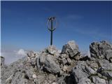 54
54 55
55
Discussion about the trip Tinčkova koča - Vertatscha/Vrtača (via Zagon)
|
| Kanjavec1231. 10. 2017 |
Today my friend and I climbed to Vrtača. Up took about 4 hours (since we started a bit lower than Tinčkova koča), down 3h15min. On the section of the path shown in pictures 17, 18, 19 you really need to be careful not to be led astray by some wrong path - we went a bit on one, which we eventually realized was from animals/herd and leads nowhere  It was well trodden, so it didn't look like it at the beginning. We returned and continued nicely. Unfortunately in autumn in these parts fog/low clouds often linger, at least at the top, so we didn't see the views. At the top there were quite a few people when we arrived (about 6) and we met several on the path too. Risk of slipping exists, especially because the sun doesn't reach the ground and the path is damp and slightly muddy in places. There was very little snow left, just some patches here and there. Nice tour, we're already thinking of connecting it with Stol next time. It was well trodden, so it didn't look like it at the beginning. We returned and continued nicely. Unfortunately in autumn in these parts fog/low clouds often linger, at least at the top, so we didn't see the views. At the top there were quite a few people when we arrived (about 6) and we met several on the path too. Risk of slipping exists, especially because the sun doesn't reach the ground and the path is damp and slightly muddy in places. There was very little snow left, just some patches here and there. Nice tour, we're already thinking of connecting it with Stol next time.
|
|
|
|
| Ulmus6. 08. 2018 |
Yesterday I hiked the path with my 8-year-old son. From Tinčkova koča to the top of Vrtača 3 hours. The path through Zagon is well-trodden, crucial is the junction before the torrent, where you go straight (right) across the torrent. The path description mentions many junctions that we didn't even notice. If you follow the most trodden trail, you reach the collapsed concrete shelter on planina Za Šijo (picture 28), after that everything is signposted and marked. Nice trip, suitable also for children with a bit more stamina. We returned via Zelenica, and during the descent from Šija we detoured to Srednji vrh, from which there is a great view of Vrtača.
|
|
|
To post a comment you must log in:
If you do not yet have a username, you must first
register.