Tolminske Ravne - Grušnica (via planina na Kalu)
Starting point: Tolminske Ravne (924 m)
| Latitude/Longitude: | 46,22940°N 13,77150°E |
| |
Route name: via planina na Kalu
Walking time: 1 h 45 min
Difficulty: easy unmarked way
Elevation gain: 646 m
Elevation difference along the route: 646 m
Map: Julijske Alpe - zahodni del 1:50.000
Recommended equipment (summer):
Recommended equipment (winter): ice axe, crampons
Views: 5.310
 | 3 people like this post |
Access to starting point:
We drive to Tolmin, and then we continue driving in the direction of Žabče and Zadlaz (the turn-off from the main road is located on the left bank of the Tolminka). When we get to Žabče, at the smaller crossroads we continue slightly right in the direction of the settlement Zadlaz. In the settlement Zadlaz-Žabče the road temporarily descends, where it crosses the Zadlaščica over a bridge, and then it again starts to ascend steeply on a narrow but all the time asphalted road. After approximately 12 km from the main road we get to the marked parking lot in Tolminskih Ravnah, where we park.
Route description:
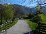
From the parking lot, we return a few steps back to the red mountain direction signs, which we follow in the direction of the mountain hut Koča na planini Razor and mountain pasture Planina Kal. The path ahead first leads us over a grazing fence, then we continue on a cart track that continues across a meadow, from which a nice view opens up on Tolminski Migovec. The cart track soon turns right and brings us to a stone fence, where it splits into two parts.
We continue on the left upper cart track in the direction of the mountain pasture Planina na Kalu (slightly right Koča na planini Razor), which then ascends gently. A little higher, at the older water trough we continue right, then we cross a torrent. We soon arrive at the next junction, where we continue left in the direction of the mountain pasture Planina na Kalu and Tolminski Migovec. The old mule track then for some time continues alongside or slightly right of the nearby torrent, then at the smaller cairn a path branches off slightly to the left from the mule track, which continues alongside the torrent and leads further towards the saddle between the peak Javor on the left and Grušnica on the right, while we continue to stick to the mule track.
Higher we reach the next marked junction, where another path branches off to the right towards the mountain pasture Razor, while we continue left and for a short time continue in only a gentle ascent. One or two minutes further we leave the gentle path and continue slightly right in the direction of the mountain pasture Planina na Kalu (straight ahead we arrive at the previously mentioned saddle, from which we can continue to Javor or to the village Čadrg, and in between there is another turn-off towards the mountain pasture Planina na Kalu). After a shorter somewhat steeper ascent we return to the mule track, where we also join the path from Čadrg.
We continue right and ascend on the mule track all the way to the mountain pasture Planina na Kalu, where to the right of a small saddle stand some old huts.
From the saddle, from where a nice view opens up towards the Tolminka valley, Vrh nad Peski, and the view is also nice on the peaks above Tolminske Ravne, which we have occasionally already seen during the ascent, we continue slightly left of the Grušnica ridge on an easy-to-follow path. After a shorter traverse ascent we reach the eastern ridge of Grušnica, from where a nice view opens up towards the south. Here the path turns somewhat to the right, then brings us in a few minutes of increasingly panoramic walking to the panoramic summit, from which a nice view opens up on the surrounding mountains.
The description and pictures refer to the condition in 2016 (April).

Photos:
 1
1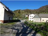 2
2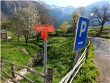 3
3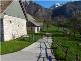 4
4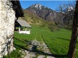 5
5 6
6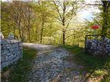 7
7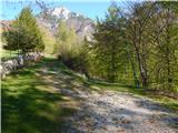 8
8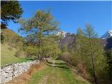 9
9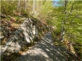 10
10 11
11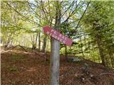 12
12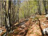 13
13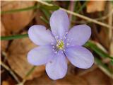 14
14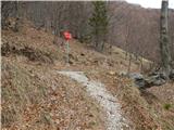 15
15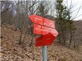 16
16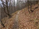 17
17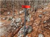 18
18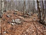 19
19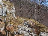 20
20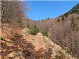 21
21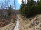 22
22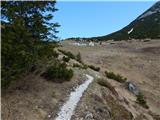 23
23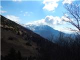 24
24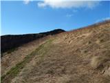 25
25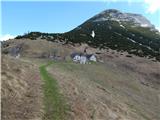 26
26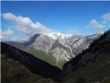 27
27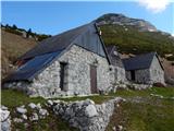 28
28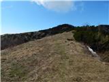 29
29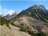 30
30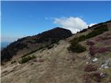 31
31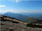 32
32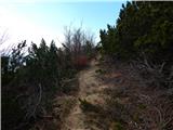 33
33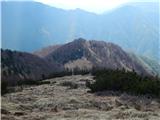 34
34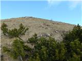 35
35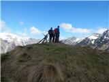 36
36 37
37
Discussion about the trip Tolminske Ravne - Grušnica (via planina na Kalu)
|
| soraya200227. 05. 2020 |
On Sunday from Tolminske Ravne to the mountain pasture on Kal, to Grušnica, to mountain pasture Razor and back to Tolminske Ravne......wonderful Sunday hike for the soul.
|
|
|
|
| darinka411. 02. 2022 17:57:40 |
I didn't imagine that this peak, which isn't even high, is so scenic. Especially if you go on a nice sunny day. Even in winter.
|
|
|
To post a comment you must log in:
If you do not yet have a username, you must first
register.