Tolminske Ravne - Javor (above Tolminske Ravne)
Starting point: Tolminske Ravne (924 m)
| Latitude/Longitude: | 46,22940°N 13,77150°E |
| |
Walking time: 1 h 20 min
Difficulty: easy unmarked way
Elevation gain: 439 m
Elevation difference along the route: 439 m
Map: Julijske Alpe - zahodni del 1:50.000
Recommended equipment (summer):
Recommended equipment (winter): ice axe, crampons
Views: 1.930
 | 2 people like this post |
Access to starting point:
We drive to Tolmin, then continue driving towards Žabče and Zadlaz (the turn-off from the main road is located on the left bank of Tolminka). When we arrive in Žabče, at the smaller crossroads we continue slightly right towards the settlement Zadlaz. In the settlement Zadlaz-Žabče the road temporarily descends, where we cross Zadlaščica over a bridge, then it starts ascending steeply again on a narrow but all the time asphalted road. After approximately 12 km from the main road we arrive at the marked parking lot in Tolminske Ravne, where we park.
Route description:
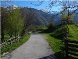
From the parking lot, we return a few steps back to the red alpine direction signs, which we follow in the direction of the mountain hut Koča na planini Razor and mountain pasture Planina Kal. The path ahead first leads over a pasture fence, then we continue on the cart track, which continues across the meadow, from which a nice view opens up on Tolminski Migovec. The cart track soon turns right and brings us to a stone fence, where it splits into two parts.
We continue on the left upper cart track in the direction of the mountain pasture Planina na Kalu (slightly right Koča na planini Razor), which then ascends gently. A little higher, at the older water trough we continue right, then we cross the torrent. Soon we arrive at the next junction, where we continue left in the direction of the mountain pasture Planina na Kalu and Tolminski Migovec. The old mule track continues for some time by or slightly right of the nearby torrent, then moves further right away from it. At the spot where the mule track distances itself from the torrent a smaller cairn usually stands by the path, where we continue left on a well-beaten footpath which continues along the torrent. The path ahead leads us quite steeply upwards, occasionally coming very close to the bed of the torrent, so more caution is needed at some spots, but we can avoid these spots since the slope to the right of the gully is passable. Higher the torrent becomes less distinct, and when we almost step out of the forest, the footpath splits into two parts, and we continue on the right one, which brings us to the saddle between the peak Javor on the left and Grušnica on the right.
On the saddle we also reach the marked path Čadrg - Planina na Kalu, and we continue left, first on easier pathless terrain onto the initially indistinct ridge of the peak Javor, where a footpath reappears right of the dwarf pines. We follow this footpath all the way to the peak a few minutes away, from which a nice view opens up.
Description and pictures refer to the condition in 2016 (April).

Photos:
 1
1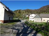 2
2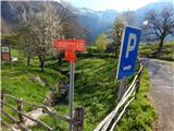 3
3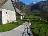 4
4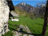 5
5 6
6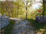 7
7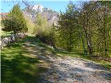 8
8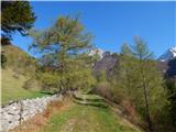 9
9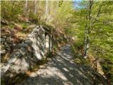 10
10 11
11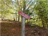 12
12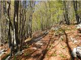 13
13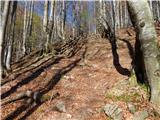 14
14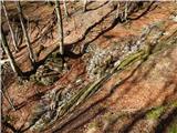 15
15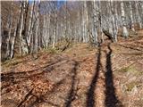 16
16 17
17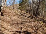 18
18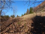 19
19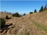 20
20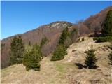 21
21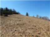 22
22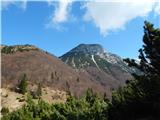 23
23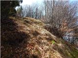 24
24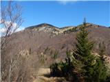 25
25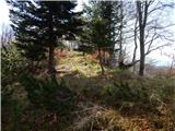 26
26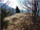 27
27 28
28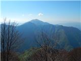 29
29 30
30
Discussion about the trip Tolminske Ravne - Javor (above Tolminske Ravne)
To post a comment you must log in:
If you do not yet have a username, you must first
register.