Tonnerhütte - Herterhöhe (Zirbenweg)
Starting point: Tonnerhütte (1594 m)
| Latitude/Longitude: | 47,05213°N 14,53002°E |
| |
Route name: Zirbenweg
Walking time: 50 min
Difficulty: easy marked way
Elevation gain: 206 m
Elevation difference along the route: 215 m
Map: WK 212 Seetaler Alpen 1:50.000
Recommended equipment (summer):
Recommended equipment (winter): ice axe, crampons
Views: 170
 | 2 people like this post |
Access to starting point:
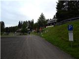
A) Via the Ljubelj border crossing we drive into Austria and follow the signs for Celovec / Klagenfurt am Wörthersee. In Celovec, at McDonald's, we turn right onto the south bypass / Südring, at the next major intersection we turn right again towards Velikovec / Völkermarkt and Mostič / Brückl. We soon leave the road towards Velikovec as shortly after the Obi store we turn right towards the highway and Mostič. Continuing past the Ikea store, we follow the signs for Mostič and pass the highway on-ramps. When we arrive in Mostič we follow the signs for Svinec / Eberstein and Hüttenberg and then Mühlen, which is already located in Steiermark / Steiermark. We reach Mühlen by turning right off the main road, and through the settlement we follow the signs for Jakobsberg and the Tonnerhütte mountain hut, higher up just the signs for the Tonnerhütte mountain hut, where we park on a paid parking lot (4 EUR personal car, June 2020).
B) Via the Jezerski Vrh, Holmec or Vič border crossings we drive into Austria, then we follow the signs for Velikovec / Völkermarkt, from there the signs for Mostič / Brückl. When we arrive in Mostič we follow the signs for Svinec / Eberstein and Hüttenberg and then Mühlen, which is already located in Steiermark / Steiermark. We reach Mühlen by turning right off the main road, and through the settlement we follow the signs for Jakobsberg and the Tonnerhütte mountain hut, higher up just the signs for the Tonnerhütte mountain hut, where we park on a paid parking lot (4 EUR personal car, June 2020).
Route description:
From the parking lot we walk above the mountain hut, where the path splits, and we choose the left path Zirbenweg (right - normal path). The path quickly transitions to a pasture through which we follow the signs for Zirbitzkogel and Zirbenweg. Along the path, which in one section even descends slightly, we notice several informative-educational panels. Higher up we reach a macadam road, which we follow to the left, at the junctions following the wider road. The road shortly turns right, then with ever more beautiful views brings us to the Herterhöhe viewpoint in a few minutes, where the normal path also joins, and via which we can descend.
The description and pictures refer to the condition in June 2020.
Along the route: Herterhöhe (1800m)
Photos:
 1
1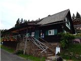 2
2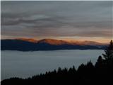 3
3 4
4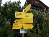 5
5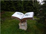 6
6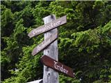 7
7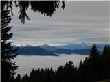 8
8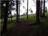 9
9 10
10 11
11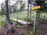 12
12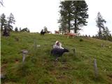 13
13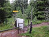 14
14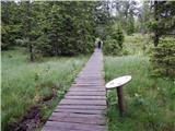 15
15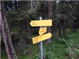 16
16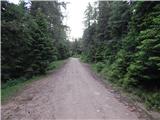 17
17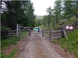 18
18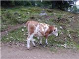 19
19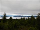 20
20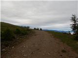 21
21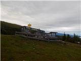 22
22 23
23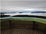 24
24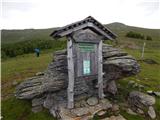 25
25
Discussion about the trip Tonnerhütte - Herterhöhe (Zirbenweg)
To post a comment you must log in:
If you do not yet have a username, you must first
register.