Tonnerhütte - Zirbitzkogel (winter path)
Starting point: Tonnerhütte (1594 m)
Starting point Lat/Lon: 47.05213°N 14.53002°E 
Path name: winter path
Time of walking: 2 h 27 min
Difficulty: easy unmarked way
Difficulty of skiing: no data
Altitude difference: 802 m
Altitude difference (by path): 802 m
Map: WK 212 Seetaler Alpen 1:50.000
Access to starting point:
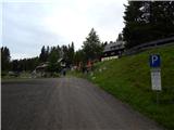
A) Over the border crossing Ljubelj we drive to Austria and follow the signs for Celovec / Klagenfurt am Wörthersee. In Celovec at McDonalds we go right on the south bypass road / Südring, and at the next larger crossroad we go once again right in the direction towards Velikovec / Völkermarkt and Mostič / Brückl. The road towards Velikovec we soon leave because a little after the store Obi we turn right in the direction of highway and Mostič. Further, we go past the store Ikea, where we follow the signs for Mostič and we go past the turn-offs to the highway. When we get to Mostič we follow the signs for Svinec / Eberstein in Hüttenberg and then Mühlen, which is located already in Steiermark. Mühlen we reach by leaving the main road to the right, and through the settlement, we follow the signs for Jakobsberg and mountain hut Tonnerhütte, and higher only the signs for mountain hut Tonnerhütte, where we park on a payable parking lot (4 eur personal car, June 2020).
B) Over the border crossing Jezerski Vrh, Holmec or Vič we drive to Austria, and then we follow the signs for Velikovec / Völkermarkt, and from there we follow the signs for Mostič / Brückl. When we get to Mostič we follow the signs for Svinec / Eberstein in Hüttenberg and then Mühlen, which is located already in Steiermark. Mühlen we reach by leaving the main road to the right, and through the settlement, we follow the signs for Jakobsberg and mountain hut Tonnerhütte, and higher only the signs for mountain hut Tonnerhütte, where we park on a payable parking lot (4 eur personal car, June 2020).
Path description:
From the parking lot, we walk above the mountain hut, where the path splits, and we choose the right panorama path / Panoramaweg (left - Zirbenweg). We at first walk on the road which is ascending diagonally towards the right, and only a little after the left turn we leave it and we continue right in the direction of Zirbitzkogel. The path ahead leads us by the edge of the route of a ski slope, and when the ski slope ends, the path for some time flattens. We follow the marked path, which through a lane of a forest brings us on an ample pastures, where we quickly reach the viewpoint Herterhöhe, where there are situated panorama boards.
We continue straight towards Zirbitzkogel, where with increasingly beautiful views we reach the next marked crossing, where the path branches off to the left towards the peaks Kreiskogel (2306 meters) and Wenzelalpe (2151 meters) and mountain hut Winterleitenhütte (1782 meters), and we still continue straight on. Next follows a quite steady ascent, which offers nice views, before crossing the first stream we leave the normal marked path and we continue slightly left on at first easier pathless terrain, where we follow the winter blazes (wooden poles). Next follows a diagonal ascent towards the left, where in few minutes we reach pond Hirschnlackn.
The pond, where a relatively easy to follow footpath appears, we bypass on the right side, and only a little further we go past another smaller pond. Next follows a steeper ascent, where we follow the footpath, by which we are accompanied by occasional winter blazes. Higher, the footpath starts vanishing, and we follow the winter blazes, which lead us on a slope steeply upwards. When the slope flattens we quickly reach a marked path, which we follow to the right (left - Scharfes Eck and mountain hut Winterleiten Hütte), and then in few minutes of a diagonal ascent we reach the mountain hut Zirbitzkogel Hütte, where few more paths join.
Here we go right and past a rocky chapel we quickly reach the panoramic peak, from which the view reaches all the way to Slovenian and Italian mountains.
The starting point - Herterhöhe 0:40, Herterhöhe - Zirbitzkogelhaus 1:45, Zirbitzkogelhaus - Zirbitzkogel 0:02.
Description and pictures refer to a condition in June 2020.
On the way: Herterhöhe (1800m), Hirschnlackn (2010m), Zirbitzkogel Hütte (Seetaler Alpe) (2376m)
Pictures:
 1
1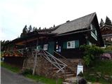 2
2 3
3 4
4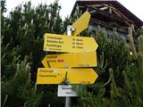 5
5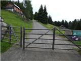 6
6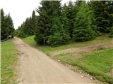 7
7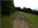 8
8 9
9 10
10 11
11 12
12 13
13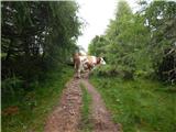 14
14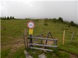 15
15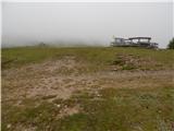 16
16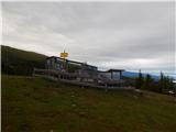 17
17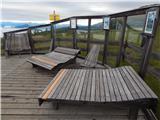 18
18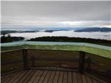 19
19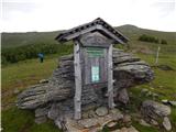 20
20 21
21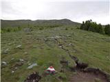 22
22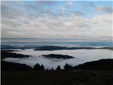 23
23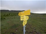 24
24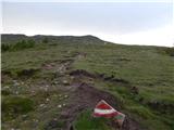 25
25 26
26 27
27 28
28 29
29 30
30 31
31 32
32 33
33 34
34 35
35 36
36 37
37 38
38 39
39 40
40 41
41 42
42 43
43 44
44 45
45 46
46 47
47 48
48 49
49