Starting point: Topol (783 m)
| Latitude/Longitude: | 45,75450°N 14,54370°E |
| |
Walking time: 15 min
Difficulty: easy unmarked way
Elevation gain: 65 m
Elevation difference along the route: 65 m
Map: Snežnik 1:50.000
Recommended equipment (summer):
Recommended equipment (winter):
Views: 2.603
 | 1 person like this post |
Access to starting point:
A) From the Ljubljana–Koper highway, take the Unec exit, then follow the road towards Cerknica and further towards Bloške Police and Nova vas. From Nova vas, continue driving on the main road towards Sodražica to the nearby crossroad, where a somewhat narrower road branches off to the right towards Studenec na Blokah and the settlement Hrib - Loški Potok. Further on, drive through Studenec na Blokah, behind which we soon arrive at a crossroad, where the road towards the village Ravne na Blokah branches off to the left, straight ahead the road continues towards the settlement Hrib - Loški Potok, and to the right the road branches off towards the village Topol. Park at a suitable place near the crossroad.
B) From the Ljubljana–Kočevje road at Žlebič, turn onto the road towards Sodražica. From Sodražica, continue on the main road towards Nova vas na Blokah to the settlement Runarsko, or the crossroad a few hundred meters after the end of the place. From that crossroad, continue sharply left towards Studenec na Blokah and the settlement Hrib - Loški Potok. Further on, drive through Studenec na Blokah, behind which we soon arrive at a crossroad, where the road towards the village Ravne na Blokah branches off to the left, straight ahead the road continues towards the settlement Hrib - Loški Potok, and to the right the road branches off towards the village Topol. Park at a suitable place near the crossroad.
Route description:
From the parking spot, first walk to the nearby cross, from there continue on the cart track, which starts to ascend towards the north; this immediately takes us to extensive pastures (during the grazing season, crossing the pasture fence is forbidden, then we must make a detour along the left side of the pasture and return to the cart track higher up). Further on, we ascend along a relatively gentle cart track ascending over increasingly panoramic grassy slopes. Higher up, the cart track turns somewhat more to the right and climbs almost to the ridge, which it does not reach, as it continues to the left of it. A little further on, the cart track gradually ends, but wheel ruts are still visible over the panoramic grassy slope. A few more minutes of easy walking follow, and we arrive at the summit of the 848 m high Belovka, whose summit is recognisable by a small masonry structure.
Photos:
 1
1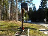 2
2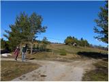 3
3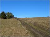 4
4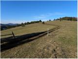 5
5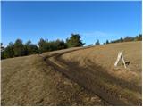 6
6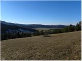 7
7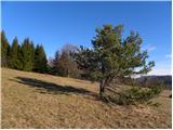 8
8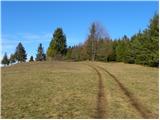 9
9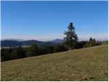 10
10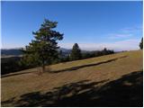 11
11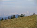 12
12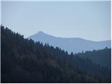 13
13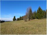 14
14 15
15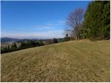 16
16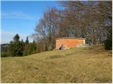 17
17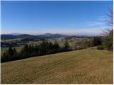 18
18
Discussion about the trip Topol - Belovka
|
| grega_p26. 04. 2021 12:34:23 |
The masonry building is no longer there, instead there is now a container.
Otherwise beautiful views - Snežnik still lives up to its name.
|
|
|
|
| rokeg25. 02. 2023 08:59:41 |
The stone building is still up there. There are two little peaks. On the first one is this stone building, on the second a container.
|
|
|
To post a comment you must log in:
If you do not yet have a username, you must first
register.