Topol - Polhograjska Grmada
Starting point: Topol (651 m)
| Latitude/Longitude: | 46,09110°N 14,36900°E |
| |
Walking time: 1 h 15 min
Difficulty: easy marked way
Elevation gain: 247 m
Elevation difference along the route: 300 m
Map: Ljubljana - okolica 1:50.000
Recommended equipment (summer):
Recommended equipment (winter): ice axe, crampons
Views: 128.220
 | 9 people like this post |
Access to starting point:
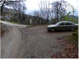
From Medvode we drive to the village of Sora, where we head towards the village of Topol (Katarina). When the road brings us to the mentioned village we turn right and follow it further. Soon it brings us to the next crossroad, where the road towards the village of Belo branches off to the right. We park here on a smaller parking lot by the road.
From Dobrova we drive ahead towards Polhov Gradec. When the signpost for the village of Topol directs us right we turn onto this road and follow it further to the crossroad for the village of Belo, where we park on a smaller parking lot by the road.
Route description:
From the parking lot at the primary school we ascend along the asphalt road to the inn Dobnikar, and from there we continue on the asphalt road that runs along some sort of ridge, then we arrive at the next crossroad, where we continue slightly right in the direction of the village of Belo, Grmada and Tošč.
We walk along the road for another approximately 10 minutes, then we leave the road and continue slightly right in the direction of Grmada. Further, we continue on at first a wide cart track that crosses the slopes without major changes in altitude. After a few minutes of further walking, a relatively steep footpath branches off to the left from the cart track, on which we continue the ascent. After a few minutes the steepness eases and the path brings us to a small saddle, where we continue right (left path to Goljek).
We continue on the path, which with some descents and ascents crosses the slopes towards the west. The path, from which we occasionally get some views, brings us after approximately 1 hour of walking to a junction by which a pleasant bench is placed.
We continue straight on the marked path in the direction of Grmada (left Setnica, right tourist farm Gonte). Further the path in a moderate ascent crosses the slopes slightly to the left, then it starts to ascend steeply on the summit and in snow slippery-dangerous slope of Grmada. The steepness then eases and the path brings us to the panoramic summit ridge of Grmada, from which we have only a few steps to the top.

The trip can be extended to the following destinations: Tošč (1 h)
Photos:
 1
1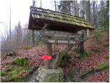 2
2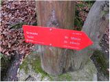 3
3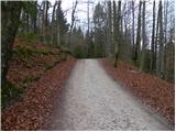 4
4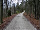 5
5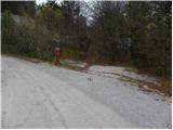 6
6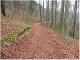 7
7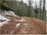 8
8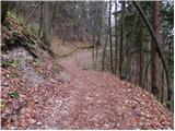 9
9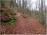 10
10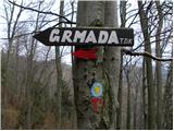 11
11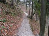 12
12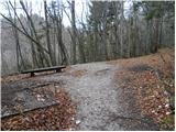 13
13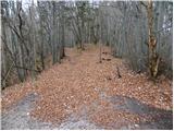 14
14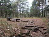 15
15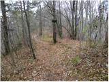 16
16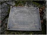 17
17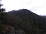 18
18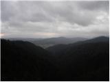 19
19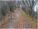 20
20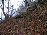 21
21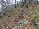 22
22 23
23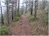 24
24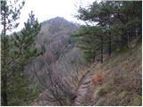 25
25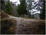 26
26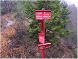 27
27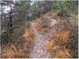 28
28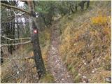 29
29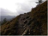 30
30 31
31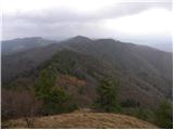 32
32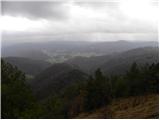 33
33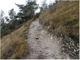 34
34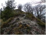 35
35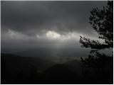 36
36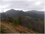 37
37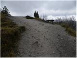 38
38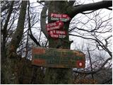 39
39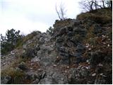 40
40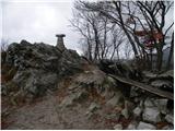 41
41 42
42
Discussion about the trip Topol - Polhograjska Grmada
|
| Gost22. 09. 2006 |
Beautiful, easy hike with nice views, last 10 minutes somewhat steep. Descent towards Gontam awkward in places.
|
|
|
|
| Gost3. 11. 2006 |
is it good here plss write to me plss write to me
|
|
|
|
| Gost3. 11. 2006 |
The trip is not demanding and except for the last part it runs through the forest. But it's a short tour suitable for less than half a day. You can extend the trip to Tošč past the tourist farm Gonte. Best regards
|
|
|
|
| Gost28. 04. 2007 |
Very pleasant, easy trail, but round trip takes about 2.5 hours, if you also go to the tourist farm Gonte. Wonderful view, soft forest path, towards the summit it's a rocky path. If sunny, the ascent is somewhat strenuous due to the heat, so I recommend early morning (which applies to all mountains and hills). Too bad we didn't decide on ascent to Tošč due to the heat, maybe next time.
|
|
|
|
| Damijan13. 05. 2007 |
Beautiful short tour through the forest, last 10 minutes steeper. At the end quite a solid view.
|
|
|
|
| kolesar27. 04. 2009 |
Yesterday we walked the path, which is not demanding but very pleasant. Our youngest daughter liked it a lot because it is mostly flat, only the last part is a bit steeper. It has some rocky sections perfect for small children.
|
|
|
|
| podplat27. 01. 2011 |
Despite cloudy weather and forecast for snowfall, I set off for Polhograjska Grmada. During the hike from Topol through the forest and onwards, small crampons would have been very useful, as the path is icy in places, and very smoothed snow in others. In the last steep section it was especially slippery but I made it to the top, and back with a lot of caution too. Alone on the path, two of us at the top, on the way back I met one female hiker and later another hiker. Instead of lounging at home it was a pleasant trip, and also a lesson that even lower hills are no joke when it comes to crampon use. Next time they'll be on my boots or at least in the backpack. Regards Borut
|
|
|
|
| baxi8. 05. 2011 |
I like Grmada because it's the highest hill I've been on so far.
|
|
|
|
| KARAMELICA27. 01. 2013 |
Were up there on Friday, 25.1.2013 when there was a full moon hike, it was lightly snowing and no views, but it was a real winter idyll. At Gonte an ensemble was playing, real atmosphere, in short, great. Recommend.
|
|
|
|
| Holcar217. 06. 2013 |
Yesterday and today on Grmada, both days terrible heat up there, which gains even more power due to the rocks on the path. Lots of Carniolan lilies, one unfortunately pulled out and even thrown aside . .
maybe it wasn't even that hot, but I was completely exhausted.
up there I ran-walked.
|
|
|
|
| irenan27. 09. 2015 |
Today I was at Grmada, there is no stamp at the summit - only the wooden part on the chain remains, someone has torn off or peeled off the rubber or silicone part grrrrrr
|
|
|
|
| ucakakla20. 10. 2015 |
Does anyone know if there's already a stamp at the top?
|
|
|
|
| robi210714. 11. 2015 |
We were up there at the beginning of August this year, and we could get stamped.
|
|
|
|
| modrook1222. 02. 2020 |
Is there a stamp at the top? Thanks for the answer
|
|
|
|
| Krivaa17. 04. 2022 10:45:16 |
Yesterday on a night hike lost phone (Black Xiaomi),
In the morning it was gone.
The phone is worth practically nothing but has high sentimental value, so nice monetary reward to the finder
Call 040 904 575
Regards
|
|
|
|
| Krivaa18. 04. 2022 16:33:41 |
We've fixed it, thanks everyone
|
|
|
To post a comment you must log in:
If you do not yet have a username, you must first
register.