Trdkova - Tromejnik / Dreiländerecke / Harmashatar (Ježkova pot - by road)
Starting point: Trdkova (288 m)
| Latitude/Longitude: | 46,86210°N 16,11160°E |
| |
Route name: Ježkova pot - by road
Walking time: 20 min
Difficulty: easy marked way
Elevation gain: 102 m
Elevation difference along the route: 102 m
Map:
Recommended equipment (summer):
Recommended equipment (winter):
Views: 11.189
 | 1 person like this post |
Access to starting point:
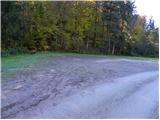
From the Pomurska motorway we head to the Murska Sobota exit, and then we continue driving towards the border crossing Hodoš. In the settlement Gornji Petrovci we continue left in the direction of the settlement Kuzma. Further, we drive through the villages Šulinci, Ženavlje and some other villages, and we follow the road to the beginning of the village Martinje (on signposts Martinje Trdkova). Here just a few tens of meters before the beginning of the village we notice signs for Tromejnik, which direct us to the right, on the road along which we quickly arrive in the village Trdkova. The road then moderately ascends and brings us to an intersection where we notice signs for Tromejnik left and right. We choose the left road, which starts to descend steeply. The road then flattens and after a few hundred meters of further driving brings us to the next intersection, where we continue right (direction Tromejnik). Further, we drive on a gently undulating macadam road, which we follow to the marked parking lot by the information boards for Tromejnik.
Route description:
From the parking lot at the tourist log cabin, we continue on the macadam road which for a short time still ascends gently, and then it brings us to another larger parking lot, after which the road starts ascending steeply. We continue in the direction of Tromejnik and continue the ascent on a poorer road which ascends steeply through the forest. The path, along which we notice numerous educational panels, flattens higher up and turns slightly to the right, where we quickly arrive at a smaller junction.
We continue sharply left and follow the gradually steeper road or cart track to the top of Tromejnik, which we reach after a few minutes of further walking through the forest.
Photos:
 1
1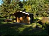 2
2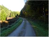 3
3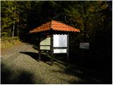 4
4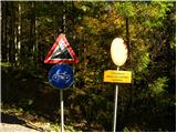 5
5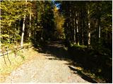 6
6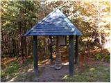 7
7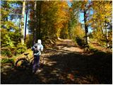 8
8 9
9 10
10 11
11 12
12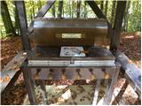 13
13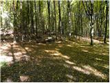 14
14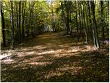 15
15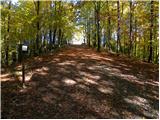 16
16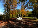 17
17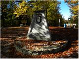 18
18
Discussion about the trip Trdkova - Tromejnik / Dreiländerecke / Harmashatar (Ježkova pot - by road)
|
| grega_p1. 11. 2010 |
From the parking at the tourist log cabin you can also go [by the] forest path - start 50m lower [than the parking] (large marker). This variant [allows you to] notice curiosities along Ježkova pot.
|
|
|
|
| Robie28. 12. 2014 |
Interesting educational path but in CATASTROPHIC condition, a lot of effort was invested but everything has been deteriorating for years - what a shame.
|
|
|
|
| AndrejRibic25. 02. 2015 |
14.2.2015 Border crossing Matjaševci - bike path (3.5km) - Tromejnik and back. The path is in excellent condition, little snow in shady spots. It leads along the border between Austria and Slovenia all the way. Recommended.
|
|
|
To post a comment you must log in:
If you do not yet have a username, you must first
register.