Trebanjski grad - Trebni vrh (via caves and hunting lodge)
Starting point: Trebanjski grad (278 m)
| Latitude/Longitude: | 45,90370°N 15,00580°E |
| |
Route name: via caves and hunting lodge
Walking time: 1 h
Difficulty: easy marked way
Elevation gain: 303 m
Elevation difference along the route: 330 m
Map:
Recommended equipment (summer):
Recommended equipment (winter): crampons
Views: 2.735
 | 1 person like this post |
Access to starting point:
A) We leave the Ljubljana–Novo mesto highway at the Trebnje–west exit, then continue driving on the old road towards Trebnje. Soon we will reach the gas station, but we turn right just a few tens of metres behind it towards the nearby Trebanje Castle, where we already notice the first hiking signposts. The marked parking lot is located somewhat above the castle; we get there by continuing right at the junction by the castle, then immediately left. A short drive past the castle follows, then we arrive at the next hiking signposts, where the signs for the parking lot direct us left.
B) From the Novo mesto–Ljubljana highway we head to the Trebnje–east exit, then continue driving on the old road towards Trebnje. We then drive south of Trebnje, and once we are on the west side of the town we turn right towards Trebnje. A few tens of metres further, at the junction we turn left and drive over the overpass to Trebanje Castle, where we already notice the first hiking signposts. The marked parking lot is located somewhat above the castle; we get there by continuing right at the junction by the castle, then immediately twice left. A short drive past the castle follows, then we arrive at the next hiking signposts, where the signs for the parking lot direct us left.
Route description:
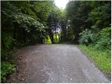
From the parking lot, we descend a few metres to the mountain signposts mentioned in the description of the starting point, from where we continue in the direction of Vrhtrebnje. The path first bypasses a residential house on the left side, then passes into the forest, through which it first runs on a cart track. The marked path quickly leaves the cart track and turns a little more to the left, where it ascends to the overpass over the highway. On the other side of the highway we ascend steep stairs (from here a nice view opens up on Trebnje and surroundings), above them we cross a poor macadam road. Above the road, the path returns into the forest and brings us to a marked junction.
From the junction we continue slightly left in the direction of Vrhtrebnje past Mala and Velika jama (slightly right - steep path to Trebni vrh and Vrhtrebnje). The path ahead moderately ascends through the forest and relatively quickly brings us to the entrance to Velika jama cave. From Velika jama we continue left and temporarily descend, then the path turns right and in a few steps ascends from Mala jama. Above Mala jama, the path steeply ascends for a short time, then brings us in moderate gradient to the cart track, which we follow to the right, but we walk on it only briefly, as the marks then lead us left onto a marked path. The path we are walking on joins a little higher the path from Odrga.
We follow the mentioned path to the right, which in a gentle ascent brings us out of the forest to the place where we join the steep path.
Immediately when we reach the asphalt road, the path to Trebni vrh branches off to the left, we continue straight along the road, which leads us past a few houses, then joins a second asphalt road, which we follow to the right. A short descent follows, then the path brings us to a larger chapel, where we continue left towards the nearby church of St. Jakob.
From the church we continue briefly along the road, then quickly arrive at the marker of the 15th meridian and the hunting lodge.
From the hunting lodge we continue along the macadam road, which we soon leave, and continue left onto a forested cart track, up which we ascend to Trebni vrh.

Photos:
 1
1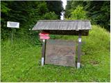 2
2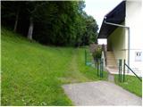 3
3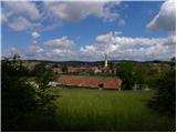 4
4 5
5 6
6 7
7 8
8 9
9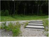 10
10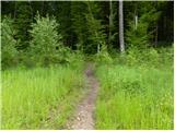 11
11 12
12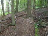 13
13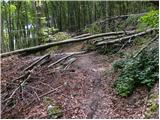 14
14 15
15 16
16 17
17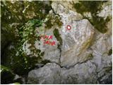 18
18 19
19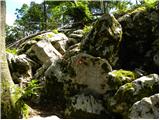 20
20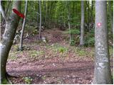 21
21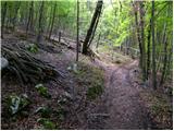 22
22 23
23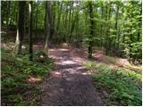 24
24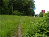 25
25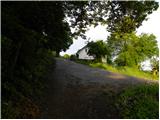 26
26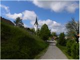 27
27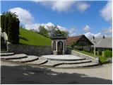 28
28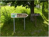 29
29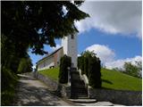 30
30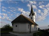 31
31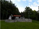 32
32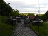 33
33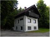 34
34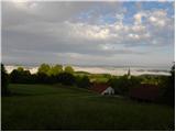 35
35 36
36 37
37 38
38 39
39
Discussion about the trip Trebanjski grad - Trebni vrh (via caves and hunting lodge)
To post a comment you must log in:
If you do not yet have a username, you must first
register.