Trenta - Vodnikov Vršac (Vršac nad Zadnjico)
Starting point: Trenta (620 m)
| Latitude/Longitude: | 46,37720°N 13,74950°E |
| |
Walking time: 4 h 55 min
Difficulty: easy pathless terrain
Elevation gain: 1574 m
Elevation difference along the route: 1630 m
Map: TNP 1:50.000
Recommended equipment (summer): helmet
Recommended equipment (winter): helmet, ice axe, crampons
Views: 3.160
 | 1 person like this post |
Access to starting point:
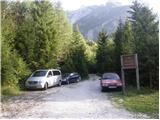
A) First, we drive to Kranjska Gora, and then we continue driving through the Vršič pass towards Bovec. Soon after the 50th serpentine the road crosses the Krajcarica river, from where we drive approximately another 1 km to the spot where a forest road closed by a ramp branches off to the left. We park a few meters before the ramp on a suitable place by the road.
B) We drive to Bovec, and then we continue driving towards Trenta. When we arrive in Trenta, we will notice a forest road which branches off sharply to the right from the main road before the center of the settlement. At the mentioned intersection, which is located a few hundred meters before the center of Trenta, we turn sharply right and then park on a suitable place by the road.
Route description:
From the ramp we continue on the forest road, which gently ascends and brings us to an intersection, next to which there is a smaller "parking lot". From the intersection we continue on the lower right road following the signs for Prehodavci, but we walk on it only a short time, as the signs then lead us left into the forest. The path ahead leads past a house and behind it starts ascending again. Further on we ascend along the Beladovec stream, on which we can observe some nice small waterfalls. During the ascent along the stream the path gradually becomes less steep, then it turns slightly to the left, where it flattens even more. There follow a few minutes of completely easy walking, then the path, which runs along an old mule track, starts to ascend moderately in switchbacks. For some time we still ascend through the forest, then, when we are already high above the stream, the forest also gradually starts to thin out. There follow a few more minutes of walking and the path brings us to the hunting hut in Trebiški dol.
The path ahead still continues along the mule track, which leads us below the ridge of Špičje on the right and Velika glava and Veliki Konj on the left. The moderately steep path, which continues through the scenic valley, splits a little higher into two parts.
We continue on the right path (straight to saddle Čez dol, Zadnjica and Zadnjiški Ozebnik, to the latter leads an unmarked path) in the direction of Prehodavci. Just a few 10 meters higher we arrive at the next junction, where the path from saddle Čez dol and Zadnjica joins us. Again we continue right and continue the path along the wide mule track, which further crosses somewhat precipitous slopes. During the ascent over the precipitous slope we will notice on the left side a smaller "chapel" (statue of Mary with Jesus).
Further on the slope along which the path runs becomes less steep and more and more scenic. Higher the well-preserved mule track leads us over a somewhat less steep slope of Zelena griva, above it the slope becomes steeper again. There follow a few shorter steep sections, then the path and the slope flatten. Somewhat above the indistinct break we arrive at a marked junction, where we continue left (right Lepo or Veliko špičje - Stanko Kosa path, straight Koča pri Triglavskih jezerih) towards the nearby Zasavska koča na Prehodavcih. The path ahead leads us along a wide and scenic ridge, which past the winter bivouac brings us to Zasavska koča in a few minutes.
From the hut we continue towards the northeast and first descend a little. The path then brings us to a junction where right leads the path to drinking water.
Here the path starts ascending again and crosses the slopes above Jezero pod Vršacem. The path then ascends somewhat more steeply and brings us to the saddle between Kanjavec and Vodnikov Vršac.
From the saddle we continue a few dozen meters along the marked path, which starts descending. We then leave the marked path and head left onto pathless terrain. Here we walk on an easy grassy slope, and for orientation we are also helped by a few cairns. After a short ascent we reach the slopes on the south side of the peak and there follows an ascent along the scenic slope to the summit.
Trenta - Zasavska koča 4:15, Zasavska koča - Vršac nad Zadnjico 40 minutes.

Photos:
 1
1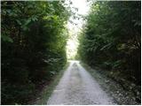 2
2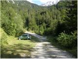 3
3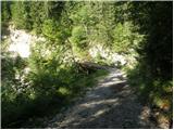 4
4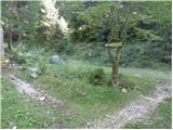 5
5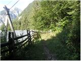 6
6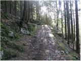 7
7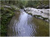 8
8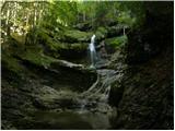 9
9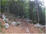 10
10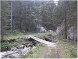 11
11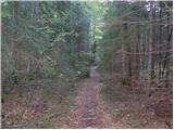 12
12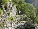 13
13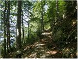 14
14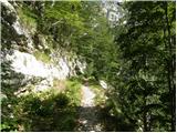 15
15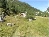 16
16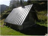 17
17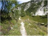 18
18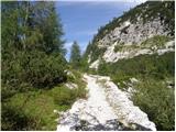 19
19 20
20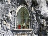 21
21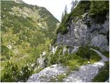 22
22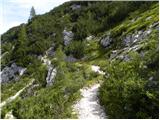 23
23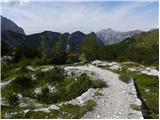 24
24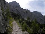 25
25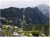 26
26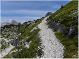 27
27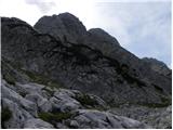 28
28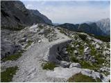 29
29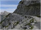 30
30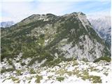 31
31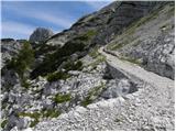 32
32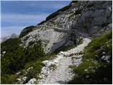 33
33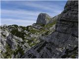 34
34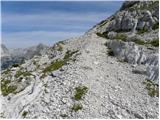 35
35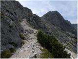 36
36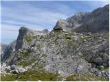 37
37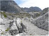 38
38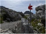 39
39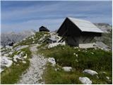 40
40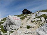 41
41 42
42 43
43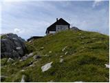 44
44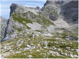 45
45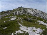 46
46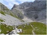 47
47 48
48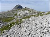 49
49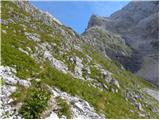 50
50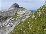 51
51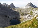 52
52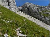 53
53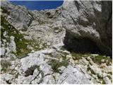 54
54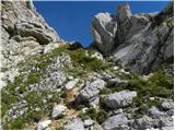 55
55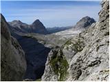 56
56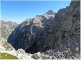 57
57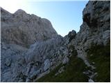 58
58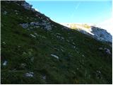 59
59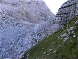 60
60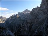 61
61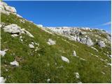 62
62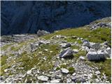 63
63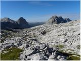 64
64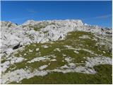 65
65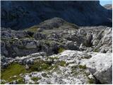 66
66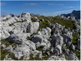 67
67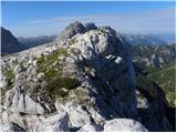 68
68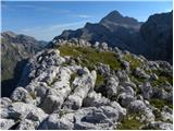 69
69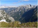 70
70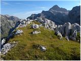 71
71
Discussion about the trip Trenta - Vodnikov Vršac (Vršac nad Zadnjico)
|
| saram25. 08. 2024 20:51:35 |
Yesterday 24.08.2024 I visited this summit. Very nice viewpoint. Completely alone on the entire trail, although there were quite a few hikers up to Zasavska koča na Prehodavcih. The trail is nicely traceable. I started from Trenta, trail bp.
|
|
|
To post a comment you must log in:
If you do not yet have a username, you must first
register.