Trnovec - Osolnik (via Mavški graben)
Starting point: Trnovec (390 m)
| Latitude/Longitude: | 46,12350°N 14,35370°E |
| |
Route name: via Mavški graben
Walking time: 1 h 15 min
Difficulty: easy marked way
Elevation gain: 468 m
Elevation difference along the route: 468 m
Map: Ljubljana - okolica 1:50.000
Recommended equipment (summer):
Recommended equipment (winter): crampons
Views: 8.290
 | 2 people like this post |
Access to starting point:
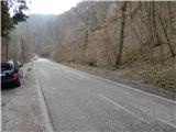
a) First we drive to Medvode, then at the Špar store we leave the main road and continue towards the railway station and the settlement of Sora. In Sora we turn left towards Katarina, and when we arrive in the settlement of Trnovec, we watch for the red mountain signs for Osolnik, which we see on the right side of the main road. A good 100 meters further at the junction of the gravel road there are more. We park in the parking lot by the road, between the two junctions of the path to Osolnik.
b) From Kranj we drive towards Škofja Loka, then from the outskirts of Škofja Loka we follow the signs for Gorenja vas. Before the Sten tunnel we exit the roundabout towards the settlement of Sora. We continue through the settlements of Hosta, Pungert, Gosteče and Draga to the settlement of Sora, where we turn right towards Katarina. When we arrive in the settlement of Trnovec, we watch for the red mountain signs for Osolnik, which we see on the right side of the main road. A good 100 meters further at the junction of the gravel road there are more. We park in the parking lot by the road, between the two junctions of the path to Osolnik.
c) From the Poljanska valley we drive towards Škofja Loka and then along the bypass and through the Sten tunnel. After the tunnel we turn right and follow the signs for the settlement of Sora. We continue through the settlements of Hosta, Pungert, Gosteče and Draga to the settlement of Sora, where we turn right towards Katarina. When we arrive in the settlement of Trnovec, we watch for the red mountain signs for Osolnik, which we see on the right side of the main road. A good 100 meters further at the junction of the gravel road there are more. We park in the parking lot by the road, between the two junctions of the path to Osolnik.
Route description:
Due to the consequences of the floods in August 2023, Mavški graben is completely buried and impassable, and the footbridge was also washed away. The mountain path on the section Ločnica pri Rusu–Pod Osolnikom is closed until further notice.
From the starting point we go back a little, then at a small hamlet we see signs for the circular path to Osolnik, which direct us onto a side road that turns into a cart track upon entering the forest. Initially there follows an easy ascent along the Mavški graben stream, then the path becomes steeper and the stream more picturesque. Higher up we cross the stream via a small bridge, then from the ravine we move onto the slope. A few more minutes of ascent through the forest follow, then along the edge of a meadow where we already see the summit of Osolnik on the left, the path turns right into the forest, where it temporarily levels out completely. A short moderate ascent follows, then we reach the road where we join the path from Sora.
We continue left to the nearby junction, where at the shrine we leave the road and continue right onto the mountain path (straight ahead the Osovnik hut). An ascent along an indistinct ridge follows, after a few minutes the path becomes somewhat steeper and climbs in a few switchbacks. When we step out of the forest, we already see the church of St. Mohor and Fortunat ahead, only a few dozen steps separate us from it, and the summit is a little further from the church.
The description and photos refer to the situation in 2018 (March).

Photos:
 1
1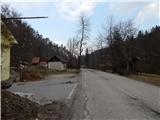 2
2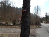 3
3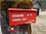 4
4 5
5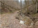 6
6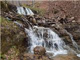 7
7 8
8 9
9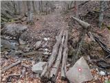 10
10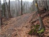 11
11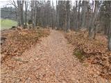 12
12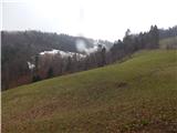 13
13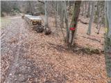 14
14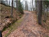 15
15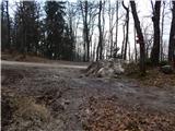 16
16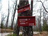 17
17 18
18 19
19 20
20 21
21 22
22 23
23 24
24 25
25 26
26 27
27 28
28 29
29 30
30
Discussion about the trip Trnovec - Osolnik (via Mavški graben)
|
| viru529. 06. 2025 15:33:37 |
At the beginning of the path, where there is a sign for the circular path (picture number 4), there is a notice from the Alpine Association of Slovenia below stating that the path is temporarily closed.
On the PZS path condition page (https://stanje-poti.pzs.si/) it says that the path has been closed since 6.8.2023 due to floods:
SLO: Zaradi posledic poplav je graben zasut in neprehoden, odneslo je brv. Planinska pot skozi Mavški graben je do nadaljnjega ZAPRTA. ENG: Due to the effects of floods, Mavški graben is covered with fallen trees and impassable, the footbridge is gone. The marked trail is CLOSED until further notice.
|
|
|
|
| jozee29. 06. 2025 21:54:46 |
I think the situation is not as bad as it appears in the post. In dry weather, visitors to Osolnik also use this path.
|
|
|
To post a comment you must log in:
If you do not yet have a username, you must first
register.