Korte / Trögern - Virnikov Grintovec
Starting point: Korte / Trögern (991 m)
| Latitude/Longitude: | 46,43720°N 14,48880°E |
| |
Walking time: 2 h 15 min
Difficulty: easy marked way
Elevation gain: 663 m
Elevation difference along the route: 685 m
Map: Karavanke - osrednji del 1:50.000
Recommended equipment (summer):
Recommended equipment (winter): ice axe, crampons
Views: 6.845
 | 1 person like this post |
Access to starting point:
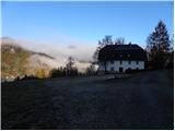
From the Ljubljana - Jesenice highway, take the Kranj - East exit and follow the road ahead in the direction of Jezersko. From Zgornje Jezersko, continue driving towards Austria to the settlement Železna Kapla / Bad Eisenkappel, where at a somewhat larger intersection turn left towards the settlements Obirsko / Ebriach, Šajda / Zell - Schaida and Korte / Trögern. Further, drive a few kilometers through the valley of the Obirski potok stream, then turn left towards the settlement Korte / Trögern. Further, drive through the Skoz peči gorge to the already mentioned settlement, where park on a large parking lot by the former inn Pristovnik.
The starting point can also be reached from the Savinja Valley, namely via the Pavličev vrh border crossing.
Route description:
From the parking lot, we head onto the road by which we arrived at the starting point. After approximately 3 minutes of descent, we will arrive at a crossroads where a road branches off sharply to the left, alongside which there are mountain signs for Virnikov Grintovec, Roblekova planina and Jezersko. Head onto the mentioned road, which begins to ascend transversely across initially still panoramic slopes, from which a nice view opens up onto Virnikov Grintovec, Pečovnik, Plešivec and surrounding hamlets.
When the partly panoramic slopes end, the road turns right and crosses the Pristovški potok stream, after which we arrive in more or less dense forest. Further, we ascend through the forest for quite some time, following the "main" road at crossroads, which higher up brings us to a marked junction.
Here, continue sharply right towards Virnikov Grintovec (straight ahead Roblekova planina 5 minutes) on the path that enters the forest and begins to ascend moderately. The cart track brings us a little higher to a clearing, from which a view opens up onto our goal and a little further onto Obir; it then turns slightly right. A short stretch of walking follows on the wide cart track, after which the blazes direct us left onto a narrower and gradually increasingly steep cart track. A little higher, another cart track joins from the left; we continue right and after a few minutes of further walking arrive at the Žingerc saddle, where we step onto the Slovenian side.
Continue towards Virnikov Grintovec on the path that enters the forest, which begins to ascend ever more steeply. The fairly steep path brings us higher onto the main ridge, where it turns left. On the ridge, from which beautiful views open up onto the surrounding peaks, the steepness also eases. We follow this occasionally very panoramic path, which is slippery in places (no major danger when dry), all the way to the summit of Virnikov Grintovec.

Along the route: Žingerc (1345m)
Photos:
 1
1 2
2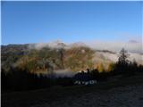 3
3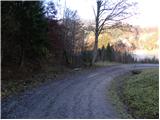 4
4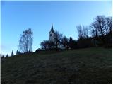 5
5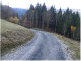 6
6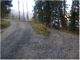 7
7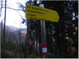 8
8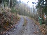 9
9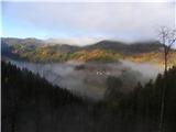 10
10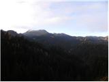 11
11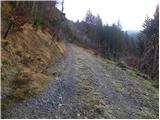 12
12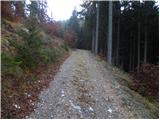 13
13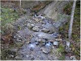 14
14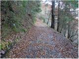 15
15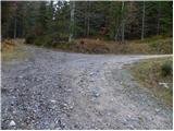 16
16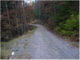 17
17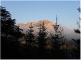 18
18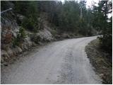 19
19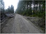 20
20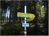 21
21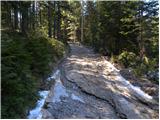 22
22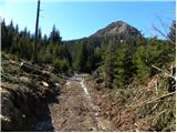 23
23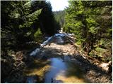 24
24 25
25 26
26 27
27 28
28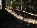 29
29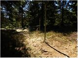 30
30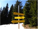 31
31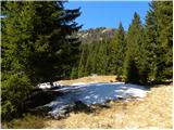 32
32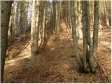 33
33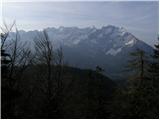 34
34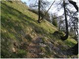 35
35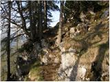 36
36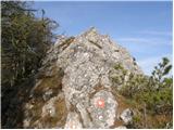 37
37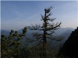 38
38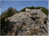 39
39 40
40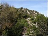 41
41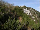 42
42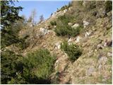 43
43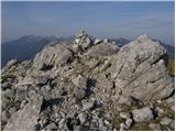 44
44 45
45
Discussion about the trip Korte / Trögern - Virnikov Grintovec
|
| marinka6712. 08. 2013 |
You can't reach Gostilna Pristovnik by car anymore, but have to park on the road at the turnoff for the church. That's what a friendly lady from Romania explained to us, who has a refreshment stand lower by the road. The path is thus supposedly extended by approx. 1 hour. Well, we didn't check, but drove to Jezersko and ascended V. Grintovec from there.
|
|
|
To post a comment you must log in:
If you do not yet have a username, you must first
register.