Trojane - Koča na Čemšeniški planini
Starting point: Trojane (561 m)
| Latitude/Longitude: | 46,18790°N 14,88280°E |
| |
Walking time: 2 h 30 min
Difficulty: easy marked way
Elevation gain: 559 m
Elevation difference along the route: 600 m
Map: Posavsko hribovje - zahodni del 1:50.000
Recommended equipment (summer):
Recommended equipment (winter): crampons
Views: 16.118
 | 2 people like this post |
Access to starting point:
From the highway Ljubljana - Maribor, we take the Trojane exit, then continue driving on the parallel old road towards Trojane and Domžale. Our starting point is located right next to the catering company Gostinsko podjetje Trojane. We park somewhere nearby, as parking in front of the catering company is permitted only for guests.
Route description:
From the parking lot at Gostinsko podjetje Trojane, we continue on the asphalt road in the direction of Izlake. The road first leads us along a panoramic ridge, then gently descends to the hamlet V Zideh, where we leave the main road towards Izlake and continue left towards the village Šentgotard. We follow the road towards Šentgotard for only a few meters, then the signs for Čemšeniška planina direct us to the right onto a marked footpath, which already after a few minutes returns to the road.
The road then brings us to Šentgotard, where we bypass the church of St. Gotard on the left side. When the mentioned village ends, we arrive at the next crossroad. We continue right in the direction of Čemšenik, Dobrljevo and Brezje (left Prvine and Limovce) and walk on the asphalt road for a few minutes, then the signs for Čemšeniška planina direct us sharply left onto a marked footpath. The footpath quickly widens into a cart track, along which we ascend to the crossroad at Ovčje jame in a few minutes.
From the crossroad we continue on the road towards the east (direction Čemšeniška planina) and walk along it to the edge of the forest, from there onto a marked footpath, which soon crosses a poor forest road. We ascend through the forest for some time, then reach the macadam road which leads towards Prvine. We follow it to the left, after which after a few minutes we notice the signs for Čemšeniška planina, which direct us sharply right onto a gently sloping cart track. After a few meters the cart track splits into two parts, we choose the upper left cart track, which higher changes into a somewhat steeper mountain path. Higher we return to the road, and we walk along it to the parking lot at Prvine.
Here we bypass the nearby hotel D on the left side, and the road brings us to the ski track of the Prvine ski centre, from where a beautiful view opens up. Here we leave the road and continue the ascent slightly right onto a cart track, which ascends transversely across the ski slope, then passes into the forest, where it gradually changes into a wide path. There follows a few minutes of moderate ascent through the forest, then we reach a wide cart track, along which in a few steps of further walking we arrive at the marked junction.
Here we continue straight (sharply right and downhill to Izlake, Čemšenik, Kisovec...) on the path which gradually passes along the edge of steep grassy slopes. We continue the ascent along the edge of panoramic slopes, from which a nice view opens up on the surrounding places and nearby hills. Higher the path flattens and passes onto steep slopes, across which we walk to the Koča na Čemšeniški planini in a few minutes.

Along the route: V Zideh (565m), Šentgotard (629m), Prvine (870m)
Photos:
 1
1 2
2 3
3 4
4 5
5 6
6 7
7 8
8 9
9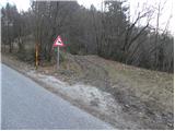 10
10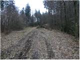 11
11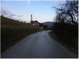 12
12 13
13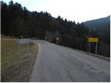 14
14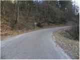 15
15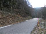 16
16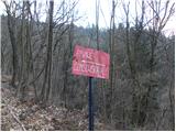 17
17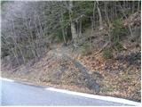 18
18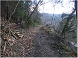 19
19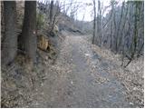 20
20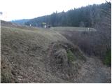 21
21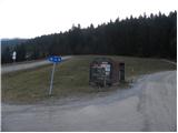 22
22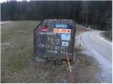 23
23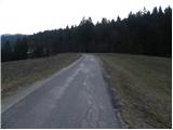 24
24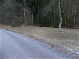 25
25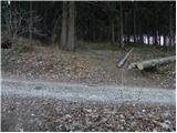 26
26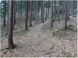 27
27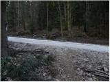 28
28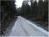 29
29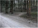 30
30 31
31 32
32 33
33 34
34 35
35 36
36 37
37 38
38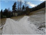 39
39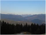 40
40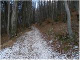 41
41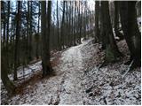 42
42 43
43 44
44 45
45 46
46 47
47 48
48 49
49 50
50 51
51 52
52 53
53 54
54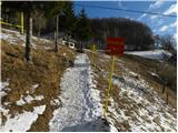 55
55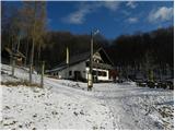 56
56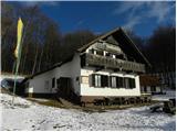 57
57
Discussion about the trip Trojane - Koča na Čemšeniški planini
To post a comment you must log in:
If you do not yet have a username, you must first
register.