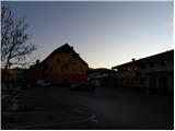
Starting point: Trojane (561 m)
| Latitude/Longitude: | 46,18790°N 14,88280°E |
| |
Walking time: 2 h 30 min
Difficulty: easy marked way
Elevation gain: 395 m
Elevation difference along the route: 500 m
Map: Posavsko hribovje - zahodni del 1:50.000
Recommended equipment (summer):
Recommended equipment (winter):
Views: 11.685
 | 3 people like this post |
Access to starting point:
From the highway Ljubljana - Maribor, we go to the exit Trojane, and then we continue driving on the parallel old road towards Trojane and Domžale. Our starting point is located right next to the catering company Gostinsko podjetje Trojane. We park somewhere nearby, parking in front of the catering company is only for guests.
Route description:
From the parking lot at the catering company Gostinsko podjetje Trojane, we walk to the bus stop, and from there we carefully cross the main road. On the other side of the road, we ascend on steep stairs and above them we continue left. After a few steps, we will reach a marked path, and we follow it right among houses to the nearby inscription box.
From the inscription box, the path which runs on a worse road starts descending towards the valley of the stream Bolska. When we get to the mentioned valley, we step on a wider macadam road which we follow to the left. Further, we are ascending for some time through the mentioned valley, and then the road avoids it a little to the left. Further, we are ascending diagonally towards the right, meanwhile we cross a larger number of smaller streams and springs, which on dry days mostly dry up. Higher, we get to a marked crossroad, where we continue on the left wider macadam road, by which there are also signs for pasture "pašnik Lipovc". From the crossroad ahead, the road is only a short time ascending, and then it gradually starts gently descending and it brings us to the next crossroad.
We continue straight in the direction of Rokovnjaška pot (right pasture Lipovec) and we still continue on the macadam road. At the next crossroad, we continue slightly left in the direction of Špilk and Kekec and we continue on the road with some shorter ascents and descents for quite some time. After a good 2 hours of walking on a wider macadam road, signs for Špilk point us to the left on a somewhat narrower and also a bit steeper road which we follow only a few minutes. After a few minutes, still before we step out of the forest, signposts for Špilk will point us left on a relatively steep footpath. The path ahead is still ascending through the forest, but through its periphery, so that we can with a few steps to the right get to a panoramic meadow. Only a little higher, the path crosses a worse cart track and then it brings us on the main ridge of Špilk. Here the path turns to the left and after two minutes of additional walking brings us to the summit, in the middle of which stands a smaller bivouac.

Photos:
 1
1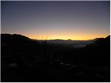 2
2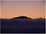 3
3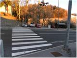 4
4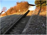 5
5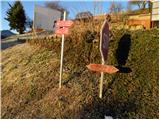 6
6 7
7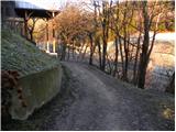 8
8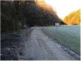 9
9 10
10 11
11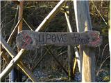 12
12 13
13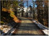 14
14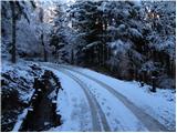 15
15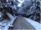 16
16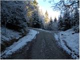 17
17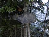 18
18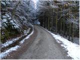 19
19 20
20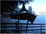 21
21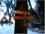 22
22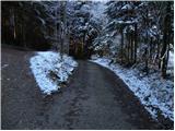 23
23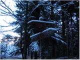 24
24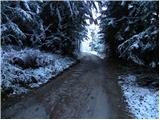 25
25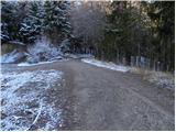 26
26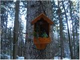 27
27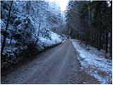 28
28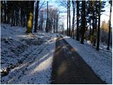 29
29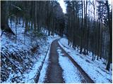 30
30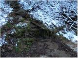 31
31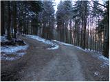 32
32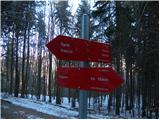 33
33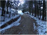 34
34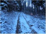 35
35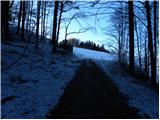 36
36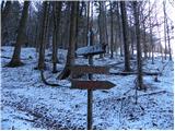 37
37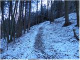 38
38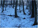 39
39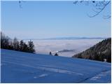 40
40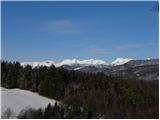 41
41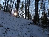 42
42 43
43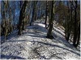 44
44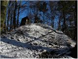 45
45 46
46
Discussion about the trip Trojane - Špilk
|
| starakapa23. 12. 2011 |
Yesterday, December 22, I went from Trojane to Špilk. The trail is mostly lightly snow-covered but you don't need crampons. At two or three spots where water flows over the road, it's icy, but you can avoid it. I was also at Lipovec pasture. Very interesting, especially their TROPHIES, not to mention the WC. Very welcoming!!! The bivouac at Špilk is well maintained and clean. So, the trail itself is nice and especially solitary with very little sun. In summer I recommend it to young families and hikers seeking solitude.
|
|
|
|
| baro2. 04. 2013 |
Very nice hike. It would also be suitable for runners who love trail running, or in the forest, as practically 90% of the path is on a forest road, and the ascent is also very gentle. Nicely marked and maintained, the bivouac is also nice.
|
|
|
|
| herman83. 04. 2013 |
You had a great time, I've walked this path many times too. From the path description and photos it's clear you did the whole path on the road. It would be even better to turn left right after Lipovec past the barrier. The path is marked and you walk through the forest the whole time. Try it next time. LP
|
|
|
|
| bruny4. 04. 2013 |
The path through the forest is indeed marked but the markers are in poor condition. Slightly above the path there is also the 913-meter-high peak Reznarca. Based on what I saw, I would assess that the forest trail !? has been abandoned-(maybe someone knows more?) and was deliberately rerouted to the forest road. Geopedia also doesn't ,,recognize,, it. Along the forest path there is practically the only point - a wooden cross whose restoration was taken care of by hunters according to the inscription. But the forest path is nice, also sunnier and the ascent to the summit of Špilk is from the eastern side.Lp
|
|
|
|
| herman810. 04. 2013 |
The trail is of course not abandoned, but it is true that it is poorly marked from the start. Few hikers know about this trail. I go on this trail to Špilk at least 10 times every year. Usually I then stop by Kekec, where the caretaker is the old partisan Matevž, who really likes it when someone visits him.
|
|
|
|
| ejti10. 04. 2013 |
Matevž is already 85, but he still manages everything himself, even drives himself from Kamnik. It's open on weekends. He really likes to tell some war stories - some are downright cinematic, but true.
He's really a guy!
|
|
|
|
| bruny1. 05. 2019 |
Today from Trojane along the described path... For lovers of forest roads and shady terrains  definitely the right one... definitely the right one...
|
|
|
|
| bruny31. 07. 2020 |
This morning, today on Friday on the last day of July from Trojane to Špilk. After storms in the past days still quite some freshness in the Špilk forests...
|
|
|
|
| bruny21. 07. 2022 15:17:42 |
Along the described path today... To photo no. 37 and back.  It was great... It was great...
|
|
|
|
| bruny29. 07. 2022 16:20:35 |
Today on the described path...Turnaround and back to Trojane ,,somewhere,, between photos 32/33...
|
|
|
To post a comment you must log in:
If you do not yet have a username, you must first
register.