Trpčane - Koča na Kozleku
Starting point: Trpčane (425 m)
| Latitude/Longitude: | 45,52810°N 14,31640°E |
| |
Walking time: 1 h 45 min
Difficulty: easy marked way
Elevation gain: 572 m
Elevation difference along the route: 572 m
Map: Snežnik 1:50.000
Recommended equipment (summer):
Recommended equipment (winter):
Views: 9.682
 | 1 person like this post |
Access to starting point:
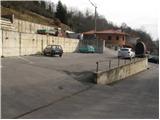
From the highway Ljubljana - Koper, we go to the Postojna exit and follow the road ahead in the direction of Reka and Ilirska Bistrica. At the end of Ilirska Bistrica, we turn left towards the villages Vrbovo, Jablanica and Trpčane. We drive past the villages Jasen, Vrbovo, Vrbica and Jablanica to the village Trpčane, where at the inn in the village we turn left in the direction of Kozlek. We park on one of the parking lots in the village. Don't park in the yard.
Route description:
From the parking lot, we continue through the village upwards to the spot where the blazes direct us onto a cart track. The cart track then leads past a grazing fence in which they breed wild boars. The path ahead ascends gently over ample grassy slopes after which we come below the foot of Kozlek. We still continue on the marked cart track, which gradually brings us into the forest. We then leave the often quite muddy cart track as the blazes direct us onto a footpath which ascends more steeply. The moderately steep path brings us higher to the next cart track, which soon has a junction, where we continue right in the direction of Kozlek. The cart track then in a moderate ascent crosses slopes towards the east and higher turns left onto an indistinct saddle, where there is the next junction. We continue left into the forest in the direction of Kozlek. The path, which gradually ascends steeper and steeper, brings us after a further 15 minutes of walking to the summit of Kozlek, from which only a short descent follows to the mountain hut.

Photos:
 1
1 2
2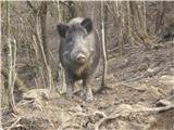 3
3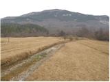 4
4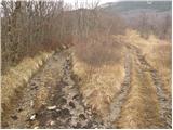 5
5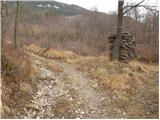 6
6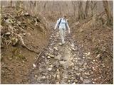 7
7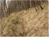 8
8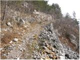 9
9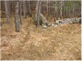 10
10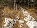 11
11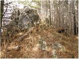 12
12 13
13
Discussion about the trip Trpčane - Koča na Kozleku
To post a comment you must log in:
If you do not yet have a username, you must first
register.