Tržič (Slap) - Dom pod Storžičem
Starting point: Tržič (Slap) (540 m)
| Latitude/Longitude: | 46,36820°N 14,31910°E |
| |
Walking time: 2 h 15 min
Difficulty: easy marked way
Elevation gain: 583 m
Elevation difference along the route: 583 m
Map: Karavanke - osrednji del 1:50.000
Recommended equipment (summer):
Recommended equipment (winter): crampons
Views: 8.500
 | 1 person like this post |
Access to starting point:
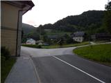
We drive to Tržič, and then we follow the signs for Dovžanova soteska and Lom pod Storžičem. Still before Tržič ends, we arrive at a crossroads, where near the factory Lepenka an ascending road branches off to the right towards the settlement Lom pod Storžičem. At the crossroads begins the described path; we park at an appropriate place nearby.
Route description:
At the crossroads we notice signs for Dom pod Storžičem and Storžič, which direct us right onto the road towards the settlement Lom pod Storžičem. At first we walk past a few more houses, then the mountain signs for the footpath direct us slightly right onto a cart track that continues through the forest. At a few smaller junctions we continue left, and from the path a nice view temporarily opens up on the hamlet Slap. A little further ahead, at the chapel we step out of the forest and the path takes us to the settlement Lom pod Storžičem, where we also reach a narrower asphalt road. Along the mentioned road we go past a few houses, then we descend to the main road, which we follow right uphill.
We continue walking on the asphalt road, from which first a road branches off to the left to the Štorman apartments, a little further a marked path towards Tič and mountain pasture Konjščica. We continue on the road, which leads past the branch primary school Lom pod Storžičem, then also past the parish church of St. Catherine of Alexandria. With nice views we continue through the village, then at a smaller NOB monument we continue right onto a side road that leads past a few more houses, after which the asphalt ends. For a short time we continue on macadam, then we return to the main road, along which we quickly reach the settlement Grahovše. There follows a fairly level walk, where we walk past individual houses, at crossroads following the signs for Dom pod Storžičem. At the hamlet Slaparska vas the asphalt finally ends, the road splits a little further ahead. We continue slightly right (left: mountain pasture Javornik, Stegovnik, mountain pasture Konjščica, Bela peč and tourist farm Rekar). The road to Dom pod Storžičem remains completely level for a while longer, but when it enters the forest it gradually begins to ascend moderately. While walking along the road the path leads us past a water trough, a little further, somewhat behind a smaller shrine, the signs for Dom pod Storžičem direct us right. This is followed by crossing a stream, immediately after the stream we go left onto a footpath that first steeply ascends through a narrow strip of forest, then mostly moderately ascends across Senožeti. During the ascent across Senožeti a nice view opens up on Bela peč and Storžič, higher also on Begunjščica and Stol. When we leave Senožeti, we first cross a poor macadam road, then we fully approach the macadam road that leads towards Dom pod Storžičem.
We continue on the marked path, which returns to the forest, and follow it all the way to the mountain hut Dom pod Storžičem, which we reach after a few minutes of further walking.
Tržič - Lom pod Storžičem 30 minutes, Lom pod Storžičem - Grahovše 30 minutes, Grahovše - Dom pod Storžičem 1:15.
Description and pictures refer to the condition in 2018 (June).

Along the route: Lom pod Storžičem (696m), Grahovše (818m)
Photos:
 1
1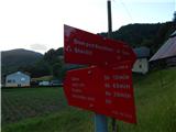 2
2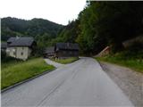 3
3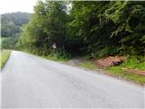 4
4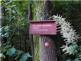 5
5 6
6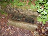 7
7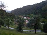 8
8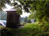 9
9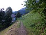 10
10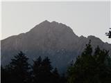 11
11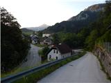 12
12 13
13 14
14 15
15 16
16 17
17 18
18 19
19 20
20 21
21 22
22 23
23 24
24 25
25 26
26 27
27 28
28 29
29 30
30 31
31 32
32 33
33 34
34 35
35 36
36 37
37 38
38 39
39 40
40 41
41 42
42 43
43 44
44 45
45 46
46 47
47 48
48 49
49 50
50 51
51 52
52
Discussion about the trip Tržič (Slap) - Dom pod Storžičem
To post a comment you must log in:
If you do not yet have a username, you must first
register.