Tržič - Veliki vrh above Završnik (via Kamnek)
Starting point: Tržič (530 m)
| Latitude/Longitude: | 46,36470°N 14,31030°E |
| |
Route name: via Kamnek
Walking time: 1 h 45 min
Difficulty: easy marked way
Elevation gain: 438 m
Elevation difference along the route: 500 m
Map: Karavanke - osrednji del 1:50.000
Recommended equipment (summer):
Recommended equipment (winter): ice axe, crampons
Views: 7.525
 | 1 person like this post |
Access to starting point:
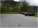
From the Ljubljana - Jesenice highway we take the Ljubelj (Tržič) exit, then before the gas station in Bistrica pri Tržiču we turn right downhill, where we quickly arrive in Tržič. At the intersection past the Mercator store we turn left in the direction of Tržič Museum, but we continue driving along Koroška cesta, which we follow through the center of the town to the nearby pizzeria. Here we turn right through the old courtyard gates and then past the parking lot for guests of the pizzeria and the children's playground we drive to the parking lot by the castle.
Route description:
From the parking lot by the castle we first descend the stairs, then continue left on a wide path, from which a nice view of Tržič opens up. A little further ahead we arrive at the chapel, where we continue straight in the direction of Radetzkyjeva pot. We continue the ascent on a gentle path, then an arrow on a tree directs us right, where we quickly arrive at the nearby gardens. Above the gardens the path enters the forest and begins to ascend steeply. Further on, the well-marked path leads past a few more junctions, then gradually transitions to an increasingly panoramic ridge. Here a marked path branches off slightly to the left, bypassing the peak Kamnek; we continue slightly right and after 3 minutes of further walking ascend to the panoramic Kamnek (on maps Kamnik).
From Kamnek we continue straight along the initially still panoramic ridge, then the path enters a low forest and begins to descend. When the path levels out, the path to Slap branches off to the right, and from the left the previously mentioned path that bypasses Kamnek joins us.
We continue straight and begin to ascend gently to moderately along the Pirmance ridge. When the ridge becomes quite steep, the marked path turns left onto somewhat less steep slopes, across which we continue traversing to the right. After a few minutes the forest thins out somewhat and the path returns to the ridge, which we reach right on a smaller saddle between the peaks Pirmance and Veliki vrh.
Here we leave the marked path, which goes right to the eastern side of the mountain, and continue straight uphill on an unmarked but easily followable path, along which in 5 minutes of further walking we ascend to the panoramic Veliki vrh nad Završnikom.

Photos:
 1
1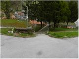 2
2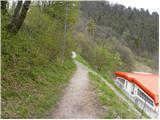 3
3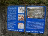 4
4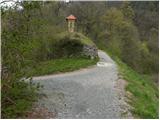 5
5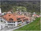 6
6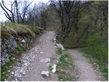 7
7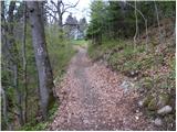 8
8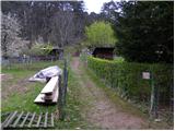 9
9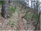 10
10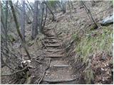 11
11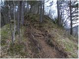 12
12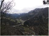 13
13 14
14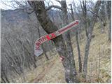 15
15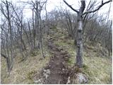 16
16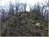 17
17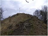 18
18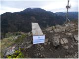 19
19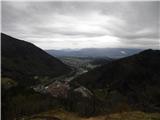 20
20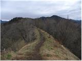 21
21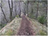 22
22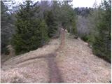 23
23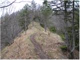 24
24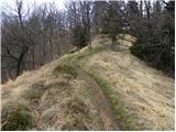 25
25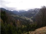 26
26 27
27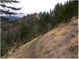 28
28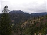 29
29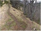 30
30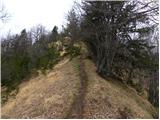 31
31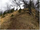 32
32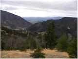 33
33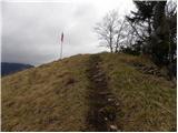 34
34 35
35
Discussion about the trip Tržič - Veliki vrh above Završnik (via Kamnek)
|
| natasja31. 03. 2017 |
Very nice path . There is no stamp neither at Kamnek nor at Veliki vrh. . There is no stamp neither at Kamnek nor at Veliki vrh.
Along the path there are 2x turn-offs for SLAP, before Kamnek and before Veliki vrh. Does anyone know if the path leads to the Slap settlement or actually to some waterfall?
|
|
|
|
| UB7731. 03. 2017 |
The path leads to the Slap settlement. But you can make a nice loop if you descend to Slap and return to the starting point at the castle.
|
|
|
|
| natasja1. 04. 2017 |
@UB77, thanks for the info and idea for the next one . .
|
|
|
|
| michael668. 07. 2022 11:10:51 |
There is a stamp at Kamnek
|
|
|
To post a comment you must log in:
If you do not yet have a username, you must first
register.