Tržiški graben - Storžič (via Javorniški preval)
Starting point: Tržiški graben (1010 m)
| Latitude/Longitude: | 46,36670°N 14,42470°E |
| |
Route name: via Javorniški preval
Walking time: 3 h 45 min
Difficulty: difficult marked way
Elevation gain: 1122 m
Elevation difference along the route: 1140 m
Map: Karavanke - osrednji del 1:50.000
Recommended equipment (summer): helmet
Recommended equipment (winter): helmet, ice axe, crampons
Views: 4.591
 | 1 person like this post |
Access to starting point:
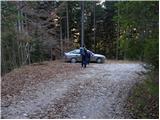
From the Ljubljana-Jesenice motorway, take the Kranj-east exit and follow the road towards Jezersko. Before reaching Zgornje Jezersko, or more precisely right after the Kanonir inn, leave the main road and continue left onto the local road, which begins to climb moderately along the Reka stream. Soon we reach a small junction, where the road to Kozji vrh branches steeply uphill to the left, but we continue along the wider road, following it to the next junction. Here continue left towards Storžič (right Stegovnik) and continue climbing along the stream. Higher up, in the middle of a sharp right bend, a footpath towards Storžič and Kališče branches straight ahead, but we follow the road for a while longer, or more precisely to the spot where we notice the mountaineering direction sign reading Javorniški preval 2h 10 min. Park here at a suitable spot by the road.
The road is CLOSED from 20.7. to 20.10. When the road is closed, park lower down, which extends the ascent by nearly an hour.
Route description:
From the starting point, head onto the steep footpath towards Javorniški preval. After a few minutes of ascent, the path flattens and gradually leads us to a tractor track, along which we cross the slopes to the right. Just after the track crosses a wide torrent gully, we leave it and continue the ascent slightly left onto an initially parallel mountaineering path. The path ahead ascends steeply for a while, then turns right, crossing a somewhat steeper gully. On the other side of the gully, the path flattens and crosses the slopes to the right in a moderate ascent. During the crossing, the path from Bašeljski preval joins from the left, and we follow the transverse path to the junction at Javorniški preval, where there is also the logbook box of the Viharnik mountaineering association.
From the mentioned pass, continue sharply left towards Storžič (straight down to Dom pod Storžičem, slightly right Stegovnik west path, right Stegovnik east path) and proceed along the path that gently ascends through the forest. Further on, the initially gentle path quickly brings us to the steep slopes of Škarjeva peč, across which we ascend transversely for some time, then the path turns slightly left and begins to ascend steeply. A transverse ascent to the right follows, where a chain assists due to the steepness and often damp terrain. The ascent along the chain follows, with brackets and pins helping at some points. The secured section ends after a few minutes, and the path continues transversely across occasionally quite steep slopes. Higher up, occasional views open up, the slope becomes less steep, and the path leads to a marked junction where we join the more trodden path from Dom pod Storžičem - the path over Škarjev rob.
Continue straight, then ascend transversely along the western slopes of the Škarjev rob ridge, from where we have a nice view of the path ahead and Storžič. Higher up, the path brings us to the mentioned ridge, from which we also get a view of the Jezersko side, where the highest peaks of the Kamniško Savinjske Alpe are clearly visible. Further on, we ascend through a belt of dwarf pines, then onto scree slopes where snow patches may still be found in early summer. The ascent along the edge of the scree follows, then we reach the technically more demanding part of the path, where we first cross a slightly exposed gully (if snow-covered, there is a high risk of slipping without winter equipment), then ascend a steep valleyette exposed to falling rocks. In the upper part of the valleyette, safety features assist, and the path then turns somewhat right. Another approximately 10 minutes of ascent on a fairly steep slope follows, and the increasingly panoramic path leads to the summit of Storžič.
Starting point - Javorniški preval 1:40, Javorniški preval - Škarjev rob junction 0:35, Škarjev rob junction - Storžič 1:30.

Along the route: Razpotje pod Javorniškim prevalom (1393m), Javorniški preval (1467m), Škarjeva peč (1671m), Razpotje Škarjev rob (1670m), Škarjev rob (1801m)
Photos:
 1
1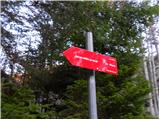 2
2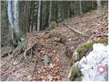 3
3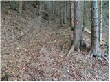 4
4 5
5 6
6 7
7 8
8 9
9 10
10 11
11 12
12 13
13 14
14 15
15 16
16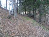 17
17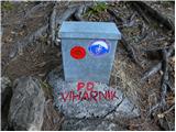 18
18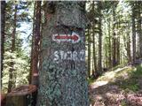 19
19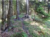 20
20 21
21 22
22 23
23 24
24 25
25 26
26 27
27 28
28 29
29 30
30 31
31 32
32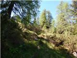 33
33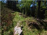 34
34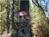 35
35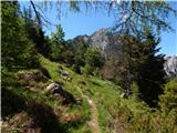 36
36 37
37 38
38 39
39 40
40 41
41 42
42 43
43 44
44 45
45 46
46 47
47 48
48 49
49 50
50 51
51 52
52 53
53
Discussion about the trip Tržiški graben - Storžič (via Javorniški preval)
To post a comment you must log in:
If you do not yet have a username, you must first
register.