Turracher Höhe - Rinsennock (southern way)
Starting point: Turracher Höhe (1795 m)
| Latitude/Longitude: | 46,91470°N 13,87500°E |
| |
Route name: southern way
Walking time: 1 h 45 min
Difficulty: easy marked way
Elevation gain: 539 m
Elevation difference along the route: 539 m
Map:
Recommended equipment (summer):
Recommended equipment (winter): ice axe, crampons
Views: 3.668
 | 1 person like this post |
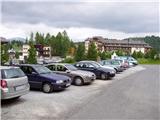
Access to starting point:
From Austrian Kärnten: first we drive to the settlement Feldkirchen, from where we follow a well-marked road to the mountain pass Turracher Höhe.
From Austrian Steiermark and Salzburg we drive to the valley of the river Mur and follow the road to the settlement Predlitz (the settlement is located west of Murau). In Predlitz we leave the main road and continue driving towards the mountain pass Turracher Höhe.
Route description:
From the parking lot on Turracher Höhe we go on the path in the direction of the summits Kornock and Rinsennock. After a few minutes of walking on the road, we come to a junction next to the summer sledding track. At the junction there are signposts, where it says Kornock and Rinsennock left and right (a possible circular path). If we have decided for the ascent on a somewhat more southern path, we continue left and then immediately right over a grazing fence onto a footpath. Further, the path, which moderately ascends through the forest, brings us to the area where a sign warns that we are entering the area of falling rocks. The path ahead leads us past a spring and the earlier mentioned avalanche terrain. After that, the path starts to ascend more steeply and quickly brings us to a bench that invites us to sit down and enjoy the view of the surroundings.
Further, the path brings us into more level terrain, to a partly abandoned mountain pasture, in the middle of which we notice a decaying shepherd hut. Just a little before the mentioned hut we turn left, cross the stream and ascend a path vegetated with bushes. After a few minutes of diagonal ascent we pass from the bushes onto expansive grassy slopes along which we continue for some time with a fairly gentle ascent. Soon the path starts to ascend more steeply, turns right and brings us to the summit slope of the mountain. We follow this panoramic and not too steep ridge path all the way to the grassy summit.

Photos:
 1
1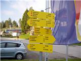 2
2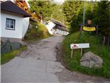 3
3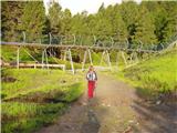 4
4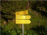 5
5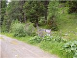 6
6 7
7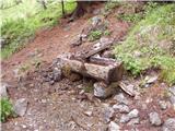 8
8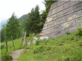 9
9 10
10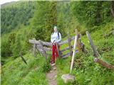 11
11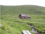 12
12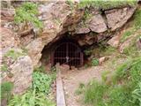 13
13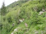 14
14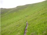 15
15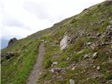 16
16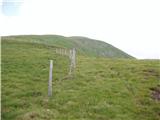 17
17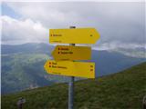 18
18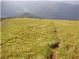 19
19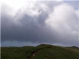 20
20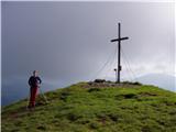 21
21
Discussion about the trip Turracher Höhe - Rinsennock (southern way)
|
| felix2. 08. 2022 18:49:13 |
It is necessary to warn that near the abandoned mine there is a junction, which is not marked. Left leads the trail that is in this description, right leads the so-called "Barbaraweg" to Kornock. Since the markings for that trail are more visible, it can mislead us here in case of carelessness.
|
|
|
To post a comment you must log in:
If you do not yet have a username, you must first
register.