Turracher Höhe - Schoberriegel
Starting point: Turracher Höhe (1795 m)
| Latitude/Longitude: | 46,91470°N 13,87500°E |
| |
Walking time: 1 h 20 min
Difficulty: easy marked way
Elevation gain: 413 m
Elevation difference along the route: 430 m
Map:
Recommended equipment (summer):
Recommended equipment (winter): ice axe, crampons
Views: 5.723
 | 2 people like this post |
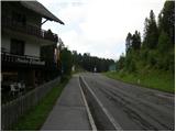
Access to starting point:
From Kärnten: first we drive to the settlement Feldkirchen, from where we follow a well-marked road to the mountain pass Turracher Höhe.
From Steiermark and Salzburg we drive to the valley of the river Mur and follow the road to the settlement Predlitz (the settlement is located west of the town Murau). In Predlitz we leave the main road and continue driving towards the mountain pass Turracher Höhe.
Route description:
From the parking lot, we first cross the main road, then head onto a narrower asphalt road that branches off at the pension »Elizabeth«. The road first descends a little past the parking lots, then turns slightly to the right. We follow the signs for Schoberriegel. The asphalt then ends and we continue to follow the macadam road, which brings us to a crossroads with signposts. We continue in the direction of Schoberriegel, Eisenhut. The worsening road brings us to the hut Sonnalmhütte, which is located by the ski slope.
From the hut we continue along the road following the signs for Eisenhut. After a few turns, when we reach the upper station of the cableway, we leave the road and turn right onto the footpath. The path initially runs through a sparse forest and occasionally a nice view opens towards the lake Turrachsee, which is located on the mountain pass Turracher Höhe. When we reach the ridge, the path turns slightly to the left and slowly the last trees disappear. The path then continues along the ridge and brings us to the grassy summit Schoberriegel.

Along the route: Sonnalmhütte (1880m)
Photos:
 1
1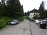 2
2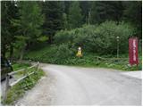 3
3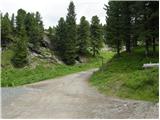 4
4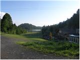 5
5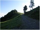 6
6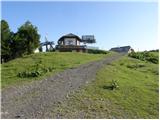 7
7 8
8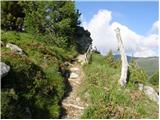 9
9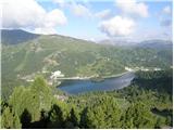 10
10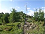 11
11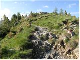 12
12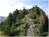 13
13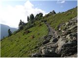 14
14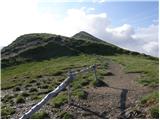 15
15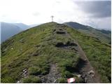 16
16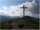 17
17
Discussion about the trip Turracher Höhe - Schoberriegel
|
| švedrc20. 12. 2010 |
Since it snowed on Saturday night, I put on snowshoes and made a track to Schoberriegel. At the starting point the thermometer showed -12°. There's quite a lot of snow, only on the summit the wind blew it away.
|
|
|
|
| švedrc21. 12. 2010 |
correction... I meant to write snowshoes
regards
|
|
|
|
| Borut129. 12. 2025 22:17:38 |
The summit is quite visited even in winter, during our visit the path was well trodden.
|
|
|
To post a comment you must log in:
If you do not yet have a username, you must first
register.