Tuškov Grič - Koča na Črnem vrhu above Novaki
Starting point: Tuškov Grič (1010 m)
| Latitude/Longitude: | 46,17110°N 14,04210°E |
| |
Walking time: 35 min
Difficulty: easy marked way
Elevation gain: 235 m
Elevation difference along the route: 235 m
Map: Škofjeloško in Cerkljansko hribovje 1:50.000
Recommended equipment (summer):
Recommended equipment (winter):
Views: 6.691
 | 2 people like this post |
Access to starting point:
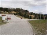
From Škofja Loka we drive towards Gorenja vas and further to Hotavlje. Here signs for the ski center point us to the right. At the next crossroads, we follow the road in the direction of the mentioned ski slope and the road then brings us to the large parking lot Počivalo. We continue through the parking lot on the road which starts descending and quickly brings us to the next crossroad, where we continue right upwards. We follow the road ahead to the next large parking lot named Tuškov Grič.
Access from Cerkno: We drive through Novaki towards the ski center Cerkno to the parking lot Tuškov Grič.
From Železniki over Davča we drive to the ski center Cerkno. We park at the Tuškov Grič parking lot.
Route description:
Near the parking lot, we notice mountain signposts that direct us to the path in the direction of Blegoš and Črni vrh. The path first ascends transversely across the meadow, then enters the forest, where it ascends moderately. After approximately 15 minutes, we come to a forest road which quickly brings us out of the forest to the Cerkno ski slope (while the ski slope operates, walking on the ski slope is forbidden). We then continue the ascent on a rough road which leads us up the ski slope and brings us a little higher to a path junction. We continue on the right road which in 5 minutes brings us to the mountain hut on Črni vrh.
Photos:
 1
1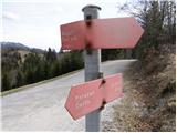 2
2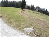 3
3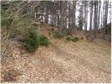 4
4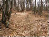 5
5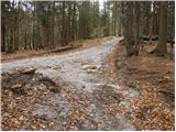 6
6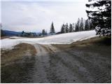 7
7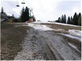 8
8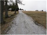 9
9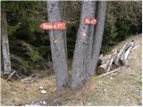 10
10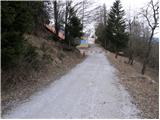 11
11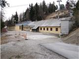 12
12
Discussion about the trip Tuškov Grič - Koča na Črnem vrhu above Novaki
|
| julius26. 02. 2019 |
The building is still there, but it is no longer a mountain hut. It has been removed from the register of Slovenian mountain huts.
|
|
|
|
| BredaT4. 10. 2022 08:52:23 |
Hello, I'm interested if anyone knows if the facility is still operating.
|
|
|
To post a comment you must log in:
If you do not yet have a username, you must first
register.