Uglov laz - Dom na Travni Gori
Starting point: Uglov laz (856 m)
| Latitude/Longitude: | 45,74710°N 14,60610°E |
| |
Walking time: 1 h 10 min
Difficulty: easy marked way
Elevation gain: 50 m
Elevation difference along the route: 150 m
Map:
Recommended equipment (summer):
Recommended equipment (winter):
Views: 5.039
 | 2 people like this post |
Access to starting point:
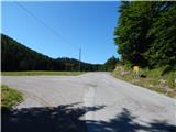
A) From the road Ljubljana - Kočevje, at the settlement Žlebič we turn right (from the direction of Kočevje left) in the direction of Sodražica, from Sodražica we continue driving in the direction of Loški Potok. After a little less than 5 km of ascent from Sodražica we arrive at a crossroads, where a macadam road towards Travna Gora branches off to the left. Here we turn left and then we park at an appropriate place by the road, best on some wider passing place.
B) From the Bloška Plateau we drive to the settlement Ravne na Blokah, and then we drive through the settlements Kračali and Janeži. We bypass the settlement Križeti on the left side, and then we join the main road which runs from Sodražica towards Hrib-Loški Potok. We follow the road to the right, then a little further at the first crossroads we continue left in the direction of Travna Gora. We park at an appropriate place by the road, best on some wider passing place.
C) From Mali Log, Retje, or Hrib-Loški Potok we drive towards Sodražica. When after a few kilometers we arrive at the spot where we notice signs for Travna Gora, we continue right and then we park at an appropriate place by the road, best on some wider passing place.
Route description:
From the crossroads, the road runs for a short time through a meadow, then passes into the forest and gradually ascends. Higher, the road flattens and brings us out of the forest, where we bypass the shooting range on the right side. The road continues with some shorter ascents and descents, and leads partly through the forest, and partly through karst meadows. After we bypass Pšeničev vrh on the right side, the road starts to descend more steeply, and at the right turn a marked path from Sodražica also joins from the left. From the turn we continue the descent, from the road already after a few meters a worse road branches off to the right, which leads towards Ravni dol.
We continue on the main wider road, which stops descending, and then in a few minutes brings us to a sign which marks the beginning of the settlement Travna Gora. Here the road leads among pastures, and at the crossroads we continue on the right road (straight to the settlement Travna Gora). The path ahead leads us past some holiday cottages, and then ascends to the next crossroads, where we again continue right in the direction of Dom na Travni Gori. There follow a few minutes of walking on the road, and then we arrive at a crossroads which is located directly above Dom na Travni Gori. Here we continue straight and through the meadow in one minute of additional walking descend to the mentioned mountain hut.

Along the route: Travna Gora (880m)
Photos:
 1
1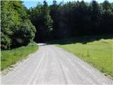 2
2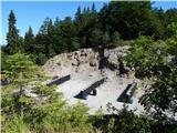 3
3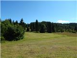 4
4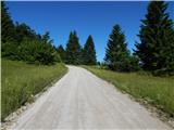 5
5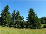 6
6 7
7 8
8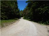 9
9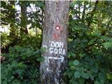 10
10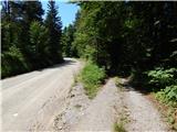 11
11 12
12 13
13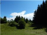 14
14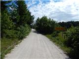 15
15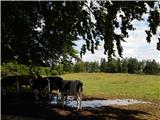 16
16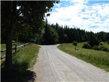 17
17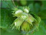 18
18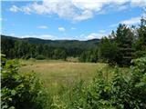 19
19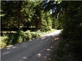 20
20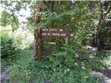 21
21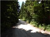 22
22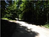 23
23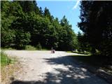 24
24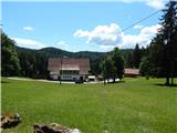 25
25 26
26 27
27 28
28
Discussion about the trip Uglov laz - Dom na Travni Gori
To post a comment you must log in:
If you do not yet have a username, you must first
register.