Ukanc - Planina za Migovcem
Starting point: Ukanc (570 m)
| Latitude/Longitude: | 46,27580°N 13,83580°E |
| |
Walking time: 3 h
Difficulty: easy unmarked way
Elevation gain: 1030 m
Elevation difference along the route: 1030 m
Map: TNP 1:50.000
Recommended equipment (summer):
Recommended equipment (winter): ice axe, crampons
Views: 4.972
 | 1 person like this post |
Access to starting point:
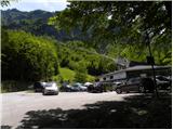
From the highway Ljubljana - Jesenice we take the exit Lesce and follow the road towards Bled, Bohinjska Bistrica, Ribčev Laz and ski area Vogel. We park on a large well-maintained parking lot at the bottom station of the cableway on Vogel.
Route description:
Below the bottom station of the cableway on Vogel we notice a forest road (in winter a ski slope), which starts moderately ascending towards the west. The path ahead continues for some time gently to moderately ascending, then brings us out of the forest onto a panoramic slope, from where a beautiful view opens up on Komarča, Pršivec and Lake Bohinj.
When the road or ski slope turns left and starts ascending more steeply, we pay attention, because after approximately 100 m, on the right side we notice a smaller cairn, by which a initially quite overgrown footpath starts, which after a shorter crossing starts ascending more steeply through the forest. Higher, the footpath temporarily flattens and crosses slightly steeper slopes towards the right. From here a nice view of the surroundings opens up for a short time, then the path returns to the forest, through which it again starts ascending more steeply. The somewhat overgrown path in places brings us higher to a larger rock (picture no. 17), behind which after a few tens of meters we arrive at an unmarked junction.
At the junction, where there is also a smaller cairn, we continue left (right hunting cottage Na Melu and Ražnova Suha) and continue the path on a more overgrown trail, which first crosses slopes towards the left, then brings us out of the forest and higher bushes onto panoramic and high-grass-covered slopes, from which a nice view opens up on Pršivec and Lake Bohinj. We continue the ascent on an occasionally quite overgrown and in some places harder-to-follow path (harder-to-follow spots are mainly where a fallen tree lies across the path). Higher, the path continues for some time through a belt of bushes and dwarf pines, then arrives in a series of smaller basins, where numerous cairns also show the way. When the dwarf pines already thin out considerably the path turns somewhat to the right and gradually flattens. Here follows a short left bend and the path brings us to the mountain pasture Planina za Migovcem, where we also step onto the marked path Vogel - Komna.

Photos:
 1
1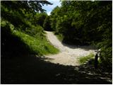 2
2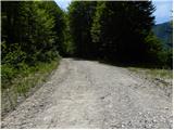 3
3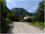 4
4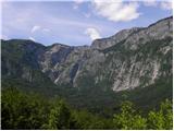 5
5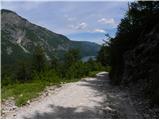 6
6 7
7 8
8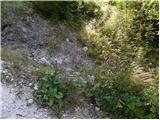 9
9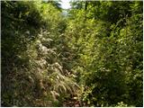 10
10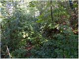 11
11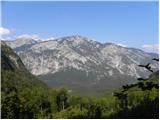 12
12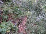 13
13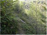 14
14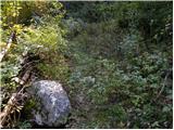 15
15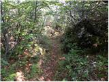 16
16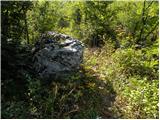 17
17 18
18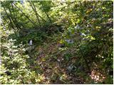 19
19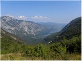 20
20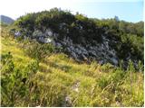 21
21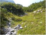 22
22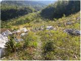 23
23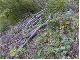 24
24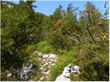 25
25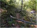 26
26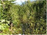 27
27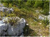 28
28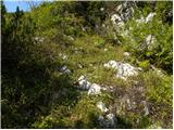 29
29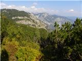 30
30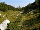 31
31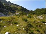 32
32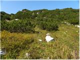 33
33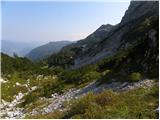 34
34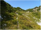 35
35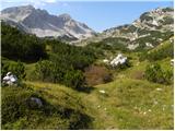 36
36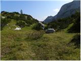 37
37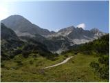 38
38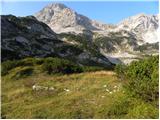 39
39
Discussion about the trip Ukanc - Planina za Migovcem
|
| Pi_is_exactly_326. 07. 2016 |
The path is now quite overgrown with bushes and scree. There are also numerous fallen trees across it.
|
|
|
|
| grega_p3. 06. 2022 18:51:09 |
Hello,
has anyone hiked this trail recently by chance? I'm wondering if the trail is still passable or already too overgrown. Thanks for any info...
|
|
|
|
| rokeg6. 06. 2022 09:14:24 |
Last year it was passable and fairly traceable, two sections were very overgrown and harder to trace. With a bit of orientation sense it's doable. Otherwise it's generally quite overgrown.
|
|
|
|
| grega_p7. 06. 2022 01:46:21 |
Great, thanks for the info..
|
|
|
To post a comment you must log in:
If you do not yet have a username, you must first
register.