Starting point: Unec (517 m)
| Latitude/Longitude: | 45,82178°N 14,28844°E |
| |
Walking time: 35 min
Difficulty: easy unmarked way
Elevation gain: 77 m
Elevation difference along the route: 113 m
Map: maPZS, OpenTopoMap, OpenStreetMap
Recommended equipment (summer):
Recommended equipment (winter):
Views: 774
 | 1 person like this post |
Access to starting point:
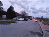
We leave the Primorska highway at the Unec exit and head towards Cerknica. Immediately after the highway junction in the direction of Ljubljana, we will notice a well-maintained parking lot on our left. Due to one-way traffic, we bypass it and, just before the first house in Unec, turn left to enter it, as clearly indicated by the traffic signs. If arriving from the direction of Cerknica, we drive through the village center of Unec and, immediately after the last house (or slightly beyond the only traffic light in the area), turn right into the aforementioned parking lot. Elsewhere in Unec, parking options are limited. Where parking is available, it is usually reserved for customers of stores or establishments and is time-restricted.
Public transport:
Buses from the direction of Ljubljana, Planina... stop at the bus stop next to the NOB monument, immediately after the Portus inn. Buses from the direction of Cerknica stop at the bus stop opposite the cemetery, slightly further east. The nearest railway station is in Rakek, approximately 2 km east of Unec. Since there is mostly no sidewalk along the main road, a slightly longer detour via parallel macadam roads north of the main road is recommended.
Route description:From the starting point at the parking lot, we head along the main road (with the sidewalk on our left) towards Unec. After slightly less than 200 meters, we reach a traffic-light-controlled crossroad in front of the inn Portus. Here, we cross the main road and turn onto a side road that branches off to the right. The road leads us past the aforementioned inn Portus, an agricultural cooperative with a Mercator franchise store, and the Kovinoplastika Lož factory, all on our left, and continues under the viaduct of the Primorska highway, where we enter the settlement of Hribce, now incorporated into Unec.
Soon after crossing under the highway, we reach a junction with a traffic sign recommending snow chains in winter conditions. Here, we continue straight/“left” (definitely not right). Soon, the dense settlement ends, and the previously paved road becomes a gravel macadam road. We continue along this road, which is initially bordered by barbed wire on our right. After passing a more isolated house, this road becomes a forest path, used at our own responsibility. Immediately after this point, the road begins to ascend slightly more steeply, first turning right in a bend, then at the forest edge, we reach a junction with wooden signposts, where we turn left towards Postojna. By the way, at this junction, we cross the former Rapallo border and enter the territory of the Kingdom of Italy from the period between the two world wars.
The road, still ascending, briefly runs along the edge between a meadow (on our left) and the forest (on our right) before turning left towards the south and entering the forest. If we pay attention, we may notice a resting area with benches on our right. The road, which runs along the eastern foot of Topol, soon reaches its highest point and begins to descend gently from there. After about 300 meters, we notice a space on the left side of the road that could serve as a parking area (though there are no signs permitting or prohibiting it), and a little further ahead, we reach an unmarked intersection of four roads. We arrive at a sort of “ring” of forest roads that encircles Unška koliševka at an appropriate distance. Here, we turn right onto a road where a traffic sign immediately after the intersection prohibits all vehicle traffic, and we may also notice posts for a physical barrier with a chain.
The road, initially heading north, quickly turns west in two left bends, and after slightly less than 200 meters from the intersection, we notice a cart track branching off to the right. At the same spot, a keen eye may spot a poorly trodden footpath branching left, leading to one of the entrances to an underground bunker system “somewhere in the middle of nowhere” (verified to be connected to tunnels entered from the “official” starting point above the eastern edge of Unška koliševka). Here, we prefer to continue straight along the road. Soon, we notice a small holiday cottage on the left, followed by a livestock water trough also on the left, and a bit further, an information board indicating we’ve reached the official “entry point” to Unška koliševka at its northern edge, the official destination of this route.
From this point, several footpaths lead to views of the vertical walls of Unška koliševka. If we proceed clockwise, we will eventually reach the remains of an Italian military fortification and the “official” entry point to the underground tunnel system. For entry, we definitely need a good flashlight (preferably with spare batteries). At the start, we tread carefully on uneven stairs, then take care not to trip over drainage channels, noting that Italian men nine decades ago were apparently not very tall

. Otherwise, the tunnel system is quite extensive, so knowledge of basic graph theory algorithms is recommended.
We can take an “unofficial” beaten path that, heading counterclockwise, runs just above the northwestern edge of Unška koliševka, offering some spectacular views before reaching a forest road at the western edge after about a “quarter circle.”
An intermediate path leading to the bottom of Unška koliševka is extremely demanding and dangerous in case of a slip. After a few steep and high steps, we can reach another entrance to the underground tunnels. If we turn right immediately after the entrance, the tunnel ends and opens to a scenic spot right above a precipice, from where continuing the path is not possible.
The description refers to conditions in November 2023.

Along the route: najvišja točka (pod Topolami) (630m)
Photos:
 1
1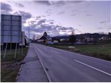 2
2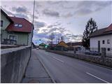 3
3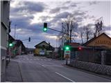 4
4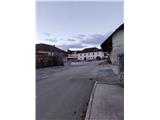 5
5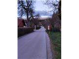 6
6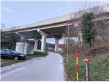 7
7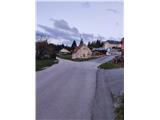 8
8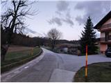 9
9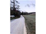 10
10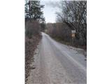 11
11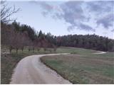 12
12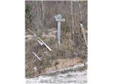 13
13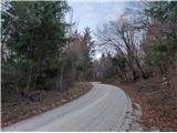 14
14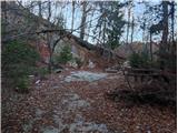 15
15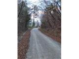 16
16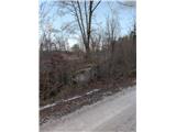 17
17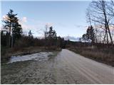 18
18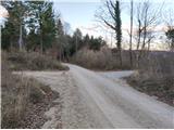 19
19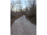 20
20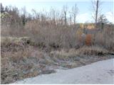 21
21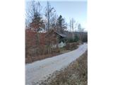 22
22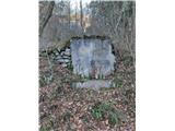 23
23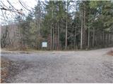 24
24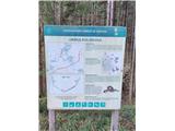 25
25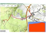 26
26
Discussion about the trip Unec - Unška koliševka
To post a comment you must log in:
If you do not yet have a username, you must first
register.