Unternberg - Feistritzer Schwaig (via Kampstein)
Starting point: Unternberg (825 m)
| Latitude/Longitude: | 47,57888°N 16,01951°E |
| |
Route name: via Kampstein
Walking time: 3 h 15 min
Difficulty: easy marked way
Elevation gain: 613 m
Elevation difference along the route: 700 m
Map:
Recommended equipment (summer):
Recommended equipment (winter): ice axe, crampons
Views: 96
 | 1 person like this post |
Access to starting point:
Leave the A2 motorway Graz - Vienna / Wien at the Aspang Markt exit and follow the road to the mentioned place. When we arrive in the town, follow the signs to the Mariensee settlement; at the end of the town, go straight towards St. Corona am Wechsel. Thereafter, we begin to climb more steeply, but we follow the road to the Unternberg settlement, where we park at the parking lot next to the Familienskiland St. Corona am Wechsel ski area.
Route description:
From the parking lot, we return a bit back through the settlement, then go right towards the west, initially still passing a few houses. Soon we reach the ski slope trail, where in the dry months numerous downhill cycling paths run. On this section, carefully follow the hiking path signs, and when crossing the tracks, additional caution is required. Higher up, follow the signs to the Kampstein summit and Herrgottschnitzerhütte hut; after a while we leave the ski area, at junctions continue following the signs to the Herrgottschnitzerhütte hut. When the path levels out higher up, only a few minutes of walking remain to the Herrgottschnitzerhütte hut.
In front of the hut, go right in the direction of Gipfelkreuz and Kampsteinerschwaig and return to the forest. Through the forest we ascend moderately, at a few junctions follow the markers; in the last part of the ascent the path levels out further and we follow the gentle path all the way to the indistinct summit. At the highest point of the summit there is a thermometer, one minute further there are also some benches and a cross.
The path ahead leads westwards and begins to descend moderately. A few minutes lower we arrive at the edge of a pasture, from where a nice view opens up to the highest peaks of the Wechsel range. A little further the forest ends and on a gentle grassy section we quickly reach the Kampsteiner Schwaig hut.
Bypass the hut on the left side and follow the signs to Hochwechsel; the path ahead first gently ascends on a grassy section surrounded by sparse forest. When the path returns to the forest, bypass the Frauenalpe summit on the right side and begin descending towards the west. Lower down the path stops descending, but when we start ascending again we reach a junction at the Schwarzer Herrgot cross, from where we continue left towards Feistritzer Schwaig (straight to Arabichl).
This is followed by about 15 minutes of gentle ascent to the left and the cart track leads us to the Feistritzer Schwaig alpine pasture.
Starting point - Herrgottschnitzerhütte am Wechsel 1:30, Herrgottschnitzerhütte am Wechsel - Kampstein 0:30, Kampstein - Kampsteiner Schwaig 0:15, Kampsteiner Schwaig - Schwarzer Herrgot 0:45, Schwarzer Herrgot - Feistritzer Schwaig 0:15.
Description and photos refer to the status of November 2025.

Photos:
 1
1 2
2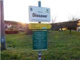 3
3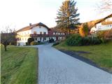 4
4 5
5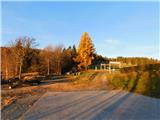 6
6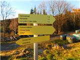 7
7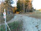 8
8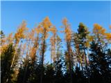 9
9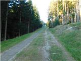 10
10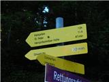 11
11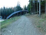 12
12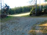 13
13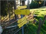 14
14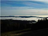 15
15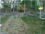 16
16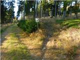 17
17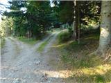 18
18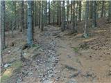 19
19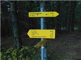 20
20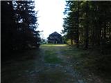 21
21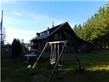 22
22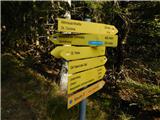 23
23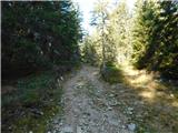 24
24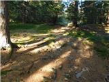 25
25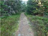 26
26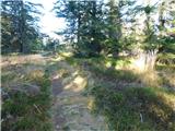 27
27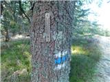 28
28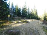 29
29 30
30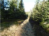 31
31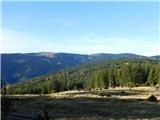 32
32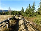 33
33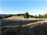 34
34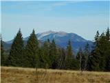 35
35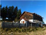 36
36 37
37 38
38 39
39 40
40 41
41 42
42 43
43 44
44 45
45 46
46 47
47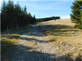 48
48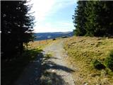 49
49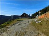 50
50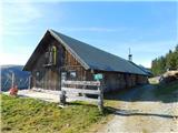 51
51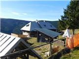 52
52
Discussion about the trip Unternberg - Feistritzer Schwaig (via Kampstein)
To post a comment you must log in:
If you do not yet have a username, you must first
register.