V Koncu - Bivak pod Grintovcem (via Gamsov skret)
Starting point: V Koncu (900 m)
Route name: via Gamsov skret
Walking time: 3 h 15 min
Difficulty: very difficult unmarked way
Elevation gain: 1200 m
Elevation difference along the route: 1200 m
Map: Kamniške in Savinjske Alpe 1:50.000
Recommended equipment (summer): helmet
Recommended equipment (winter): helmet, ice axe, crampons
Views: 17.154
 | 2 people like this post |
Access to starting point:
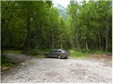
We drive to Kamnik and follow the road ahead towards the valley of Kamniška Bistrica. From the hut in Kamniška Bistrica we continue driving on the forest road, which brings us higher to a crossroads, where we continue straight (right Jermanca, starting point for Kamniško sedlo). The road then past Žagana peč brings us to the parking lot at the lower station of the cargo cableway to Kokrsko sedlo.
Route description:
From the parking lot at the bottom station of the cableway, we continue on the road to the «upper parking lot». Here, by the parking lot on the left side of the road, we will notice two cart tracks. The left cart track, which is marked with signs on a tree, leads towards Kokrsko sedlo. We, however, head to the right cart track (this cart track is also on the left side of the road).
At first we walk for some time on the mentioned cart track, from which some side cart tracks also branch off, then the cart track turns into a footpath. Further on, we ascend for quite some time on a narrow footpath through the forest. The path here constantly runs on the left side of the valley and thus avoids the steep rocky jump in the lower part of the valley.
When we come out of the forest, the path crosses somewhat steeper slopes to the right and brings us to grassy slopes. There follows an ascent on grassy terrain, which brings us below the walls of Kogl.
Here a better-trodden footpath turns left towards the wall, but we continue slightly right on a narrow path. The path on this section is quite poorly visible and runs on the left side of the torrent up the valley. For orientation, the clearly visible waterfall of the mentioned torrent (usually without water) can serve. The footpath already somewhat before the waterfall turns left and enters the wall.
Here the path becomes very demanding and first we must climb a few metres up the almost vertical slope. There follows an ascent on a narrow secured ledge, which crosses the slope to the right and brings us to steep grassy slopes. Despite the ledge being secured, the ascent is quite demanding. It is also necessary to consider that the fixed protections are usually in somewhat worse condition than we are used to on marked paths. Further on, we ascend for some time on fairly steep grassy slopes, then the slope gradually becomes less steep and the path brings us to an unexpected bench from which there is also a very nice view in all directions.
Further on, we ascend the grassy slope up to the marked path Kokrsko sedlo - Kamniško sedlo.
Here we turn left and follow the marked path, which in gentle descents and ascents soon brings us to a junction, where we continue left (right Grintovec and Skuta) in the direction of Kokrsko sedlo. After a short ascent we reach the bivouac, which we already see in front of us.

Photos:
 1
1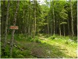 2
2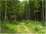 3
3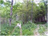 4
4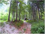 5
5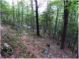 6
6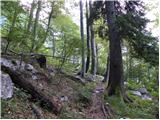 7
7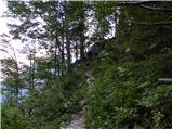 8
8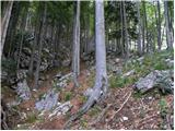 9
9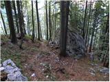 10
10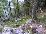 11
11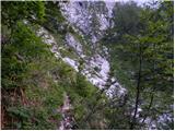 12
12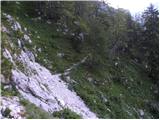 13
13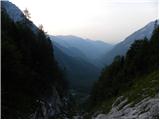 14
14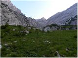 15
15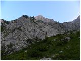 16
16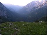 17
17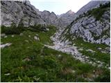 18
18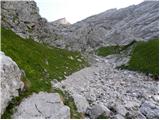 19
19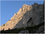 20
20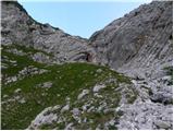 21
21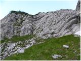 22
22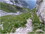 23
23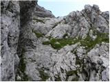 24
24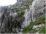 25
25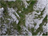 26
26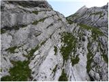 27
27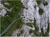 28
28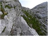 29
29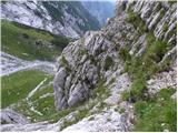 30
30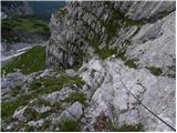 31
31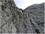 32
32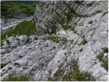 33
33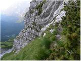 34
34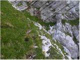 35
35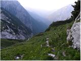 36
36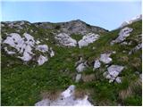 37
37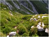 38
38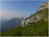 39
39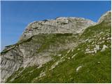 40
40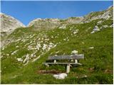 41
41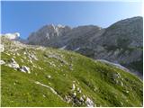 42
42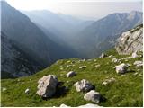 43
43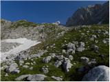 44
44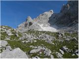 45
45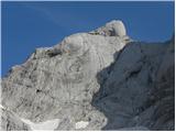 46
46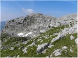 47
47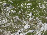 48
48 49
49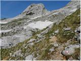 50
50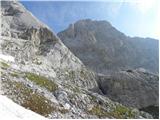 51
51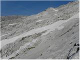 52
52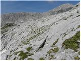 53
53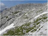 54
54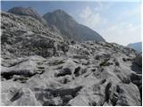 55
55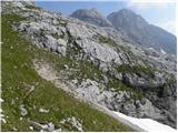 56
56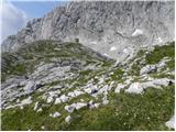 57
57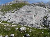 58
58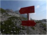 59
59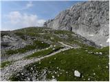 60
60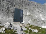 61
61
Discussion about the trip V Koncu - Bivak pod Grintovcem (via Gamsov skret)
|
| tjann7. 07. 2008 |
Extremely beautiful path, but if you go along the variant described above you don't see the skret at all...
below the wall of kogla you can also go left to the steep gully, then right up it, you meet the skret, and across the very exposed Polička - direction klopca. But I warn that this variant is considerably more demanding, no protections, helmet mandatory, for less experienced I recommend company!
|
|
|
|
| Volk10. 07. 2008 |
Otherwise, things can go like this too. The author of the description mentions 'another parking lot' above the first one, at the goods cable car. From there we don't go straight on the most graded 'road' (which leads to the path over Žmavcarje), but choose the first ledge to the left of it (there are actually four here)! Comfortably along it, at its end a nice little path joins that leads under Kogel ...
But the uninsured ledge past Gamsov Skret is quite a bit harder than the wired one.
|
|
|
|
| jesihar17. 09. 2013 |
What if I want to go in the opposite direction to Kamniška Bistrica.
From Legarji (bivouac) I go towards Mali Podi - somewhere in between does the path to Gamsov Skret branch off to the right? Is the junction hard to notice?
|
|
|
|
| garmont17. 09. 2013 |
From the bivouac go about 20 minutes towards Grebenu, then turn right onto easy grassy terrain. There is no path proper here, but the direction is clearly indicated. Some cairns help. Your "path" leads downhill and to the left and becomes progressively steeper and more visible.
From here on there are no more orientation problems.
There are two passes, as already said.
Regards
|
|
|
To post a comment you must log in:
If you do not yet have a username, you must first
register.