V Koncu - Brana (via Turska gora)
Starting point: V Koncu (900 m)
| Latitude/Longitude: | 46,34200°N 14,56820°E |
| |
Route name: via Turska gora
Walking time: 5 h 45 min
Difficulty: difficult unmarked way, very difficult marked way
Elevation gain: 1353 m
Elevation difference along the route: 1600 m
Map: Kamniške in Savinjske Alpe 1:50.000
Recommended equipment (summer): helmet, self belay set
Recommended equipment (winter): helmet, self belay set, ice axe, crampons
Views: 31.703
 | 2 people like this post |
Access to starting point:
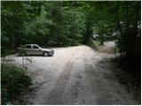
We drive to Kamnik and follow the road ahead towards the valley of Kamniška Bistrica. From the hut in Kamniška Bistrica we continue driving on the forest road, which brings us higher up to a crossroad, where we continue straight (right Jermanca, starting point for Kamniško sedlo saddle). The road then past Žagana peč brings us to the parking lot at the lower cargo cableway station to Kokrsko sedlo saddle.
Driving from the mountain hut in Kamniška Bistrica to the parking lot V Koncu is now forbidden (traffic sign), this extends the path by almost an hour.
Route description:
From the parking lot at the cargo cableway we continue on an increasingly poor road, which after 10 minutes of walking turns into a cart track. The cart track splits into two parts, and we head for the right one (the left cart track disappears, or leads towards Gamsov skret), which at a smaller boulder covered with moss (big rock) turns even a bit more to the right. Right at this spot we leave the cart track and continue straight on an initially poorly visible footpath, which later ascends steeply in zigzags. The steep and especially in wet dangerous for slipping path leads us across steep slopes, which at some points are secured with a steel cable. The steep path, which also crosses a few gullies, brings us higher to less steep slopes. After a good hour of walking the path brings us out of the forest, where it starts to ascend steeply again. The path first leads across grassy slopes surrounded by sparse forest, then with the help of some fixed protections brings us a level higher. The path ahead transitions to gravel slopes, which somewhat complicate the ascent for us, then the path turns left onto steep grassy slopes that rise above extensive scree fields. At the top of this grassy section we head slightly right and the path transitions from grass to high-alpine terrain of the basins below Skuta. Further along the path marked with cairns we reach a pleasant bivouac below Skuta in a few minutes.
From the bivouac we continue on a poorly visible and still unmarked path along an indistinct little ridge, which after 15 minutes of walking from the bivouac brings us to the marked path Kamniško sedlo - Kokrsko sedlo. Here we continue right and already after a few minutes we reach a path junction, where we continue on the right lower path in the direction of Turska gora (left Rinke). The path then starts to descend and after a few minutes brings us to the top of Turski žleb. We continue straight (left downward Okrešelj) along an increasingly scenic path, which with the help of some pegs brings us to the summit ridge of Turska gora, which we then follow to the summit. Walking along the ridge when dry presents no major difficulties, but in snow there is a high risk of slipping on the summit ridge.
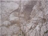
From the summit we continue on the path that starts to descend (direction Kamniško sedlo). The path, which already after a few steps starts to descend steeply, is well secured but at some points quite exposed. The path, which is constantly exposed to falling rocks, then brings us to a natural blowhole (sod brez dna). Further on we reach the sharp notch called Kotliči, beyond which the path starts to ascend gradually and after a while brings us to a junction, where we continue right steeply upward in the direction of Brana (straight Kamniško sedlo). The path ahead ascends ever more steeply along the shady slopes of Brana. The steep and at key points secured path, which is not particularly demanding, soon brings us into a smaller gully, up which we climb with some free climbing to a nice viewpoint. Here we continue sharply right along the path, which after a further 10 steps brings us to the summit slope of Brana. Here the steepness eases and a nice scenic undemanding path brings us to the spacious summit in a few minutes.
V Koncu - bivouac below Skuta 3:00, bivouac below Skuta - Turska gora 1:15, Turska gora - Brana 1:30.

Photos:
 1
1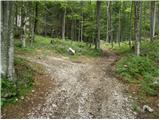 2
2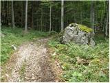 3
3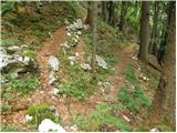 4
4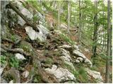 5
5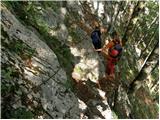 6
6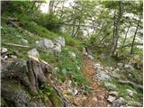 7
7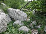 8
8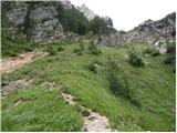 9
9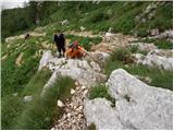 10
10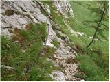 11
11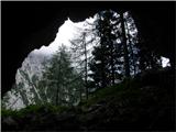 12
12 13
13 14
14 15
15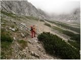 16
16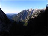 17
17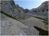 18
18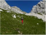 19
19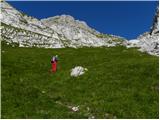 20
20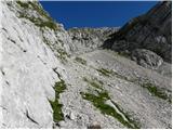 21
21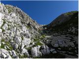 22
22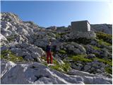 23
23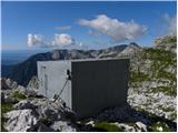 24
24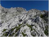 25
25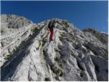 26
26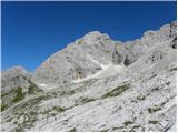 27
27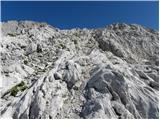 28
28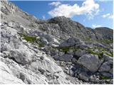 29
29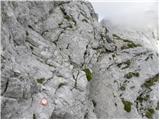 30
30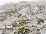 31
31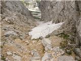 32
32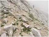 33
33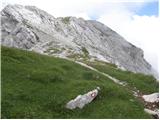 34
34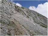 35
35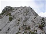 36
36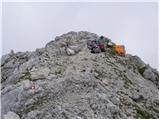 37
37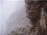 38
38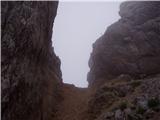 39
39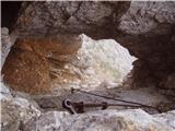 40
40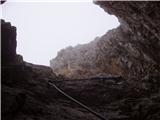 41
41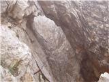 42
4243
 44
44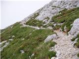 45
45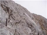 46
46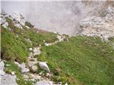 47
47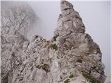 48
48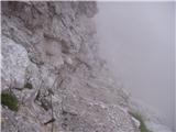 49
49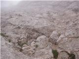 50
50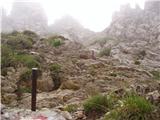 51
51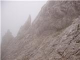 52
52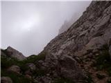 53
53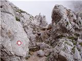 54
54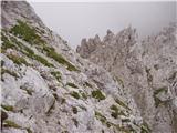 55
55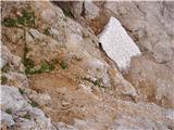 56
56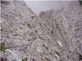 57
57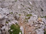 58
58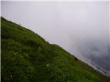 59
59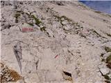 60
60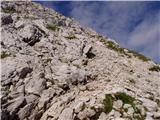 61
61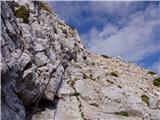 62
62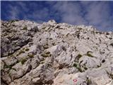 63
63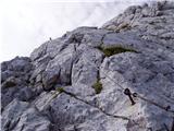 64
64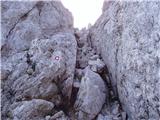 65
65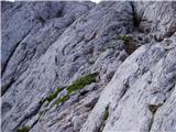 66
66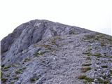 67
67 68
68
Discussion about the trip V Koncu - Brana (via Turska gora)
|
| fpetel125. 08. 2008 |
Through Žmavčarje there is an unmarked hunter’s path, in the summit section pathless terrain. The path or direction of movement is not hard to determine if the weather is nice. In fog choose another approach. The descent from Turska gora is steep and demanding.
|
|
|
|
| the dancer10. 11. 2008 |
Yesterday I hiked it from Kamn.Bistrica via Žmavčarje to the bivouac below Skuto (no snow yet), then to Turska gora, already winter conditions, then descent to Kotliče (quite wind-packed snow in places), to the wall of Brana (individual snow patches, nothing special), the path below the north wall of Brana is practically dry, ascent to Brana, a literal snow ascent went without crampons, I used the ice axe, as also from Turska. Visibility was nice at times, but fog in a minute, high clouds were fading...
|
|
|
|
| nata246. 09. 2009 |
If I go on this path to Brana and return via Kamniško sedlo to Jermanca, how much is approximately to walk from Jermanca to V Koncu and does anyone have a better suggestion so I don't go back the same way. Thanks in advance. Nataša
|
|
|
|
| rober6. 09. 2009 |
Normal walking Jermanca-Konec takes at most half an hour of normal walking, maybe a few minutes more, depending on how tired the legs are, if you knew a shortcut that goes past the landslide under Brana-Sivnica-Lepi Kamen-Konec, even less... all depends on physical fitness and joy of exploring interesting new paths...
|
|
|
|
| nata248. 09. 2009 |
If I understand correctly, the path to the bivouac under Skuta or a bit further is not marked at all. Or even at the starting point - V koncu nothing is marked, are there at least cairns somewhere? Best, Nataša
|
|
|
|
| Gorazd G8. 09. 2009 |
Nataša, you understand correctly. At the starting point V koncu it doesn't say that you can reach the Bivak pod Skuto (and a bit further to the marked path above it), the path is not marked, but you'll find some trace anyway. Among other things, also some cairn. 
|
|
|
|
| nata248. 09. 2009 |
So that means from V koncu I continue along the road I arrived on further and not towards Kokrsko sedlo.
|
|
|
|
| Gorazd G8. 09. 2009 |
That's right. Describing from "tree to tree" is not my strong suit, but the introduction from the above description seems quite good to me, just shorten those 10 minutes to just one or two minutes. 10 minutes is probably from Žagana peči.
"From the parking lot at the cargo cableway, we continue on the increasingly worse road, which after 10 minutes of walking turns into a cart track. The cart track splits into two parts, we head to the right one (the left cart track disappears, or leads towards Gamsov skret), which at a smaller moss-covered boulder (large rock) turns even more to the right. Right at that spot, we leave the cart track and continue straight onto the initially less visible path, which later steeply ascends in switchbacks."
But it might be better if someone who knows the path accompanies you.
|
|
|
|
| juhejnaprej18. 06. 2012 |
Yesterday I did this tour. I think the condition is best seen from the pictures:
|
|
|
|
| juhejnaprej18. 06. 2012 |
I noticed that you can't attach pictures to trips, anyway, below through Žmavčarje it's not too demanding and quite well visible, only at the above-mentioned boulder and at the top under the bivouac it's a bit harder to figure out where to go.
|
|
|
|
| alina18. 10. 2013 |
Does anyone know if you can drive by car to the parking lot in Konc or is the road closed to traffic?
|
|
|
|
| Marx4. 08. 2014 |
That snow patch in picture 56 was still there when I was on the tour 02.08.2014. And it's an obstacle! I bypassed it over the rocks above. Very dangerous. Here my water bottle also fell out. If someone finds it... let them drink it
|
|
|
|
| redbull5. 08. 2014 |
marx already the next day it was somehow possible. now that snow patch is definitely gone.
no panic
best
D
|
|
|
To post a comment you must log in:
If you do not yet have a username, you must first
register.