V Koncu - Grintovec (via Gamsov skret)
Starting point: V Koncu (900 m)
| Latitude/Longitude: | 46,34200°N 14,56820°E |
| |
Route name: via Gamsov skret
Walking time: 5 h 15 min
Difficulty: very difficult unmarked way
Elevation gain: 1658 m
Elevation difference along the route: 1750 m
Map: Kamniške in Savinjske Alpe 1:50.000
Recommended equipment (summer): helmet, self belay set
Recommended equipment (winter): helmet, self belay set, ice axe, crampons
Views: 27.838
 | 3 people like this post |
Access to starting point:
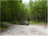
Drive to Kamnik and follow the road towards the Kamniška Bistrica valley. From the lodge in Kamniška Bistrica continue along the forest road, which leads higher to a junction where we continue straight (right Jermanca, starting point for Kamniško sedlo). The road then leads past Žagana peč to the parking lot at the lower station of the freight cable car to Kokrsko sedlo.
Route description:
From the parking lot at the lower station of the cable car we continue along the road to the "upper parking lot". Here we will notice two cart tracks next to the parking lot on the left side of the road. The left cart track, marked with signs on a tree, leads towards Kokrsko sedlo. We head onto the right cart track (this cart track is also on the left side of the road).
At first we walk for some time along the mentioned cart track from which a few side cart tracks also branch off, then the cart track turns into a path. In the continuation we ascend for quite some time along a narrow path through the forest. The path here constantly runs on the left side of the valley and thus avoids the steep rocky jump in the lower part of the valley.
When we emerge from the forest, the path crosses somewhat steeper slopes to the right and leads us to grassy slopes. This is followed by an ascent over grassy terrain that leads us under the walls of Kogel.
Here the better-trodden path turns left towards the wall, but we continue slightly right along a narrow path. The path in this section is fairly poorly visible and runs on the left side of the torrent up the valley. For orientation we can use the clearly visible waterfall of the mentioned torrent (usually without water). The path already turns left a little before the waterfall and enters the wall.
Here the path becomes very demanding and first we have to climb a few meters up an almost vertical slope. This is followed by an ascent along a narrow secured ledge that crosses the slope to the right and leads us to steep grassy slopes. Although the ledge is secured, the ascent is fairly demanding. It should also be noted that the protections are usually in somewhat poorer condition than we are used to on marked paths. In the continuation we ascend for some time over fairly steep grassy slopes, then the slope gradually becomes less steep and the path leads us to an unexpected bench from which there is also a very beautiful view in all directions.
In the continuation we ascend over the grassy slope upwards all the way to the marked path Kokrsko sedlo - Kamniško sedlo.
Here we turn left and follow the marked path which in gentle descents and ascents soon leads us to a junction where we continue right in the direction of Grintovec and Skuta (left bivouac 1 minute) along a relatively gentle path which soon leads us to the next junction. This time we continue along the left path (right Skuta), which further leads us across a karst world full of karren and abysses. Further on we carefully follow the markings which after a short ascent lead us to Mlinarsko sedlo, where the path from Jezersko joins us. We continue left in the direction of Grintovec (right Dolgi hrbet and Skuta) along a path that becomes technically demanding. The path ahead leads us along and beside an occasionally exposed ridge, then passes to the shady side of the ridge where it becomes somewhat more difficult, but numerous protections help us. The path, which in the upper part is exposed to falling rocks, leads us after approximately 1 hour of walking from Mlinarsko sedlo to the summit.
I recommend descent via Streha Grintovca.
V Koncu - Bivak 3:15, Bivak - Vrh 2:00.

Photos:
 1
1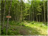 2
2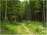 3
3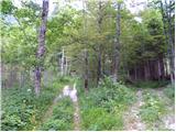 4
4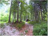 5
5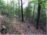 6
6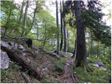 7
7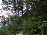 8
8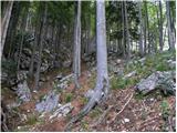 9
9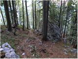 10
10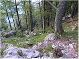 11
11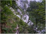 12
12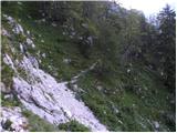 13
13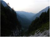 14
14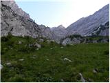 15
15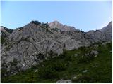 16
16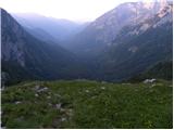 17
17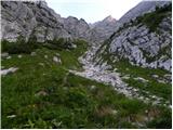 18
18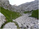 19
19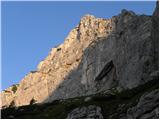 20
20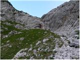 21
21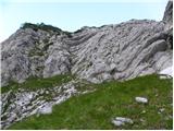 22
22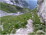 23
23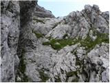 24
24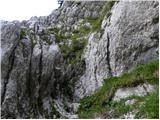 25
25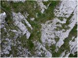 26
26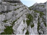 27
27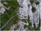 28
28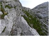 29
29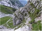 30
30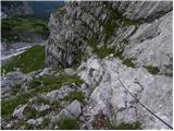 31
31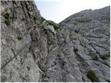 32
32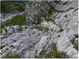 33
33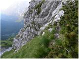 34
34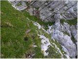 35
35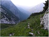 36
36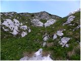 37
37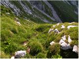 38
38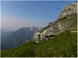 39
39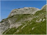 40
40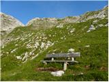 41
41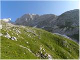 42
42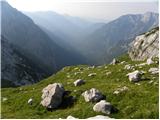 43
43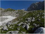 44
44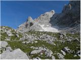 45
45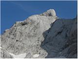 46
46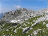 47
47 48
48 49
49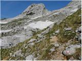 50
50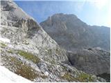 51
51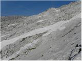 52
52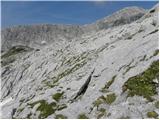 53
53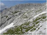 54
54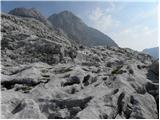 55
55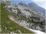 56
56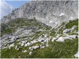 57
57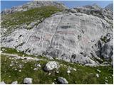 58
58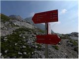 59
59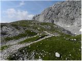 60
60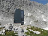 61
61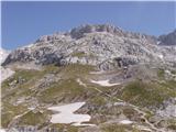 62
62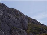 63
63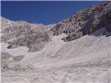 64
64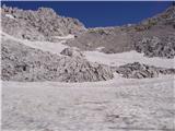 65
65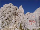 66
66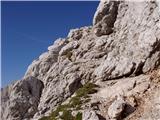 67
67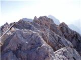 68
68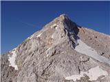 69
69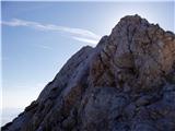 70
70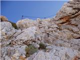 71
71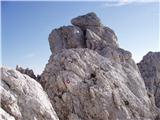 72
72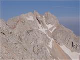 73
73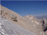 74
74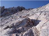 75
75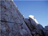 76
76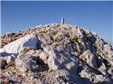 77
77 78
78
Discussion about the trip V Koncu - Grintovec (via Gamsov skret)
|
| Planinko15. 09. 2007 |
 EASY EASY
by planinko (the master of the climbing)
|
|
|
|
| Virenque8. 07. 2008 |
Gamsov skret... ha, something like that!
|
|
|
|
| the dancer2. 11. 2008 |
I'm interested  if for the correct entry into Gamsov skret one turns already at the first unmarked junction (from Jermance), because today I missed a bit, went straight through the clear-cut and at the next junction left and up the scree, where I arrived at the cave, bypassed it on the right, had approx. 100m of climbing and later higher practically already in the walls joined the correct path and overcame the step with the cables? if for the correct entry into Gamsov skret one turns already at the first unmarked junction (from Jermance), because today I missed a bit, went straight through the clear-cut and at the next junction left and up the scree, where I arrived at the cave, bypassed it on the right, had approx. 100m of climbing and later higher practically already in the walls joined the correct path and overcame the step with the cables?
Thanks 
|
|
|
|
| fpetel13. 11. 2008 |
And how are the cables? Apparently one is damaged. Which variant is safer: the old passage or the secured alternative?
Best regards.
|
|
|
|
| the dancer3. 11. 2008 |
The chains are a bit worn out, but no panic, you can still pull on them. I don't know the old passage The rocks were a bit damp, but no panic, lower down I climbed at least 100m too high  , because I missed the right entrance to Gamsov skret , because I missed the right entrance to Gamsov skret
|
|
|
|
| pohodnik385. 08. 2017 |
On Saturday 29.7. I walked the mentioned path where I haven't been for quite some years. First in thick fog so I was a bit searching for the marked path at the feet below Skuta, otherwise the path is without special features and demanding, beautiful as always
VIDEO
Best regards! Tone
|
|
|
|
| MinasTirith1. 09. 2019 |
The path description as extremely demanding seems exaggerated to me.
The path requires good physical fitness, but everything within normal limits. So those who want to set out on the path, it's not that demanding.
|
|
|
|
| garmont1. 09. 2019 |
I don't know where you saw that the path is extremely demanding.
But by no means underestimate it, especially on descent...
|
|
|
|
| garmont1. 09. 2019 |
....demanding...
|
|
|
|
| bumbam22. 10. 2019 |
I've long planned the trail over Gamsov skret, mainly because of the unexpected climbing. But the fear was completely unnecessary. Actually, to climb the few pegs is no more than 5m, then there's a nice ledge over which you pull yourself with the cable. Then a couple of minutes on steep grass and at the end you're rewarded with a nice bench and wonderful views (2.15h from the car). The trail from Mlinarsko sedlo is nice and well secured. The trail is especially nice because it's uncrowded and surrounded by wonderful views.
|
|
|
|
| bumbam22. 10. 2019 |
..correction..to bivouac 2.15h, to summit 3.15h, fast pace
|
|
|
|
| M E S A16. 10. 2022 20:20:52 |
15.10. did this trail. On the unmarked section of the trail (just before the first entry into the wall - section via Gamsov skret) you need to be careful to stay on the right path.
The protections along the entire route (via Gamsov skret and later from Mlinarsko sedlo to the summit) are in the right places and in very good condition.
For me, the section via Gamsov skret is less demanding than the section from Mlinarsko sedlo to Grintovec.
|
|
|
To post a comment you must log in:
If you do not yet have a username, you must first
register.