V Koncu - Kranjska Rinka (via Žmavčarji)
Starting point: V Koncu (900 m)
| Latitude/Longitude: | 46,34200°N 14,56820°E |
| |
Route name: via Žmavčarji
Walking time: 4 h 35 min
Difficulty: difficult unmarked way
Elevation gain: 1553 m
Elevation difference along the route: 1553 m
Map: Kamniške in Savinjske Alpe 1:50.000
Recommended equipment (summer): helmet
Recommended equipment (winter): helmet, ice axe, crampons
Views: 26.535
 | 3 people like this post |
Access to starting point:
We drive to Kamnik and follow the road ahead towards the valley of Kamniška Bistrica. From the hut in Kamniška Bistrica we continue driving on the forest road, which brings us higher to a crossroad, where we continue straight (right Jermanca, starting point for Kamniško sedlo). The road then past Žagana peč brings us to the parking lot at the lower station of the cargo cableway to Kokrsko sedlo.
Driving from the mountain hut in Kamniška Bistrica to the parking lot V Koncu is now forbidden (traffic sign), this extends the path by less than an hour.
Route description:
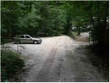
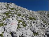
From the parking lot at the cargo cableway we continue on an increasingly rough road which after 10 minutes of walking changes into a cart track. The cart track splits into two parts, and we take the right one (the left cart track vanishes, or leads towards Gamsov skret), which by the smaller boulder covered with moss (big rock) turns a little more to the right. Right at this spot we leave the cart track and continue straight onto an initially poorly visible footpath which later ascends steeply in zigzags. The steep and especially slippery when wet path leads us over steep slopes, which are secured with a steel cable in some places. The steep path, which also crosses a few gullies, brings us higher to less steep slopes. After a good hour of walking the path brings us out of the forest, where it starts to ascend steeply again. The path first leads over grassy slopes surrounded by sparse forest, then with the help of some fixed safety gear brings us one level higher. The path ahead turns to gravelly slopes, which somewhat hinder the ascent, then the path turns left onto steep grassy slopes rising above extensive scree fields. At the top of this grassy section we head slightly right and the path transitions from grass to high-mountain terrain below Skuta. Further along the path surrounded by cairns we reach the pleasant bivouac below Skuta in a few minutes.
From the bivouac we continue on a poorly visible and still unmarked path along an indistinct ridgelet, which after 15 minutes of walking from the bivouac brings us to the marked path Kamniško sedlo - Kokrsko sedlo. Here we continue right and after a few minutes we reach a junction, where we turn sharply left towards Skuta and Rinka. A little further we reach the next junction, where we continue right uphill towards Rinka (straight to Skuta). The path ahead ascends steeply for a short time, then brings us to an indistinct ridge along and beside which we then ascend. Just before the marked path reaches the summit of Mala Rinka, it turns slightly left and descends a bit to the notch between Mala and Štajerska Rinka. On the other side of the notch the marked path starts ascending again and after a few more minutes of walking brings us to a marked junction, where we continue straight towards Kranjska Rinka (right to Koroška Rinka). The path ahead crosses the slopes of Koroška Rinka, then turns slightly left where it ascends steeply. A short very steep ascent follows, then the path brings us to the main ridge, along which we ascend to the summit of Kranjska Rinka in a few steps.
V Koncu - bivouac below Skuta 3:00, bivouac below Skuta - Kranjska Rinka 1:35.

Photos:
 1
1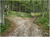 2
2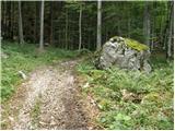 3
3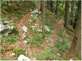 4
4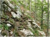 5
5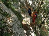 6
6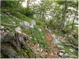 7
7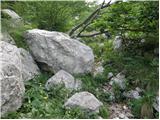 8
8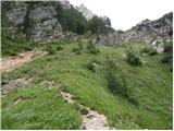 9
9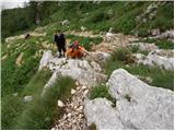 10
10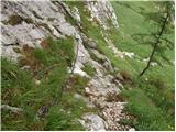 11
11 12
12 13
13 14
14 15
15 16
16 17
17 18
18 19
19 20
20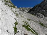 21
21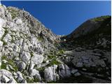 22
22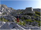 23
23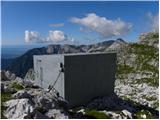 24
24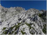 25
25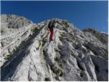 26
26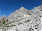 27
27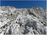 28
28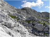 29
29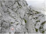 30
30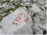 31
3132
 33
33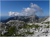 34
34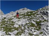 35
35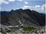 36
36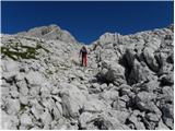 37
37 38
38 39
39 40
40 41
41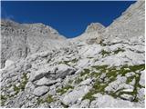 42
42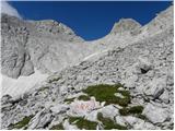 43
43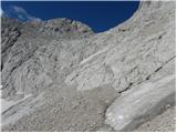 44
44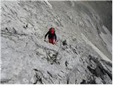 45
45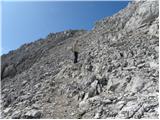 46
46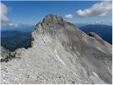 47
47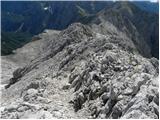 48
48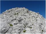 49
49 50
50
Discussion about the trip V Koncu - Kranjska Rinka (via Žmavčarji)
|
| Gost5. 02. 2008 |
What is the winter ascent through Žmavčarje like when there is no danger of snow avalanches? Thanks for the answer.
Best regards, Franci
|
|
|
|
| Gost5. 02. 2008 |
Through Žmavčarje there is a risk of slipping due to considerable steepness. Ice axe and crampons are mandatory on this tour. In the area of the bivouac below Skuta there are many birches and cracks hidden under snow. Great caution is needed. Best regards )
|
|
|
|
| pohodnik3815. 08. 2012 |
On Sunday I walked this path, which is without special features. Dense fog on ascent above, sunshine on the plains. After conquering the Rinkas continued via Turska gora and Kotliče to Kamniško sedlo. From there descent to the valley to the starting point.
SOME VIDEO SNIPPETS
Best regards!
|
|
|
|
| ggorenc25. 03. 2016 |
Can you drive to the lower cable car station with a car or do you need an off-roader? Haven't been in this area for a few years.
|
|
|
|
| andi225. 03. 2016 |
With a car. Or (as befits such nice spots as V Koncu and Žmavčarji) 20 min walk on foot from Dom v Bistricigood luck!
|
|
|
|
| redbull25. 03. 2016 |
20 min walk from the hut to Koncu?
I'd like to see that
A few years ago from Dom you had to run in the Grintovec race and do it in 14-15 min which is top running. Now it's similar just the start is across water.
|
|
|
|
| lino25. 03. 2016 |
Redbull, if it's an athlete of your caliber, it's possible.
|
|
|
|
| ggorenc3. 04. 2016 |
Thanks, I was quite an athlete 15 years ago but not anymore, the years take their toll so I'm curious what the path is like.
|
|
|
|
| ggorenc9. 11. 2017 |
I was on Skuta a few weekends ago. Still as steep as ever and rocks fly over Žmavčarje as if people up there were competing who would release more of them. Please be careful up there. A half-meter rock flew five meters from me. Someone up there did apologize to me but that doesn't help much.
|
|
|
|
| seinfeld16. 09. 2019 |
Yesterday in wonderful weather on this trail to Rinke. The trail is easy to follow, ropes help at some points, but it ascends steeply all the time. Some issues with markings from the bivouac to the foot of Rinka, but in good visibility no problem. To Rinke we needed good 4 hours of moderate hiking.
We returned over the ridge to the bivouac under Grintavec, through Kokrsko sedlo to the start. Demanding, about 14km long trail, good 1900m elevation gain, in nine hours.
|
|
|
To post a comment you must log in:
If you do not yet have a username, you must first
register.