V Koncu - Turska gora (via Žmavčarji)
Starting point: V Koncu (900 m)
| Latitude/Longitude: | 46,34200°N 14,56820°E |
| |
Route name: via Žmavčarji
Walking time: 4 h 15 min
Difficulty: difficult unmarked way
Elevation gain: 1351 m
Elevation difference along the route: 1351 m
Map: Kamniške in Savinjske Alpe 1:50.000
Recommended equipment (summer):
Recommended equipment (winter): ice axe, crampons
Views: 38.470
 | 3 people like this post |
Access to starting point:
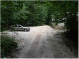
We drive to Kamnik and follow the road ahead towards the valley of Kamniška Bistrica. From the hut in Kamniška Bistrica we continue driving on the forest road which brings us higher up to a crossroad, where we continue straight (right Jermanca, starting point for Kamniško sedlo). The road then past Žagana peč brings us to the parking lot at the lower cargo cableway station to Kokrsko sedlo.
Driving from the mountain hut in Kamniška Bistrica to the parking lot V Koncu is now forbidden (traffic sign), this extends the path by less than an hour.
Route description:
From the parking lot at the cargo cableway we continue on an increasingly rough road which after 10 minutes of walking changes into a cart track. The cart track splits into two parts, and we take the right one (left cart track vanishes, or leads towards Gamsov skret), which by the smaller boulder covered with moss (big rock) turns a little more to the right. Right at this spot we leave the cart track and continue straight on at first a poorly visible footpath which later steeply ascends in zig-zags. Steep and mainly in wet slippery-dangerous path leads us over steep slopes, which on some spots are secured with a steel cable. Steep path, which also crosses a few gullies, brings us higher to less steep slopes. After a good hour of walking, the path brings us out of the forest, where it starts to ascend steeply again. The path first leads over grassy slopes surrounded by thin forest, then with the help of some fixed safety gear brings us a level higher. The path ahead passes onto gravel slopes, which somewhat complicate the ascent, then the path turns left onto steep grassy slopes rising above extensive scree fields. At the top of this grassy part we head slightly right and the path transitions from grass to high-mountain terrain of ledges below Skuta. Further along the path surrounded by cairns we reach the pleasant bivouac below Skuta in a few minutes.
From the bivouac we continue on a poorly visible and still unmarked path along an indistinct small ridge, which after 15 minutes of walking from the bivouac brings us to the marked path Kamniško sedlo - Kokrsko sedlo. Here we continue right and after a few minutes we reach a path junction, where we continue on the lower right path in the direction of Turska gora (left Rinke). The path then starts to descend and after a few minutes brings us to the top of Turski žleb. We continue straight (left downwards Okrešelj) on an increasingly panoramic path, which with the help of some pegs brings us to the summit ridge of Turska gora, which we then follow to the summit. Walking along the ridge when dry presents no major difficulties, but in snow on the summit ridge there is a high risk of slipping.
V Koncu - bivouac below Skuta 3:00, bivouac below Skuta - Turska gora 1:15.

Photos:
 1
1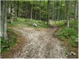 2
2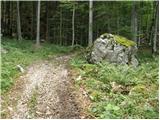 3
3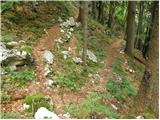 4
4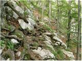 5
5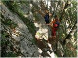 6
6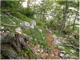 7
7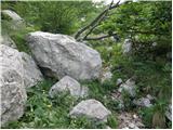 8
8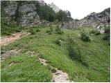 9
9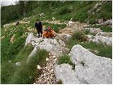 10
10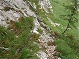 11
11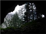 12
12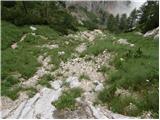 13
13 14
14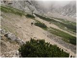 15
15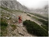 16
16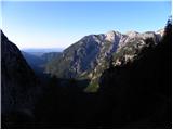 17
17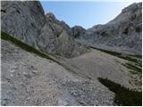 18
18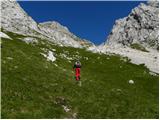 19
19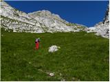 20
20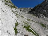 21
21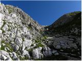 22
22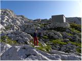 23
23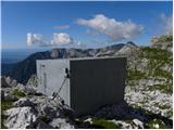 24
24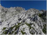 25
25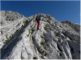 26
26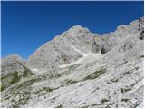 27
27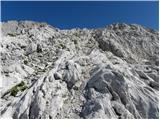 28
28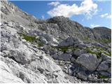 29
29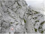 30
30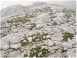 31
31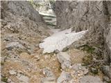 32
32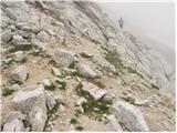 33
33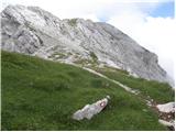 34
34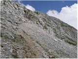 35
35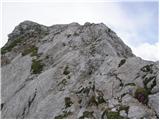 36
36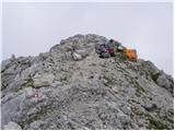 37
37
Discussion about the trip V Koncu - Turska gora (via Žmavčarji)
|
| Gost16. 05. 2007 |
Judging by the pictures, the trail doesn't seem demanding. However, as far as I know, no trail to Turska gora is really easy. I haven't been to Turska gora yet, is the trail very exposed in some sections? Miha.
|
|
|
|
| Gost16. 05. 2007 |
The ridge from Turski žleb to the summit is slightly exposed in some places but I think it doesn't cause problems, of course in dry conditions.
|
|
|
|
| Gost17. 05. 2007 |
Thanks for the information.
|
|
|
|
| Gost24. 10. 2007 |
Very pleasant tour. Through Žmavčarje in the lower part when wet risk of slipping. Towards Kamniško sedlo the hardest part through Sod brez dna, where the rope helps us through the vertical window. The part through Kotliče is exposed, but secured everywhere with steel cable.
|
|
|
|
| Gost29. 10. 2007 |
West of the bivouac approx. 10m there is a fairly large sinkhole, dangerous because there is no marking around it, careful!!
|
|
|
|
| Gost8. 02. 2008 |
Along the path, natural and cultural sights could be described.
|
|
|
|
| urbancek27. 06. 2011 |
Hi!
I'm curious about the road from Dom v Kamniški Bistrici to the lower cable car station in Koncu now (last year there was talk it was closed to traffic??!) Anyway, if open, also interested in road surface condition
Thanks for reply!
|
|
|
|
| Janez Seliškar27. 06. 2011 |
At Dom v Kamniški Bistrici there's a sign prohibiting driving further from the Dom.
|
|
|
|
| urbancek27. 06. 2011 |
And that means no more driving to V Koncu by car???
|
|
|
|
| gorskarozica3. 08. 2012 |
Very nice path through Žmavčarje, well maintained, congratulations! The length of the path is suited for very fast hikers. 
|
|
|
|
| Barentoter4. 12. 2015 |
Hello, has anyone walked these days via Žmavčarje to Turska gora or Dolgi hrbet? I'm interested if there's still any snow on the path? Thanks!
|
|
|
|
| redbull4. 12. 2015 |
If you're interested in the snow? Most of it is in that steep slope below Bivak pod Skuto (Žmavčarji). Elsewhere little, knife patches, more bare icy ground.
good luck
|
|
|
|
| smatjaz19. 05. 2016 |
Has anyone been up this path to the mountain recently? Winter gear will be in the backpack, but we'll have a beginner with us so we'd rather avoid icy patches if possible....... 
|
|
|
|
| Macesna19. 05. 2016 |
Smatjaz, look under the Conditions section, topic Bivak pod Skuto, latest photos are from 17.5.
|
|
|
|
| smatjaz19. 05. 2016 |
Thanks, I've already got the answer, it's not yet time to exercise up there so we'll wait for dry conditions.....
|
|
|
|
| čotke29. 06. 2016 |
Great hike, conditions favorable
|
|
|
|
| trdi30. 05. 2018 |
This time 2:45 to bivouac is more for fast hikers...
|
|
|
|
| Tadej30. 05. 2018 |
Thanks for the warning, I corrected the time to the bivouac to 3 hours.
|
|
|
|
| oselica25. 06. 2018 |
Is this trail still unmarked and which one is the least dangerous to Turska gora? Thanks
|
|
|
|
| HMatjaž25. 06. 2018 |
The path via Žmavčarje is unmarked.
|
|
|
|
| Hribolazec8121. 09. 2018 |
Hi, on Sunday I plan to go to Turska gora, but also to Kranjska Rinka, any advice?
Thanks
Gregor
|
|
|
|
| Kanjanez21. 07. 2019 |
And does anyone know what condition the path from Bistrica to Konca is currently in? Is it totally wrecked by storms...?
|
|
|
|
| mornar21. 07. 2019 |
I was there yesterday, the path is very bad.
|
|
|
|
| plaNinaPirsMajcen2. 09. 2025 19:32:49 |
Hi,
This time I tackled Turska gora via Žmavčarje, convinced I'd be more or less alone on the path, as the trail at the start is ruined, unmarked, and even the road to the starting point is full of water ruts.
How wrong I was 🤣 Parking at 6am was packed full (most headed towards Cojzova koča), quite a few hikers in this direction though. Along the way I met two new hiking buddies, and we gritted our knees together over Žmavčarje. The path is indeed nicely followable, just full of scree, unrelenting steepness. We saw lots of ibex and the mountains embraced us the whole time.
The bivouac is idyllic. Both the location and its design 🤩
Mali podi have their own charm too. Broken rocky terrain, full of scree slopes, cairns show the path.
The most beautiful part for me was from the view into Turski žleb from above to the summit of Turska gora. Wonderful traverse with divine views 💗
The most telling is the trail video:
https://youtu.be/xWvWq8SQKXU?si=aam27pFIWHGTwcnE
Best, Nina
|
|
|
To post a comment you must log in:
If you do not yet have a username, you must first
register.