Starting point: V Tracu (294 m)
| Latitude/Longitude: | 45,96850°N 14,48080°E |
| |
Walking time: 20 min
Difficulty: easy unmarked way
Elevation gain: -5 m
Elevation difference along the route: 1 m
Map: Ljubljana - okolica 1:50.000
Recommended equipment (summer):
Recommended equipment (winter):
Views: 590
 | 1 person like this post |
Access to starting point:
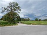
A) First, we drive to Podpeč, and then we continue driving towards Ig. When Tomišelj ends, we pay attention, because immediately after the bridge over the river Iška we turn left and park at an appropriate place by the road.
B) We drive to Ig, and then we continue driving towards Podpeč. After the settlement Brest we pay attention, because before the bridge over the river Iška we turn right onto a macadam road, alongside which we park.
Route description:
From the starting point, we continue on the road alongside which we parked, from it occasionally a nice view opens up on part of the Ljubljana Marshes and the hills which surround the mentioned landscape. After less than 15 minutes we arrive at the first board of the circular educational trail of the Nature Reserve Iški morost, and about a minute further also to the second. At the second, slightly larger information board we leave the road and continue the path on a nicely maintained trail which continues along the river Iška. A little further, at a smaller junction we continue straight on the paved path (left circular educational trail), along which we then quickly reach the observation post at Iški morost.
Description and pictures refer to the condition in the year 2015 (October).
Photos:
 1
1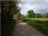 2
2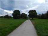 3
3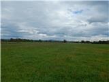 4
4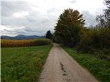 5
5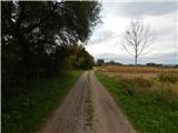 6
6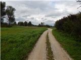 7
7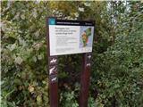 8
8 9
9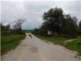 10
10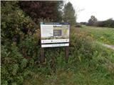 11
11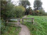 12
12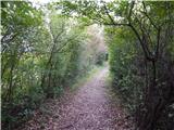 13
13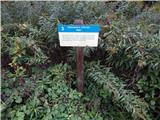 14
14 15
15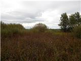 16
16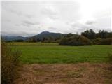 17
17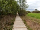 18
18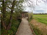 19
19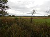 20
20
Discussion about the trip V Tracu - Iški morost
To post a comment you must log in:
If you do not yet have a username, you must first
register.