Ovčja vas / Valbruna - Jof di Miezegnot/Poldašnja špica (via Planina Strehica)
Starting point: Ovčja vas / Valbruna (807 m)
| Latitude/Longitude: | 46,49890°N 13,48580°E |
| |
Route name: via Planina Strehica
Walking time: 4 h
Difficulty: difficult marked way
Elevation gain: 1280 m
Elevation difference along the route: 1360 m
Map: Julijske Alpe - zahodni del 1:50.000
Recommended equipment (summer): helmet
Recommended equipment (winter): helmet, ice axe, crampons
Views: 6.251
 | 1 person like this post |
Access to starting point:
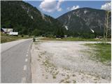
Through the border crossing Rateče or Predel we drive to Trbiž / Tarvisio, then we continue driving on the old road towards Videm / Udine. Soon we notice signs "Valbruna", which point us to the left on a local road, on which past the old cableway to Višarje we arrive in Ovčja vas / Valbruna. At the crossroad, where a road branches off to the left towards the upper end of Zajzera, we continue right towards the village Ukve / Ugovizza and we follow the road for another good 200 m to the parking lot below the power line.
Route description:
From the parking lot, we continue on the road towards Ukve and walk along it for good 100 m to the traffic sign, on which we notice the mountain signs "Forcella Nebria" (in Slovene Za vrhom), which direct us left onto path no. 608. The path initially runs along a poor road, which after a few minutes of gentle ascent enters the forest, where it brings us to a marked junction, from which the path to Podgorski vrh / Monte Nebria branches right. We continue straight ahead, first still on the cart track, then the markers direct us slightly right onto a somewhat steeper path. Soon we step out of the forest, and the path continues along a well-maintained channel intended for draining water from the local ski slope. Higher up, the path brings us to the road, which after a few minutes of further walking reaches the saddle Za vrhom / Forcella Nebria.
On the saddle, due to the construction of a new ski slope, the markers disappear, and we continue along the road for a few more minutes. After approximately 5 minutes of descent, on the left side of the ski slope we notice a poor macadam road, along which we continue the ascent. After good 10 minutes of walking along the poor road, we arrive at a torrent bed, where the road turns right (we can also reach here from the path that branches off near the saddle, but the mentioned path is completely overgrown).
On the other side of the torrent bed, the path turns left into the forest and gradually changes from the cart track into an increasingly steep path. Further on, we ascend along a well-marked path that climbs through the forest in numerous switchbacks. Higher up, the path temporarily flattens, crosses a larger gully, then gradually begins to turn more to the right. After a few minutes of further ascent, the path flattens and brings us from the forest onto a larger clearing, at the edge of which stands a well-maintained cottage.
We cross the clearing and on the other side reach an unmarked junction, where we continue straight downhill along a wide cart track. After a short descent, we reach the marked junction at Planina Strehica.
At the junction, we continue left in the direction of "Jof di Miezegnot" and continue the ascent along a partly overgrown cart track, along which we quickly reach the upper part of the pasture. Here the path turns slightly left and then continues along the edge of the forest. A little higher, the cart track enters the forest, but just a few steps before it reaches extensive scree fields and disappears there, we continue slightly left along the marked mountain path. The path first ascends somewhat more steeply through the forest, then flattens and brings us to a marked junction, where we join the path from Planina Ravne.
Here we continue right in the direction of "Jof di Miezegnot" and continue the ascent along the path that gradually passes onto less vegetated slopes. The path ahead runs along an old military mule track, beside which we can see some ruins and caverns. Higher up, the path turns right, where it flattens completely for a short time, then gradually passes onto partly grassy slopes over which it begins to ascend more steeply. The increasingly scenic path higher crosses a few more smaller gullies, then turns right and ascends over a very steep grassy slope. The path soon flattens, then ascends in a traverse over the next steep slope. At the top of the mentioned ascent, we step onto the ridge, from which a nice view opens onto the main ridge of the western Julians. The path ahead first descends gently, then relatively steeply towards the notch east of Poldašnja špica. From the notch, we continue along the ridge, then the path turns slightly right into a steep and crumbly gully. Across the gully, we ascend transversely along a ruined and slippery-dangerous path (the passage is demanding), then gradually pass onto grassy slopes over which we ascend to the next gully (here, just before entering the gully, on the right side we notice two old grenades from World War I). We ascend the gully almost straight up, then the path brings us back onto the ridge.
Here we continue right (straight ahead also possible, both paths soon join) along a relatively steep path, along which we quickly reach numerous military bunkers. The somewhat poorly marked path then leads along the ridge and higher begins to ascend steeply over rugged rocky terrain. A traversing ascent follows to the left over a relatively steep slope (slip risk), then the path ascends steeply once more and brings us to the next bunker. Here we continue left and quickly ascend to the summit along an easy ridge path.

Photos:
 1
1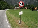 2
2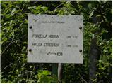 3
3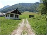 4
4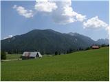 5
5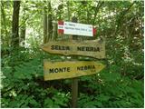 6
6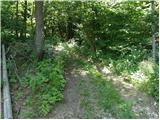 7
7 8
8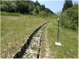 9
9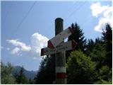 10
10 11
11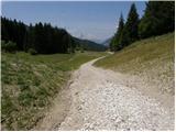 12
12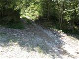 13
13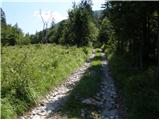 14
14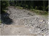 15
15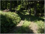 16
16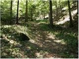 17
17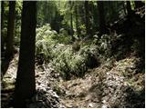 18
18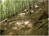 19
19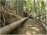 20
20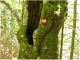 21
21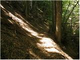 22
22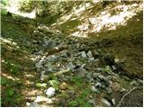 23
23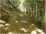 24
24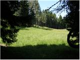 25
25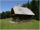 26
26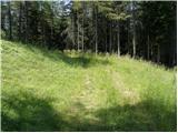 27
27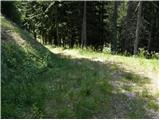 28
28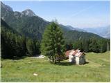 29
29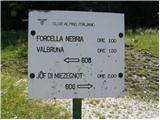 30
30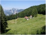 31
31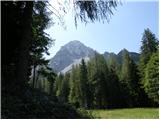 32
32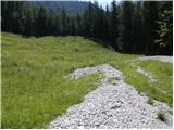 33
33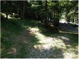 34
34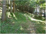 35
35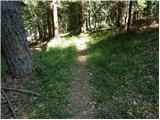 36
36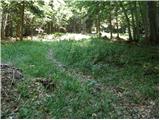 37
37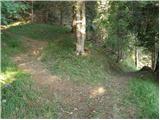 38
38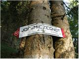 39
39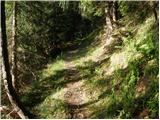 40
40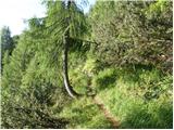 41
41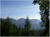 42
42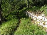 43
43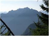 44
44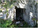 45
45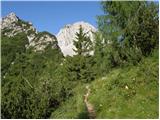 46
46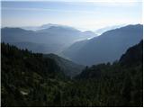 47
47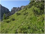 48
48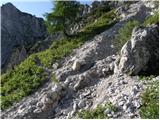 49
49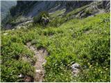 50
50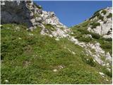 51
51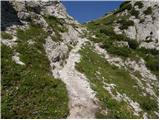 52
52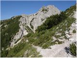 53
53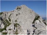 54
54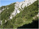 55
55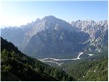 56
56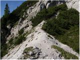 57
57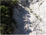 58
58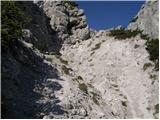 59
59 60
60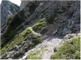 61
61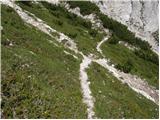 62
62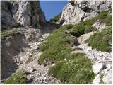 63
63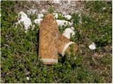 64
64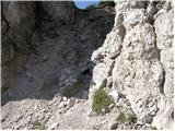 65
65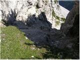 66
66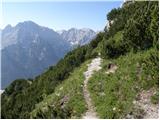 67
67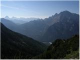 68
68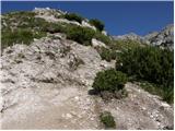 69
69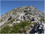 70
70 71
71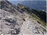 72
72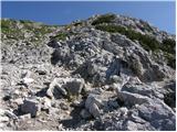 73
73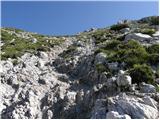 74
74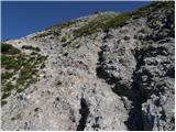 75
75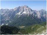 76
76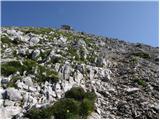 77
77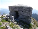 78
78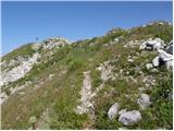 79
79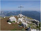 80
80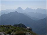 81
81
Discussion about the trip Ovčja vas / Valbruna - Jof di Miezegnot/Poldašnja špica (via Planina Strehica)
|
| VanSims25. 09. 2011 |
The second gully is a bit more demanding (and even along it there's somewhat trodden path) and just because of it the path might perhaps get a partially demanding rating, but certainly not demanding. On the final ridge orientation is a bit more demanding,
|
|
|
|
| VanSims25. 09. 2011 |
The second gully is a bit more demanding (and even along it there's somewhat trodden path) and just because of it the path might perhaps get a partially demanding rating, but certainly not demanding. On the final ridge orientation is a bit more demanding.
|
|
|
To post a comment you must log in:
If you do not yet have a username, you must first
register.