Vanganel - Marezige (via Vanganelsko jezero)
Starting point: Vanganel (22 m)
| Latitude/Longitude: | 45,51820°N 13,77850°E |
| |
Route name: via Vanganelsko jezero
Walking time: 1 h 45 min
Difficulty: easy marked way
Elevation gain: 262 m
Elevation difference along the route: 310 m
Map:
Recommended equipment (summer):
Recommended equipment (winter):
Views: 6.373
 | 1 person like this post |
Access to starting point:
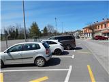
We leave the coastal highway at the exit for Pulj, Poreč and Šmarje. We then drive on the main road towards Šmarje; at the roundabout by the OMV gas station, we leave it and take the exit in the direction towards Marezige and Vanganel. In Vanganel after the sports field we turn left and then we park in the parking lot by the sports field. Parking in the parking lot of the inn Gostilna Ninis Vanganel is allowed only to visitors of the inn.
Route description:
From the parking lot, by which we notice signs for the path "Pot za srce in dušo", we return to the main road, which we carefully cross at the pedestrian crossing, and then we continue left towards Marezige. After a few steps, we leave the main road and continue right on a side road which ascends among a few houses. Further, we follow the signs, which are in the shape of red and blue lines; these then direct us a little ahead to the left onto a cart track, which quickly changes into a footpath, and on the footpath we reach an asphalt road, on which we descend to the main road Vanganel - Marezige (to here possible also on the main road), which we carefully cross and continue the path on a side road to the nearby Bavški potok, where the path splits.
We continue on the right path, which continues across private land, then passes among bushes, where the footpath is occasionally quite overgrown. Higher, we return to the main road, along which we continue to Vanganelsko jezero.
From the beginning of the lake we still continue along the main road, where the path leads us past the NOB monument; a little after the monument we continue left downwards. The path descends to the lake, along which we walk for some time, then the path starts ascending, at the junctions we follow the red and blue lines. After a few minutes, the path flattens and for some time crosses slopes towards the left, meanwhile we also cross a stream and a smaller waterfall. The path continues for some time with some shorter ascents and descents, then behind the route of the high-voltage power line we quickly arrive out of the forest, where there is a poorly marked junction.
We continue slightly right (slightly left returns to Vanganel) and continue the path among olive groves. When we leave the groves, the path leads us past the spring Starec; the path also crosses a smaller stream, then for some time it starts ascending along a forest footpath. After a shorter steep ascent we reach a cart track, along which we walk to a macadam road, which we follow to the right. The macadam road soon becomes asphalt; on it we ascend to the main road, which we carefully cross at the pedestrian crossing, then we continue the ascent on the sidewalk all the way to Marezige, where there is a viewpoint, a little further also the church of Sv. Križa, next to it the information board of the Pot za srce.
Vanganel - Vanganelsko jezero 25 minutes, Vanganelsko jezero - Marezige 1:20.
Description and pictures refer to the condition in the year 2018 (April).

Photos:
 1
1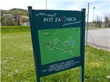 2
2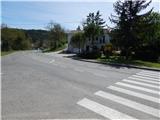 3
3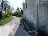 4
4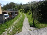 5
5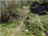 6
6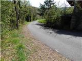 7
7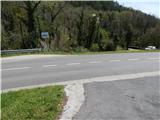 8
8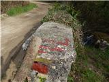 9
9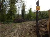 10
10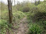 11
11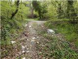 12
12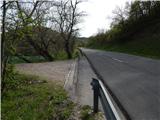 13
13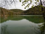 14
14 15
15 16
16 17
17 18
18 19
19 20
20 21
21 22
22 23
23 24
24 25
25 26
26 27
27 28
28 29
29 30
30 31
31 32
32 33
33 34
34 35
35 36
36 37
37 38
38 39
39 40
40 41
41 42
42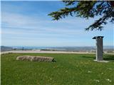 43
43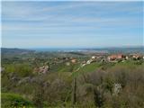 44
44 45
45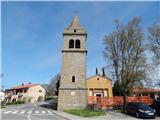 46
46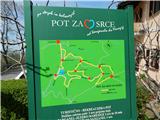 47
47
Discussion about the trip Vanganel - Marezige (via Vanganelsko jezero)
To post a comment you must log in:
If you do not yet have a username, you must first
register.