Vela Vrata - Velika Javornica (via Bijele stijene)
Starting point: Vela Vrata (1045 m)
| Latitude/Longitude: | 45,23287°N 14,97914°E |
| |
Route name: via Bijele stijene
Walking time: 3 h
Difficulty: difficult marked way
Elevation gain: 330 m
Elevation difference along the route: 400 m
Map:
Recommended equipment (summer): helmet
Recommended equipment (winter): helmet, ice axe, crampons
Views: 213
 | 1 person like this post |
Access to starting point:
a) We drive to Delnice, reaching it via the Petrina border crossing or from the Zagreb - Rijeka highway, then continue driving towards Fužine and soon proceed straight in the direction of Mrkopalj. We can also drive towards Ravna Gora and in the settlement Zalesina turn right towards Mrkopalj. In Mrkopalj, a sign for Begovo Razdolje directs us right (from the direction of Ravna Gora left) onto an ascending road, which soon brings us to the mentioned village. At the end of the village, we come to a smaller crossroad, where we continue on the right road which soon becomes a macadam. After a few kilometers, the road becomes asphalt again and quite steep. At Vrbovska Poljana, we leave the asphalt road and continue left in the direction of Bjelolasica. To the right, you reach the Janjčarica cottage. Further, we drive past a quarry, after which we soon notice hiking signs for Bjelolasica, but we continue driving on the macadam road past additional hiking signs for Bjelolasica (past a shelter) all the way to a crossroad below Gomirkovica, where we continue on a better road. We soon reach a larger crossroad, where a road from Jasenak joins from the left. We continue right and soon park in a suitable spot by the road. The road ahead is very rough. It takes approximately 3 minutes of walking to reach the information board. The macadam road is approximately 12 kilometers.
b) In Mrkopalj, we turn right (from the direction of Ravna Gora left) towards Tuk Vojni, then drive through the mentioned village and past the Bijele Stijene mountain hut. A little above the mentioned hut, the road becomes macadam. The ascending road makes a few hairpin turns, and after a few kilometers, we reach a smaller crossroad, where we continue left. We soon arrive at Matić Poljana, where there are many monuments. The road ahead becomes very poor due to logging activities. We drive past several turn-offs, following the signs for Samarske Stijene. We drive past the starting point for Samarske Stijene, but continue driving in the direction of Bijele Stijene. After a few kilometers, we reach the information board, where we park in a suitable spot by the road. The macadam road is approximately 14 kilometers.
c) From the Ogulin - Novi Vinodolski road, just after the settlement Jasenak, we notice signs for Bijele Stijene, where we turn right (from the direction of Novi Vinodolski left) onto a macadam road that initially descends. It soon starts ascending, veers to the right, and makes a long turn. The road continues ascending to a crossroad, where we proceed slightly right; to the left is the 7th kilometer, from where it is also possible to reach Bijele Stijene. After a few kilometers of quite potholed road, we reach the next crossroad, where we continue left and soon park in a suitable spot by the road. The road ahead is very rough. It takes approximately 3 minutes of walking to reach the information board. The macadam road is approximately 7.5 kilometers, but it is in quite poor condition.
All conditions refer to the state in April 2025.
Route description:
From the starting point, we head past the information board in the direction of Vihoraški put. The path leads through a smaller canyon and in 5 minutes we reach a crossing, where we continue right, left leads to 7. kilometar. The path becomes steep and makes a few short zig-zags. Soon it flattens and descends into a smaller sinkhole. On the path, there are many fallen trees. The path ascends and descends into sinkholes again, crossing some of them on the left or right side. After about half an hour of such a path, we arrive at a short rocky jump, where we need to climb a little. It is possible to bypass it slightly higher on a less visible footpath. Shortly after, there is a smaller cave to the right of the path. The path continues, becoming rocky and quite steep. Such a path brings us in 15 minutes to a ridge, where the path Vihoraški put from Samarske stijene via Ljuske joins from the right. We continue left. Initially, a gentle path through the forest quickly turns into a rocky gully, which we climb. The path turns left and through a narrow rocky passage, we reach a technically challenging part of the path. We must descend over an unsecured jump. After the jump, we arrive at a sinkhole, then continue left, and after a short traverse, we reach a crossroad where a path branches off to the right toward the "chapel," which is merely a sinkhole. We continue straight over rocks and reach another crossroad, where a western path branches off to the right toward Bijele stijene. The described path continues straight, and in a few minutes of walking on rocks, we arrive at another crossing, where a path branches off to the right to the summit of Bijele stijene (3 minutes). We continue straight in the direction of the mountain hut. The path slightly descends between rock walls and over a few short jumps, we reach the bottom of a smaller sinkhole. The path ascends more steeply from there and brings us to the mountain hut, which is on the left side of a plain. Here, we continue right, and after 50 meters of walking, we reach the bivouac.
From the bivouac, we continue along the path ahead. Initially, the path descends slightly diagonally, then more steeply among boulders to a crossing, where the left path leads to the starting point 7. kilometar, while we continue slightly right on a less trodden path that still descends. The path leads past another signpost and descends into a small valley among rocks, where in springtime there is abundant wild garlic, which may partially cover the path. After the mentioned small valley, the path crosses the slope of an unnamed peak, and after 15 minutes of walking, we reach another barely noticeable crossing, where a path branches off to the left toward the starting point 7. kilometar, while we continue right between the rocks. The path winds through several smaller sinkholes and crosses a few short rocky jumps, where there are also some fallen trees, so we carefully follow the blazes. The path then begins to ascend and traverse. After about 15 minutes of ascent, we cross an indistinct ridge and move onto a larger plain. At the start, there is a collapsed wooden cottage by the path. We walk on the plain for a few minutes, then the path briefly descends slightly, before ascending to a crossing just below the summit. To the right, the path continues to Stalak, located by the road Ogulin - Novi Vinodolski. We continue straight on a steep path to a rocky section. The path crosses a rocky ledge, and only a few meters on a narrow rocky ridge separate us from the summit.
The description and pictures refer to the condition in April 2025.

Photos:
 1
1 2
2 3
3 4
4 5
5 6
6 7
7 8
8 9
9 10
10 11
11 12
12 13
13 14
14 15
15 16
16 17
17 18
18 19
19 20
20 21
21 22
22 23
23 24
24 25
25 26
26 27
27 28
28 29
29 30
30 31
31 32
32 33
33 34
34 35
35 36
36 37
37 38
38 39
39 40
40 41
41 42
42 43
43 44
44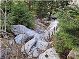 45
45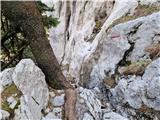 46
46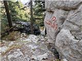 47
47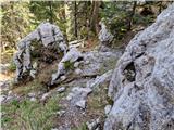 48
48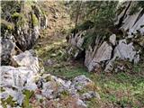 49
49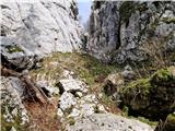 50
50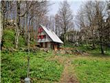 51
51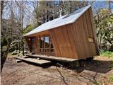 52
52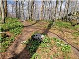 53
53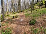 54
54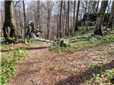 55
55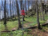 56
56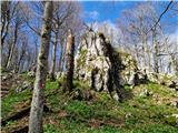 57
57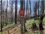 58
58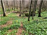 59
59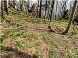 60
60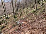 61
61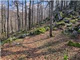 62
62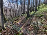 63
63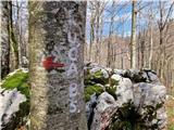 64
64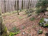 65
65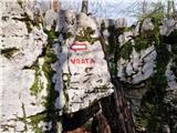 66
66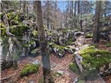 67
67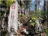 68
68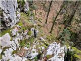 69
69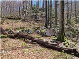 70
70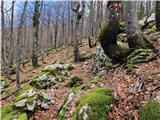 71
71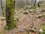 72
72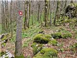 73
73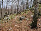 74
74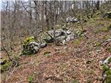 75
75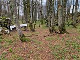 76
76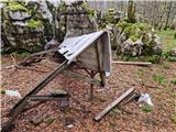 77
77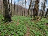 78
78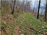 79
79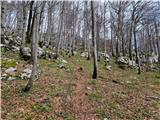 80
80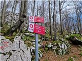 81
81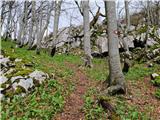 82
82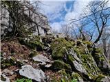 83
83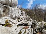 84
84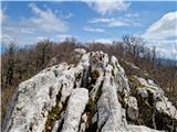 85
85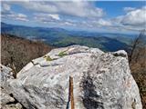 86
86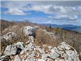 87
87
Discussion about the trip Vela Vrata - Velika Javornica (via Bijele stijene)
To post a comment you must log in:
If you do not yet have a username, you must first
register.