Velika vrata - Velika Plešivica
Starting point: Velika vrata (760 m)
| Latitude/Longitude: | 45,51310°N 14,02920°E |
| |
Walking time: 25 min
Difficulty: easy marked way
Elevation gain: 148 m
Elevation difference along the route: 148 m
Map: Slovenska Istra - Čičarija, Brkini in Kras 1:50.000
Recommended equipment (summer):
Recommended equipment (winter):
Views: 5.480
 | 1 person like this post |
Access to starting point:
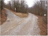
From the Ljubljana - Koper highway take the Kozina exit and follow the road ahead in the direction of Reka. In the village Obrov we turn right in the direction of the village Golac. After a few kilometers of driving we arrive in the mentioned village, where we continue right (straight Zagrad) and follow the road, which at the end of the village becomes macadam, towards Velika vrata. Higher up the path from the village Zagrad joins from the left side (access is possible also on this road), and we continue straight and follow the road to the saddle Velika vrata, where we park (Velika vrata is located at the road sign 8km).
Route description:
From Velika vrata we go right on a cart track in the direction of Slavnik and Velika Plešivica. Only a few steps after we left the road, the cart track brings us to a grazing area, where horses are grazing. Here the blazes direct us over the grazing fence onto a grassy slope, along which we then ascend on a path that is at first very poorly visible. During the ascent through the grazing area a few blazes help us, which are in the lower part quite rare. Higher the path becomes more distinct and the blazes more frequent. We then follow this increasingly panoramic path to the top of Velika Plešivica.
Photos:
 1
1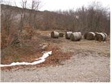 2
2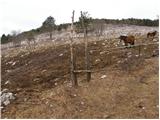 3
3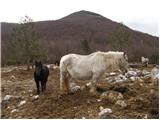 4
4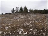 5
5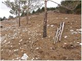 6
6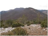 7
7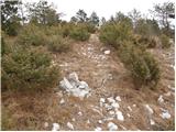 8
8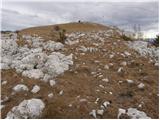 9
9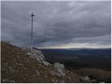 10
10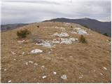 11
11 12
12
Discussion about the trip Velika vrata - Velika Plešivica
|
| grega_p16. 05. 2010 |
There are plenty of markings, but the path is hidden among overgrown vegetation... However, orientation is easy and after 25 min of junipers, sage and wild thyme we reach the panoramic summit..
Short but sweet.
best
G.
|
|
|
To post a comment you must log in:
If you do not yet have a username, you must first
register.