Vgriz / Ogris - Prešernova koča na Stolu
Starting point: Vgriz / Ogris (1180 m)
| Latitude/Longitude: | 46,47214°N 14,21100°E |
| |
Walking time: 4 h 25 min
Difficulty: difficult marked way
Elevation gain: 994 m
Elevation difference along the route: 1150 m
Map: Karavanke - osrednji del 1:50.000
Recommended equipment (summer): helmet
Recommended equipment (winter): helmet, ice axe, crampons
Views: 1.792
 | 2 people like this post |
Access to starting point:
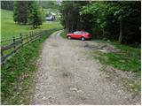
We drive to the border crossing Ljubelj and continue on the Austrian side. Soon after that, when on the left side of the road we notice a smaller church, the road towards the village Poden / Bodental branches off to the left. At the crossroad for the village Slovenji Plajberk / Windisch Bleiberg we turn left towards Poden / Bodental. In Poden / Bodental we come to mountain signposts for Celovška koča / Klagenfurter Hütte left and right. We head right and follow the road ahead to the next crossroad, where we turn left. We follow this road to a smaller parking lot, where the unmarked path from the inn Podnar / Bodenbauer joins (further driving is forbidden).
Route description:
From the parking lot, we continue past the gate on a road which in the initial part offers quite a nice view. The road then goes into the forest and brings us to a junction, where we turn left on a cart track. We follow the cart track ahead slightly upwards to a junction of two cart tracks. We head onto the slightly right marked cart track, which then starts to change into a footpath, which starts to ascend more steeply. The path brings us after a shorter ascent onto a ridge, where the path turns left and continues first still on then along the ridge. The path then passes onto steep slopes which we cross without major ascents. Further, we cross a shorter partly already overgrown scree after which the path starts ascending again and soon brings us to the grazing fence of the mountain pasture Vgriz which we reach in a few minutes of further walking. On the mountain pasture, where a shepherd hut stands, a beautiful view opens up.
The path ahead starts to descend and after a short descent brings us to a spring after which in a few steps we come to a junction. We continue straight (left downwards Podnar) and the path brings us from the forest among dwarf pines. Next follows crossing of the scree then with the help of a steel cable we descend slightly downwards. From here ahead the path is exposed to falling stones. Further, the well-secured path starts to ascend a steep rocky slope. At the top of this easier climbing section we come to a logbook, where we sign. The difficulty of the path then disappears and in a traverse ascent we come to the saddle Vrata. The path ahead starts to descend and in a few minutes brings us to a junction, where we continue straight (right Ovčji vrh) and in a few minutes of light descent we come to Celovška koča.
From the hut we head left in the direction of Stol / Hochstuhl, Svačica / Bielschitza and Prešernova koča and continue on a gentle cart track which somewhat lower changes into a mountain path, which brings us through a belt of dwarf pines to screes below Svačica. The path ahead ascends transversely across the first scree, then brings us to a short steep section, where a steel cable assists us at the crossing. The short and technically not particularly demanding section of the path ends quickly, and the path continues across the scree, over which a wide and well-maintained path leads us. With a view of the surrounding walls, we then ascend without major difficulties to the saddle Belščica, where there is a marked junction.
From the saddle Belščica, from where the path to Svačica branches off to the left, we continue straight and continue the path in the direction of Vrtača, Prešernova koča and Zelenica. We cross grassy slopes for a few minutes, then arrive at the place where the path to Vrtača branches off to the left, and we continue straight downwards. The path ahead first descends steeply down the gully, then turns right, where it passes onto extensive screes over which it ascends transversely. Higher we leave the scree and descend slightly to the nearby junction, where the upper and lower path and the path from Završnica join us.
Here we continue straight, and the path from the valley between Srednja peč 1920 m (Srednja peč is a less known peak on the left) and the ridge Orlic (Orlice are a harder accessible ridge between the saddle Belščica and Stol) gradually passes onto a larger scree, over which we ascend transversely towards the right, then the path gradually passes into a steeper valley between Mali Stol on the left and Stol on the right. Here we continue left (right Stol 10 minutes) and after a few minutes of moderate ascent we step onto the summit of Mali Stol, from which only a few 10 steps of descent separate us to Prešernova koča.
Starting point - Celovška koča 2:15, Celovška koča - Koča na Stolu 2:10.

Photos:
 1
1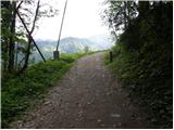 2
2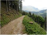 3
3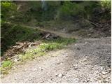 4
4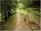 5
5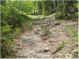 6
6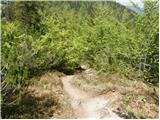 7
7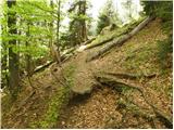 8
8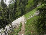 9
9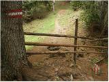 10
10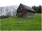 11
11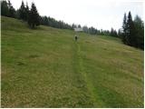 12
12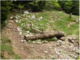 13
13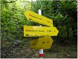 14
14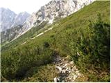 15
15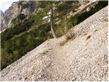 16
16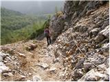 17
17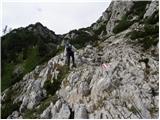 18
18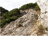 19
19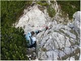 20
20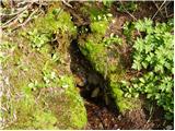 21
21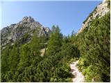 22
22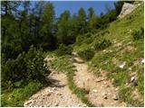 23
23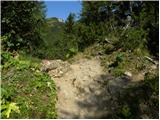 24
24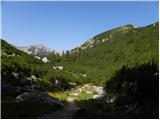 25
25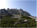 26
26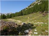 27
27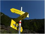 28
28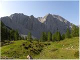 29
29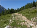 30
30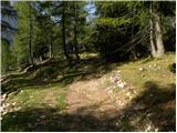 31
31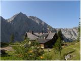 32
32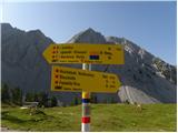 33
33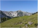 34
34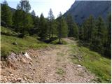 35
35 36
36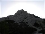 37
37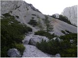 38
38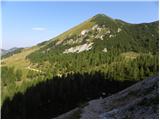 39
39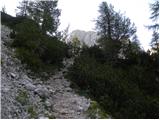 40
40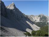 41
41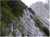 42
42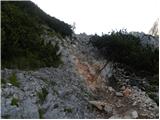 43
43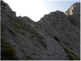 44
44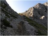 45
45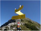 46
46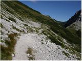 47
47 48
48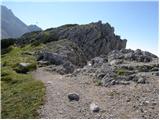 49
49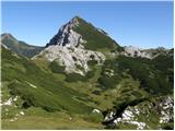 50
50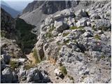 51
51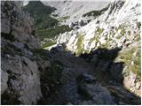 52
52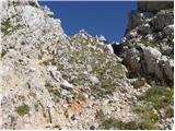 53
53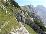 54
54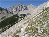 55
55 56
56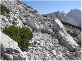 57
57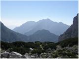 58
58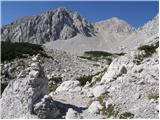 59
59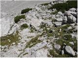 60
60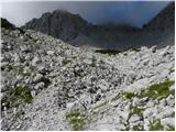 61
61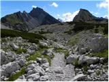 62
62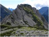 63
63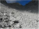 64
64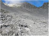 65
65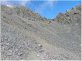 66
66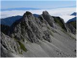 67
67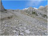 68
68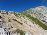 69
69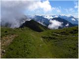 70
70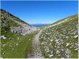 71
71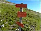 72
72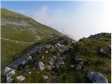 73
73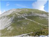 74
74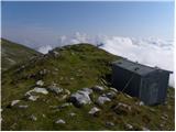 75
75 76
76 77
77 78
78
Discussion about the trip Vgriz / Ogris - Prešernova koča na Stolu
To post a comment you must log in:
If you do not yet have a username, you must first
register.