Vidrga - Zasavska Sveta gora (on a cart track)
Starting point: Vidrga (430 m)
| Latitude/Longitude: | 46,13620°N 14,86400°E |
| |
Route name: on a cart track
Walking time: 1 h 30 min
Difficulty: easy unmarked way
Elevation gain: 422 m
Elevation difference along the route: 422 m
Map:
Recommended equipment (summer):
Recommended equipment (winter): ice axe, crampons
Views: 2.200
 | 2 people like this post |
Access to starting point:
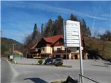
From the road Moravče - Zagorje ob Savi, in the settlement Vidrga, by the inn with accommodations Pri Vidrgarju, we turn right (from the direction of Zagorje left) in the direction of Zasavska gora. We park on an appropriate parking lot past the crossroad, near the inn or the ski slope.
Route description:
From the starting point, we continue on the asphalt road in the direction of Zasavska Sveta gora. At first, we go past the information board of the Natura 2000 area and the ski slope Kandrše Vidrga, then we start first lightly, later moderately ascending. Further, we walk through the settlement Kostrevnica, and when the settlement at the hamlet Razpotje ends, at the chapel we go right onto the cart track, where a wooden sign also directs us. Next follows an ascent through the meadow, where upon looking back a view opens up that reaches all the way to the Kamnik Savinja Alps, and when we step into the forest at the junction of cart tracks we continue slightly right.
A few steps ahead we go slightly left, then straight, where we cross a macadam road. Next follows an ascent on a steep cart track, which we follow to a smaller saddle, where we reach the marked path Vače - Zasavska Sveta gora, which we follow to the left.
The path ahead ascends on the cart track, from it we temporarily go right onto the marked path, which soon returns to the cart track. We walk a short time more on the cart track, and when it starts to descend we continue slightly right onto the marked path, which splits a few steps ahead.
We continue right in the direction of the church on Zasavska Sveta gora (straight to Koča na Zasavski Sveti gori) and after a shorter steep ascent we step onto the summit, from which a nice view opens up that reaches all the way to the Alps.
Description and pictures refer to the condition in March 2020.

Along the route: Kostrevnica (484m)
Photos:
 1
1 2
2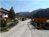 3
3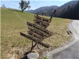 4
4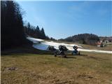 5
5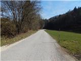 6
6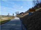 7
7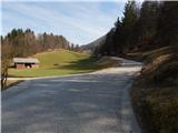 8
8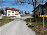 9
9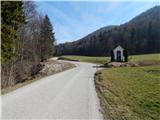 10
10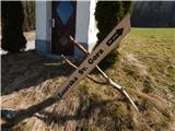 11
11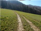 12
12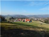 13
13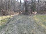 14
14 15
15 16
16 17
17 18
18 19
19 20
20 21
21 22
22 23
23 24
24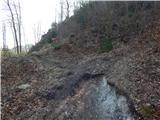 25
25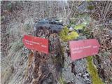 26
26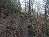 27
27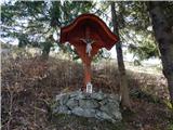 28
28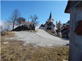 29
29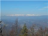 30
30 31
31
Discussion about the trip Vidrga - Zasavska Sveta gora (on a cart track)
To post a comment you must log in:
If you do not yet have a username, you must first
register.