Vikrče - Grmada (Mazijeva steza)
Starting point: Vikrče (320 m)
| Latitude/Longitude: | 46,12850°N 14,44460°E |
| |
Route name: Mazijeva steza
Walking time: 1 h 5 min
Difficulty: easy marked way
Elevation gain: 356 m
Elevation difference along the route: 356 m
Map: Ljubljana - okolica 1:50.000
Recommended equipment (summer):
Recommended equipment (winter): ice axe, crampons
Views: 7.009
 | 1 person like this post |
Access to starting point:
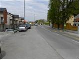
A) From the highway Ljubljana - Jesenice we take the exit Ljubljana - Šmartno, and then continue driving towards Tacen. In Tacen, just before the road over the bridge crosses the river Sava, we continue slightly right in the direction of Pirniče. Only a little after Ljubljana ends, we arrive in Vikrče, and we follow the road to the inn Kovač, which is located right next to the bus station. At the starting point there are no suitable parking spots.
B) From Šentvid we drive to Tacen, and there immediately after the bridge over the river Sava we turn left towards Pirniče. Only a little after Ljubljana ends, we arrive in Vikrče, and we follow the road to the inn Kovač, which is located right next to the bus station. At the starting point there are no suitable parking spots.
C) From Medvode we drive to Zgornje and then to Spodnje Pirniče, and we follow the road towards Tacen. When we arrive in Vikrče, we join the road that leads from Smlednik towards Tacen, and here we continue right and follow the road to the nearby inn Kovač, where the starting point of our path is. At the starting point there are no suitable parking spots.
D) We can also reach the starting point by LPP bus No. 15.
Route description:
From the inn Kovač we first walk along the road that leads towards Tacen, then, when the main road makes a slight right turn, we continue slightly left onto a narrower local road (at the intersection there is a no-driving sign, and near the sign there is also an information board for the forest educational trail on Šmarnogorska Grmada). Along the narrower asphalt road we quickly arrive at a private parking lot, where the climbing path to Grmada branches off sharply to the left, and we continue straight and follow the road to the sign reading "private". Here we continue slightly left onto a marked footpath that begins to ascend gently through the forest. After a good 10 minutes of further walking we arrive at the next junction, where we continue left in the direction of Mazijeva steza (straight ahead the path goes over Zatrep and Tacen).
The path ahead begins to ascend steeply through the forest, and occasional views open up towards the valley and part of the Polhograjski Dolomiti. Higher up the trail brings us to the ridge of Grmada, where we join the Pogačnikova pot and Westrova pot.
At the junction we continue right, and we follow the ridge path, which continues through the forest, all the way to the summit of Grmada.

The trip can be extended to the following destinations: Šmarna gora
Photos:
 1
1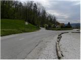 2
2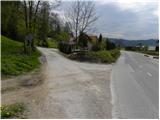 3
3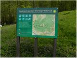 4
4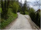 5
5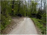 6
6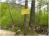 7
7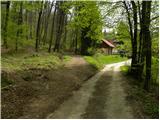 8
8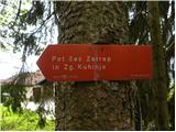 9
9 10
10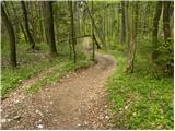 11
11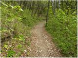 12
12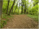 13
13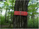 14
14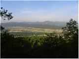 15
15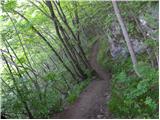 16
16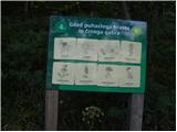 17
17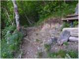 18
18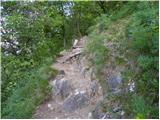 19
19 20
20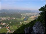 21
21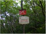 22
22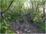 23
23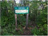 24
24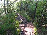 25
25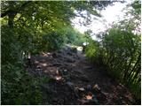 26
26 27
27
Discussion about the trip Vikrče - Grmada (Mazijeva steza)
|
| balon5. 08. 2022 11:39:46 |
Hello,
is it still possible to park at picture 6?
Thanks for the reply.
|
|
|
|
| ben5. 08. 2022 13:31:16 |
Yes, but on the third picture there's a no-traffic sign except for residents and landowners. So .... there's enough space, but if some warden passes by there, you'll get a ticket quickly.
|
|
|
|
| balon9. 08. 2022 14:02:26 |
ben thanks for the reply. We will park in a place where this certainly won't be controversial.
|
|
|
|
| balon9. 08. 2022 14:02:46 |
ben thanks for the reply. We will park in a place where this certainly won't be controversial.
|
|
|
To post a comment you must log in:
If you do not yet have a username, you must first
register.