Vikrče - Grmada (Westrova pot)
Starting point: Vikrče (320 m)
| Latitude/Longitude: | 46,12850°N 14,44460°E |
| |
Route name: Westrova pot
Walking time: 1 h
Difficulty: partly demanding marked way
Elevation gain: 356 m
Elevation difference along the route: 356 m
Map: Ljubljana - okolica 1:50.000
Recommended equipment (summer):
Recommended equipment (winter): ice axe, crampons
Views: 19.811
 | 4 people like this post |
Access to starting point:
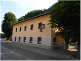
A) From the highway Ljubljana - Jesenice we go to the exit Ljubljana - Šmartno, and then we continue driving towards Tacen. In Tacen just before the road over the bridge crosses the river Sava we continue slightly right in the direction of Pirniče. Only a little after Ljubljana ends, we get to Vikrče, and we follow the road to the inn Kovač, which is located right next to the bus stop. At the starting point there are no appropriate parking spots.
B) From Šentvid we drive to Tacen, there immediately after the bridge over the river Sava left towards Pirniče. Only a little after Ljubljana ends, we get to Vikrče, and we follow the road to the inn Kovač, which is located right next to the bus stop. At the starting point there are no appropriate parking spots.
C) From Medvode we drive to Zgornje and then to Spodnje Pirniče, and we follow the road towards Tacen. When we get to Vikrče, we join the road which leads from Smlednik towards Tacen, and here we continue right and follow the road to the nearby inn Kovač, where the starting point of our path is. At the starting point there are no appropriate parking spots.
D) We can also get to the starting point by LPP bus number 15.
Route description:
We head towards the village Vikrče but only to the traffic sign, which is placed by the sidewalk. At the sign the Westrova pot branches off to the right to Grmada. The signpost for the Westrova pot warns that it is a demanding path, but it is just a steeper path that does not cause problems to the average mountaineer. More caution is needed in wet conditions or snow.
The path ascends steeply on the western slopes of Grmada for approximately 20 minutes, after that the steepness decreases. After that a climbing path from the village Vikrče joins from the right side. There follows an ascent on a wide vegetated ridge to the top of Grmada, where a beautiful view opens up.
The trip can be extended to the following destinations: Šmarna gora
Photos:
 1
1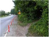 2
2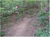 3
3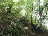 4
4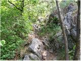 5
5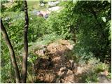 6
6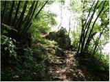 7
7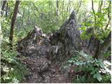 8
8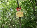 9
9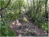 10
10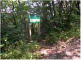 11
11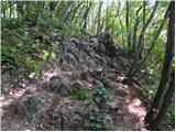 12
12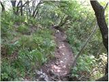 13
13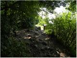 14
14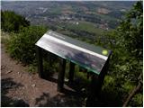 15
15 16
16
Discussion about the trip Vikrče - Grmada (Westrova pot)
|
| iztok4. 12. 2007 |
Nicely maintained trail. I recommend extending it to Šmarna gora and then returning to the starting point via Peske (everything is well marked) to make a nice loop trail
|
|
|
|
| SaschaC18. 09. 2008 |
In my opinion the nicest path to Šmarna gora or Grmada. And it's not that crowded either. I recommend that on the descent at about 1/3 of the way turn left to the freedom path which connects Westrova pot with the path through Peske which is friendlier for the descent.
|
|
|
|
| SaschaC19. 09. 2008 |
Correcting: on the way down, the Path of Freedom is to the right.
|
|
|
|
| Domch29. 03. 2012 |
Nice uphill trail - steep and good for muscle building, on some sections hands are needed too. Descent is definitely better via the freedom trail.
|
|
|
|
| Janiel7429. 03. 2012 |
Where does the Pot Svobode lead you? Which way left and which right?
|
|
|
|
| Enka29. 09. 2012 |
If you park under Westrovo (near Kovač), it's best to descend via Kovačeva steza. From Grmada you descend to the saddle and then along the road towards the path through Peske, until the forest path - Pot svobode branches off to the right, from which Kovačeva steza branches off downhill after a few meters. The junction is well marked. Via Kovačeva steza we arrive exactly at the start of Westrova pot. This is my favorite circular trail on Grmada & Šmarna gora. I usually combine it with the ascent from the saddle to ŠG, so the little dog can drink water . .
|
|
|
|
| Enka29. 09. 2012 |
Pardon, Pot svobode naturally branches off from the road to the left downhill (true, in the right bend ). ).
|
|
|
To post a comment you must log in:
If you do not yet have a username, you must first
register.