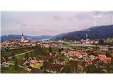
Višnja gora - Kucelj (pot dveh slapov)
Starting point: Višnja gora (386 m)
| Latitude/Longitude: | 45,95840°N 14,74460°E |
| |
Route name: pot dveh slapov
Walking time: 4 h 30 min
Difficulty: partly demanding marked way
Elevation gain: 362 m
Elevation difference along the route: 1014 m
Map: Ljubljana 1:50.000
Recommended equipment (summer):
Recommended equipment (winter): crampons
Views: 29.000
 | 1 person like this post |
Access to starting point:
Highway Ljubljana-Novo Mesto, exit Višnja gora, left below the highway and further to the lower church by the highway. You park at the church.
Route description:
At the church, we go along the highway towards Ljubljana. After 500 meters, we turn right into the village Dedni dol; at the end of the village, we continue 1.5 km on macadam and soon arrive in the forest. Behind the chapel, we turn left over the stream and go to the waterfall straight ahead all the way. At the waterfall, for the experienced via the ladder; others a little before the waterfall via the excavated steps and along the stream upwards to the source. Then follow the blazes (signs on which it is written "pot dveh slapov"). When we come to the village Blečji vrh, left on macadam to the top on the main path (a few turns and turn-offs but on the main path).
On the top of Kucelj from the lookout tower ahead 300 m, then right into the forest downwards to the village Gorenje Brezovo, at the chapel sharply to the left on the upper path, after about 300 meters of asphalt we turn right onto a cart track and straight to Gradišče 706 m.
On Gradišče at the cross on the most beaten path to the village Vrh nad Višnjo gora to the agrotourism Habjan, where you can refresh yourselves, and descent into the valley to the village, where the second left turn-off leads to the second waterfall. At the second waterfall, we go into the valley all the time along the stream. After a good 2 km you come out of the forest, then on macadam to asphalt, at the highway you turn right and you again spot the church tower, where you parked.

Photos:
 1
1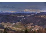 2
2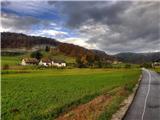 3
3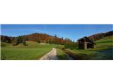 4
4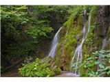 5
5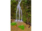 6
6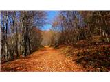 7
7 8
8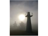 9
9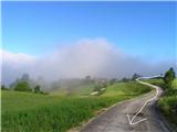 10
10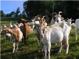 11
11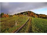 12
12 13
13 14
14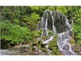 15
15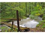 16
16 17
17
Discussion about the trip Višnja gora - Kucelj (pot dveh slapov)
|
| Lj15. 05. 2011 |
Thanks for this description. My friend and I walked the path yesterday and had a wonderful ramble by the freshness of streams and through flowering meadows between Kuceljem and Gradiščem. We got a little lost too, as befits discovering new places. We didn't see the mentioned village Bleči vrh, from the gully of Višnjica stream we came to a gravel road which brought us to scenic Kucelj. In the village Vrh nad Višnjo goro the sign "Košca" points left by the house with orange facade. Two gravel roads go left, the correct one is the upper left, which soon splits into 2 tracks - the right one is correct. We didn't go to the source of Košca, because there it was banging like on the front and even sand was flying through the air  We quickly withdrew down the nicely secured steep path along the stream. The waterfall was more modest this time. We quickly withdrew down the nicely secured steep path along the stream. The waterfall was more modest this time.
Lp, Ljubica
|
|
|
To post a comment you must log in:
If you do not yet have a username, you must first
register.