Višnja Gora - Višnja Gora Castle (Stari grad)
Starting point: Višnja Gora (371 m)
| Latitude/Longitude: | 45,95810°N 14,74130°E |
| |
Walking time: 30 min
Difficulty: easy marked way
Elevation gain: 135 m
Elevation difference along the route: 135 m
Map:
Recommended equipment (summer):
Recommended equipment (winter): crampons
Views: 2.770
 | 1 person like this post |
Access to starting point:
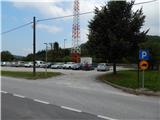
From the Ljubljana - Obrežje motorway, we take the Višnja Gora exit and drive in the direction of the centre of the settlement. Just a few dozen metres further from the bar Kic bil, we will notice on the left side a larger marked parking lot, where we park.
Route description:
From the parking lot, we continue towards the centre of Višnja Gora, then at the first crossroads we continue right in the direction of Polževo. A little further, at the next crossroads, we notice the first red mountain signposts for Stari grad, which direct us to the left road, which a little further we leave and past a few houses we climb to the other road, which we reach near the church. We continue through the old part of the town, then in front of the primary school Edo Turnher Primož, we notice an information board for the forest educational trail po sledeh višnjanskega polža.
A little behind the school, the signposts for Stari grad, Polževo and Jurčičeva pot direct us left, past a few houses, to a path that enters the forest. Through the forest we begin to ascend more steeply along the cart track, after a few minutes we arrive at a marked junction, where we continue right in the direction of Stari grad (the path straight bypasses Stari grad and leads further towards Polževo).
From the junction onwards we leave the cart track and continue the ascent along the mountain path, which in the vicinity of the castle becomes quite overgrown. For a few dozen metres we ascend the overgrown path, from which some views open up onto the surroundings.
We can descend by the same path, or continue further and descend along a better-trodden and less overgrown path to the cart track, where we return to the path that we left before the last ascent to the castle, and then descend along it to Višnja Gora.
Description and pictures refer to the condition in 2016 (September).

Photos:
 1
1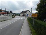 2
2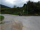 3
3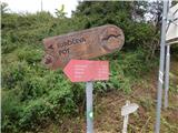 4
4 5
5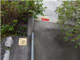 6
6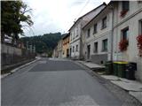 7
7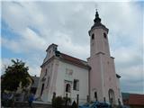 8
8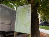 9
9 10
10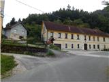 11
11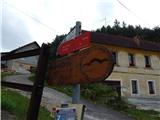 12
12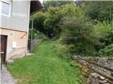 13
13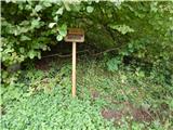 14
14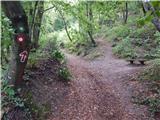 15
15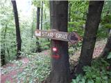 16
16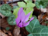 17
17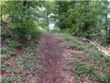 18
18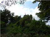 19
19 20
20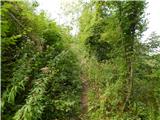 21
21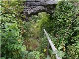 22
22 23
23 24
24 25
25
Discussion about the trip Višnja Gora - Višnja Gora Castle (Stari grad)
|
| grega_p28. 02. 2021 |
Nice mini hike. I recommend the starting point at the Educational Institution (near the primary school), where we walk along the road past the old renovated houses of the western part of Višnja Gora, past the town beekeeper to the sign (No.12).
The descent is even nicer along the western ridge (box, junipers, heather), where we join the cart track below, which brings us to the starting point in the bend below. Or straight down the path. Orientation is easy.
The whole loop at sightseeing pace and viewing the castle ruins takes less than an hour. There are currently tons of peonies on the path - they are beautiful!
|
|
|
To post a comment you must log in:
If you do not yet have a username, you must first
register.