Starting point: Visoko (707 m)
| Latitude/Longitude: | 45,89140°N 14,55630°E |
| |
Walking time: 20 min
Difficulty: easy marked way
Elevation gain: 119 m
Elevation difference along the route: 119 m
Map: Ljubljana-okolica 1:50.000
Recommended equipment (summer):
Recommended equipment (winter):
Views: 27.959
 | 3 people like this post |
Access to starting point:
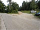
From the southern Ljubljana bypass, we head to the Ig exit and follow the road to the mentioned place. In Ig we turn left in the direction of Kurešček (right Iška vas), and then after a few 100 meters right upwards, again in the direction of Kurešček. Further, we drive on an ascending road which we follow to the spot where the next sign for Kurešček directs us left (here we leave the main road). Further, we drive to the next crossroad, by which we park on one of the several smaller parking spaces.
Route description:
From the crossroad, we continue on the right road in the direction of Kurešček. At the spot where the road makes its first sharp left turn, we will on the right side notice a cart track to which a mountain signpost directs us. From the cart track soon a marked footpath branches off to the left, which then quickly brings us to the mountain hut Dom na Kureščku. Further, we continue on the road to a large panoramic meadow, but only to the first cross by the road. Just a few meters before the cross we leave the road and go right through the meadow on a nicely beaten footpath which quickly brings us into the forest, where we notice the blazes. The path then for a short time steeply ascends and in a few minutes brings us to the church on the top of Kurešček.
The ascent is possible also on the road.
Photos:
 1
1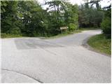 2
2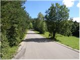 3
3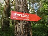 4
4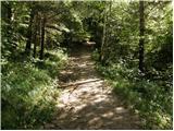 5
5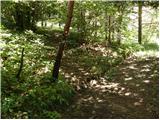 6
6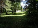 7
7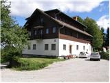 8
8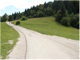 9
9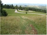 10
10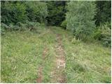 11
11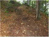 12
12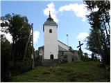 13
13
Discussion about the trip Visoko - Kurešček
|
| Gost12. 09. 2006 |
richly filled time and simple and healthy relaxation
|
|
|
|
| Gost12. 09. 2006 |
Definitely better than nothing, even if only 15 minutes........
|
|
|
|
| Gost12. 12. 2006 |
You can leave the car at Gol and via the wonderful forest road we reach the intersection at Visoko and then continue to the chapel.
From Gol we go about 1h before mass.
Best regards! Jožica
|
|
|
|
| Gost24. 12. 2006 |
Merry Christmas to all hikers. Marija
|
|
|
|
| Gost22. 04. 2007 |
very nice and peaceful just please keep dogs on a leash
|
|
|
|
| Gost22. 04. 2007 |
 hiked and it was nice hiked and it was nice
|
|
|
|
| Gost2. 05. 2007 |
when are the masses during the week
|
|
|
|
| artur29. 04. 2012 |
Is it possible to drive to the top to the church by car, because of my disabled mom?
|
|
|
|
| artur9. 05. 2013 |
For May 1st on Kurešček. Pleasant, beautiful, tidy and quiet place. But you must visit Kurešček when there are no ceremonies there....
|
|
|
|
| Lj10. 05. 2013 |
If you park your car in the spot from the first photo, you might be unpleasantly surprised upon return ... last year's visit to this place unfortunately cost me dearly...
|
|
|
To post a comment you must log in:
If you do not yet have a username, you must first
register.