Vitovlje (Križišče) - Kopitnik (via Sekulak)
Starting point: Vitovlje (Križišče) (400 m)
| Latitude/Longitude: | 45,94110°N 13,76130°E |
| |
Route name: via Sekulak
Walking time: 2 h 30 min
Difficulty: easy marked way
Elevation gain: 529 m
Elevation difference along the route: 600 m
Map: Goriška 1:50.000
Recommended equipment (summer): helmet
Recommended equipment (winter): helmet, ice axe, crampons
Views: 12.091
 | 2 people like this post |
Access to starting point:
From the highway Vipava - Nova Gorica we go to the exit Selo and follow the road ahead in the direction of the villages Črniče and Šempas. When we come to the village Vitovlje we need to pay attention, because we will in the middle of the village leave the main road and continue to drive in the direction of the farm Maloščevo (turn-off is marked). Further, we drive through the village on a narrow and steep road which higher brings us to the signpost with the inscription »Vitovska krožna pot«. We continue left past the last houses on the increasingly steep road which only a little higher changes into a macadam road by which we then park (most appropriate parking spot is between the fourth and fifth station of the Way of the Cross).
Route description:
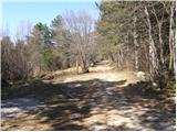
From the starting point, which is called Križišče, we continue on a rough macadam road which already after a few minutes of walking brings us to a well-marked crossing, where the marked path towards Trpinovišče, memorial plaque and Vodice branches off to the left. We continue on the right path, which past the Stations of the Cross brings us to the next well-marked crossing near the peak Vitovski hrib. We again continue right and follow the increasingly rough road which here finally changes into a cart track we follow to a panoramic summit, on which stands a church.
From the top, we descend back to a crossing, and then we continue the ascent in the direction of Čavna and Sekulak on the old Napoleon path. We soon come to the next crossing, where the path to Skozno branches off to the left, and we continue right towards Čavna. Still gentle Napoleon path soon brings us to steep rocky cliffs of Visoki zid. A wide path then leads us over carved panoramic ledge (danger of falling stones) behind which, the path returns into the forest and brings us to the spot, where the path to Kopitnik branches off to the left.
We continue slightly right in the direction of Čavna and Sekulak on a little narrower path, which at first through some smaller clearings brings us to a more steep part. The path ahead ascends steeper and only a little higher brings us to the next crossing, where we continue right in the direction of vantage point (left Kopitnik). We continue the ascent on a gently sloping path, which in 5 minutes of additional walking brings us to the vantage point Sekulak, from which a view opens up on a larger part of Vipava valley.
From Sekulak we continue left on a marked path which continues on at first very panoramic ridge. Higher, the path goes into the forest and only a little after that, it brings us to a smaller plain, where we continue sharply left in the direction of Kopitnik (right Veliki Rob). The path continues on a gentle cart track which higher brings us to an asphalt road. The road which is gently descending we follow to the left, and it soon brings us to the hunting cottage.
We continue on the road in the direction of Kopitnik (left downwards Vitovlje), and a little further it joins another path from Vitovlje (option for a descent). Only few steps ahead we get to NOB monument, where we leave the road and we continue left towards the vantage point and airfield Kopitnik.

Photos:
 1
1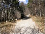 2
2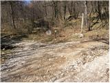 3
3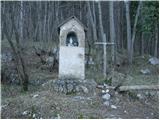 4
4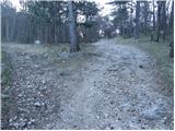 5
5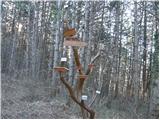 6
6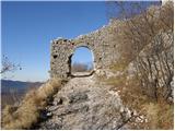 7
7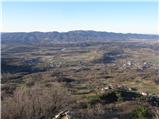 8
8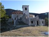 9
9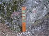 10
10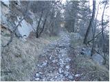 11
11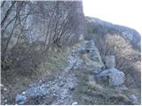 12
12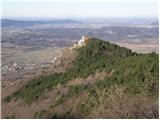 13
13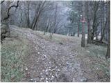 14
14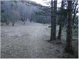 15
15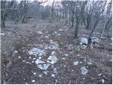 16
16 17
17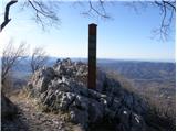 18
18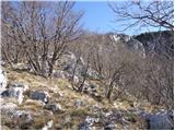 19
19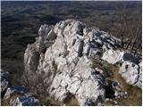 20
20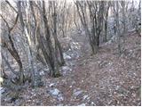 21
21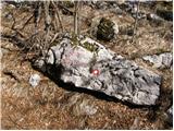 22
22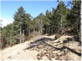 23
23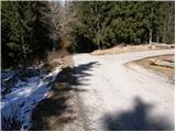 24
24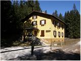 25
25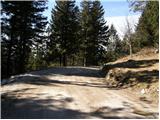 26
26 27
27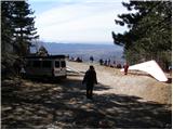 28
28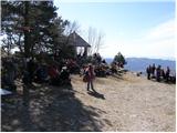 29
29
Discussion about the trip Vitovlje (Križišče) - Kopitnik (via Sekulak)
|
| darh11. 02. 2011 |
On Sunday we too ascended Sekulak and Kopitnik via this described path. To Vitovska church instead of mentioned road and track preferred footpath from left of Vitovski hrib. Descended to valley past hunting hut, last part detour past charming Vitovsko jezero. Detailed entire path description read here.
|
|
|
To post a comment you must log in:
If you do not yet have a username, you must first
register.