Vitovlje (Križišče) - Skozno
Starting point: Vitovlje (Križišče) (400 m)
| Latitude/Longitude: | 45,94110°N 13,76130°E |
| |
Walking time: 2 h
Difficulty: easy marked way
Elevation gain: 271 m
Elevation difference along the route: 415 m
Map: Goriška 1:50.000
Recommended equipment (summer):
Recommended equipment (winter): ice axe, crampons
Views: 11.577
 | 2 people like this post |
Access to starting point:
From the Vipava - Nova Gorica highway, take the Selo exit and follow the road ahead in the direction of the villages Črniče and Šempas. When we come to the village Vitovlje, pay attention, because in the middle of the village we leave the main road and continue driving in the direction of the farm Maloščevo (the turn-off is marked). Further, we drive through the village on a narrow and steep road, which higher up brings us to the signpost with the inscription »Vitovska krožna pot«. We continue left past the last houses on the increasingly steep road, which a little higher changes into a macadam road beside which we then park (the most appropriate parking spot is between the fourth and fifth Station of the Cross).
Route description:
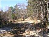
From the starting point, which is called Križišče, we continue on a worsening macadam road which after a few minutes of walking brings us to a well-marked junction, where we continue left in the direction of »Trpinovšče, spominska plošča in Vodice« (right Vitovski hrib).
We continue the ascent on at first a quite gentle cart track which higher passes into a dense forest. The cart track then steeply ascends and after a few minutes of additional walking brings us to Vodice, where there is a NOB memorial plaque.
Further, the cart track turns into a footpath which continues in a diagonal ascent towards the northwest. After a while, the path ascends even steeper and then brings us to a junction, where we join the path from Kopitnik.
We continue left in the direction of »Skozno« on the path which gradually starts to descend. We follow this path, which has a few more marked junctions, all the way to the cave and natural bridge Skozno.

The trip can be extended to the following destinations: Kopitnik
Photos:
 1
1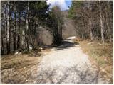 2
2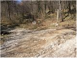 3
3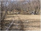 4
4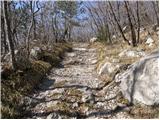 5
5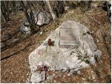 6
6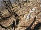 7
7 8
8 9
9 10
10 11
11 12
12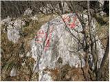 13
13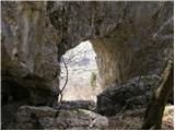 14
14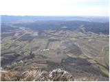 15
15
Discussion about the trip Vitovlje (Križišče) - Skozno
|
| navdušena7. 03. 2021 |
In Vitovlje there is a nice large parking lot. Don't drive cars to Križišče, it makes no sense, the road is also bad. Let's park at the parking lot - event space!
|
|
|
|
| ciklama15. 02. 2023 20:56:33 |
Today walked this trail, in the morning a bit of searching for the right starting point, then it went great. We first went to Vitovska church, worth a visit, wonderful views. From the starting point at the large parking lot at the end of the village to the Skozno window we needed a good two and a half hours. Otherwise weather for the chosen ones, trail nicely marked and followable. We will return
|
|
|
To post a comment you must log in:
If you do not yet have a username, you must first
register.